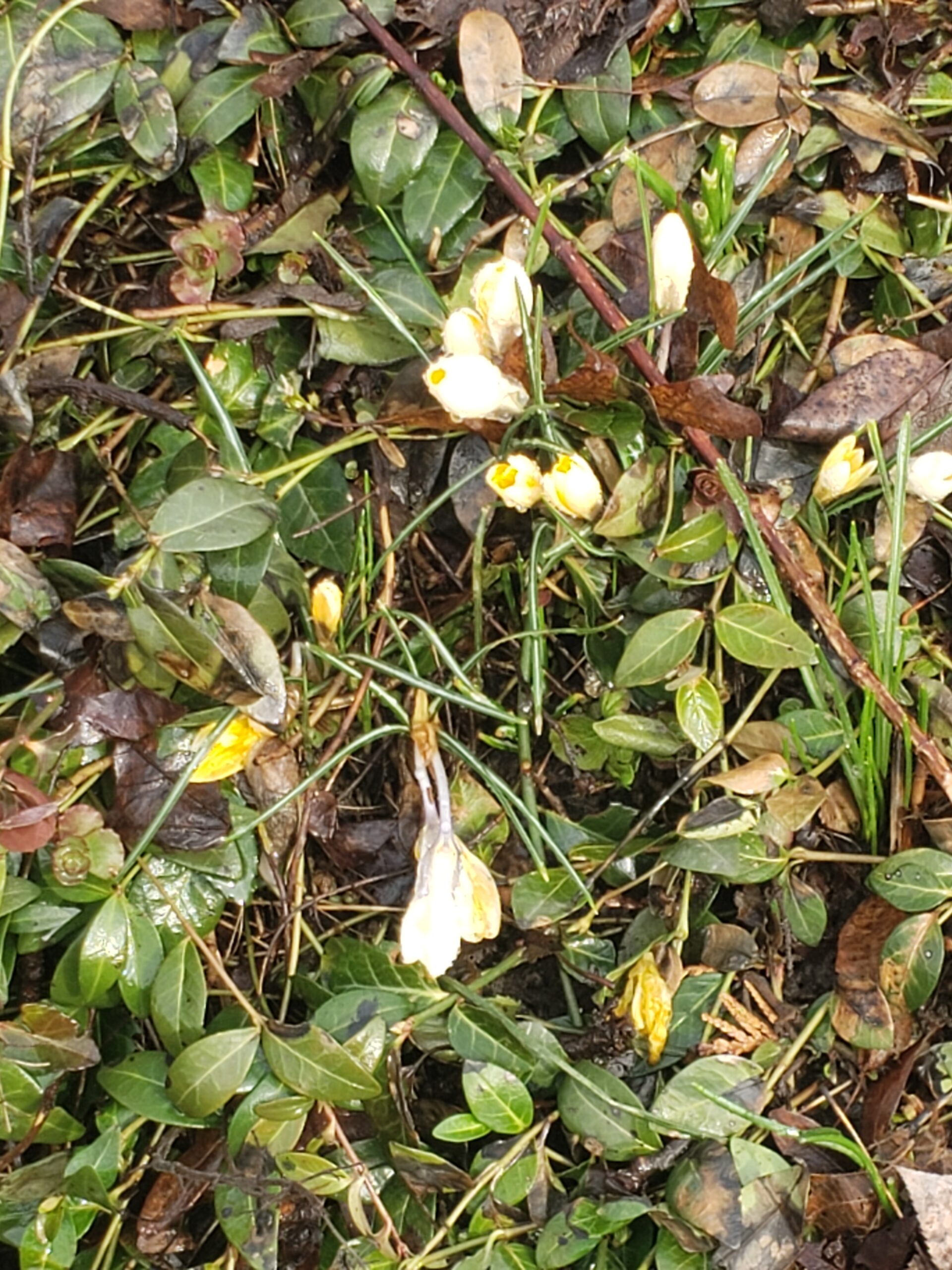
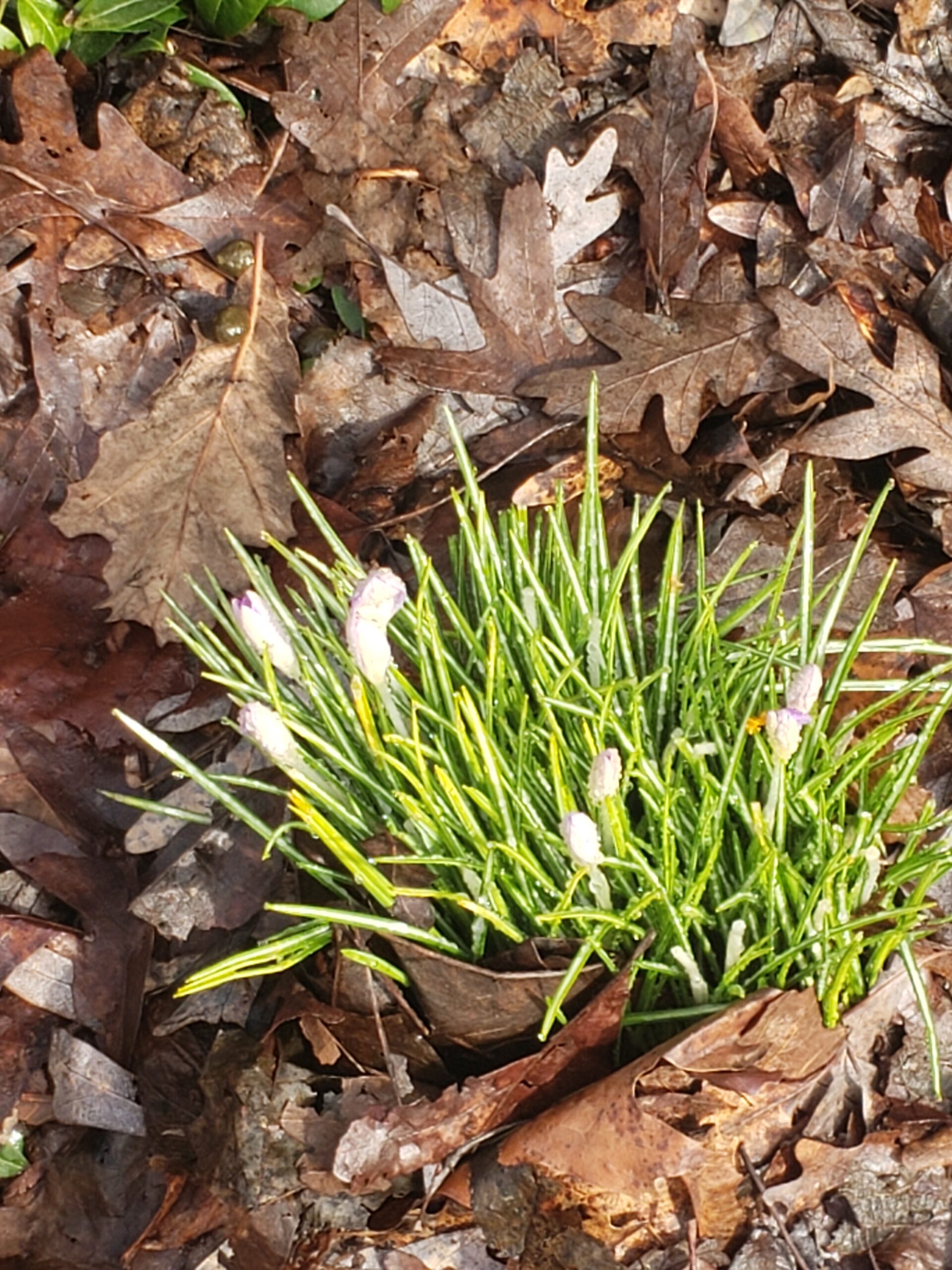
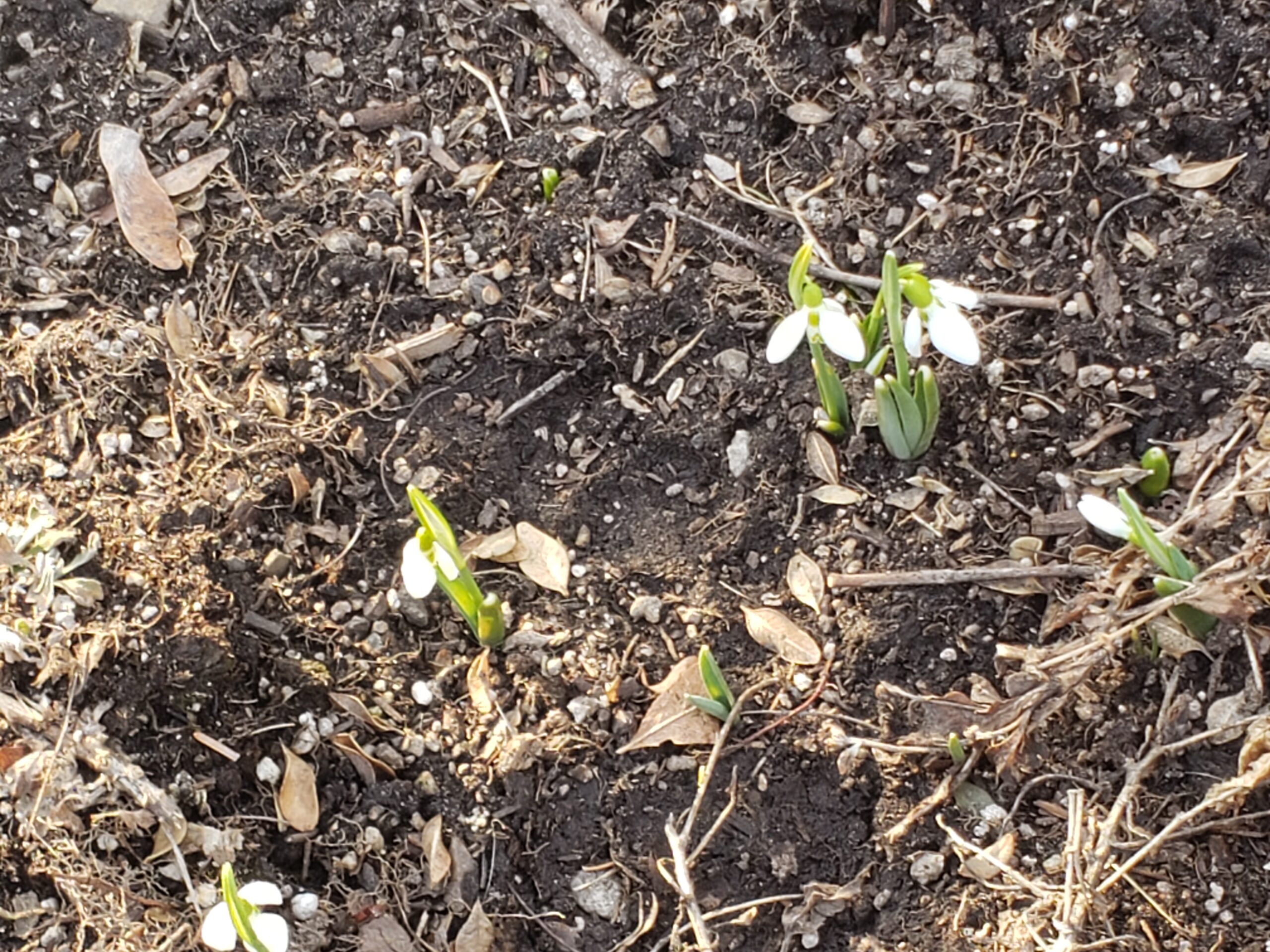
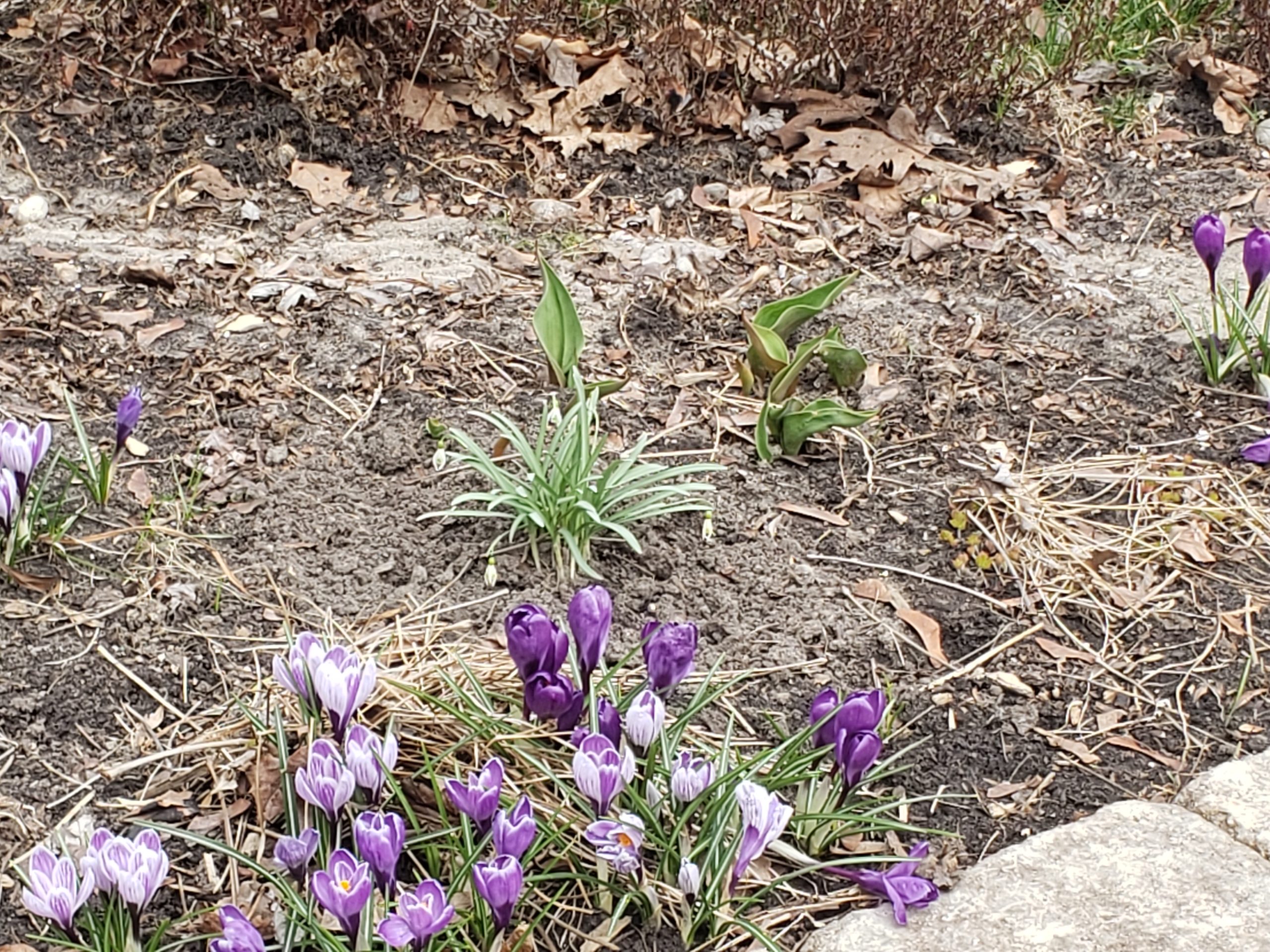
It’s March already. Riding the bike at the gym is deadly dull and boring. Also you don’t get the wind resistance and the hills. Time to get out there! Besides the spring flowers were out.
Snow DropsCrocuses
My very first ride was 10 km up and down the Beltline via Mt. Pleasant Cemetery. Not too bad, despite dodging ice patches and mud.
But then the snow storm started…
Next ride much better with the temps up +15 degrees. I was hot by the end of my 20 km with a rest stop in between at my fav cafe, Balzac’s in the Distillery District.
The Lower Don Valley trail is still shut. Many unhappy hikers and bikers who’ve inscribed on the notice: Give me back my park! and on the Danger sign: Danger due to Incompetence.
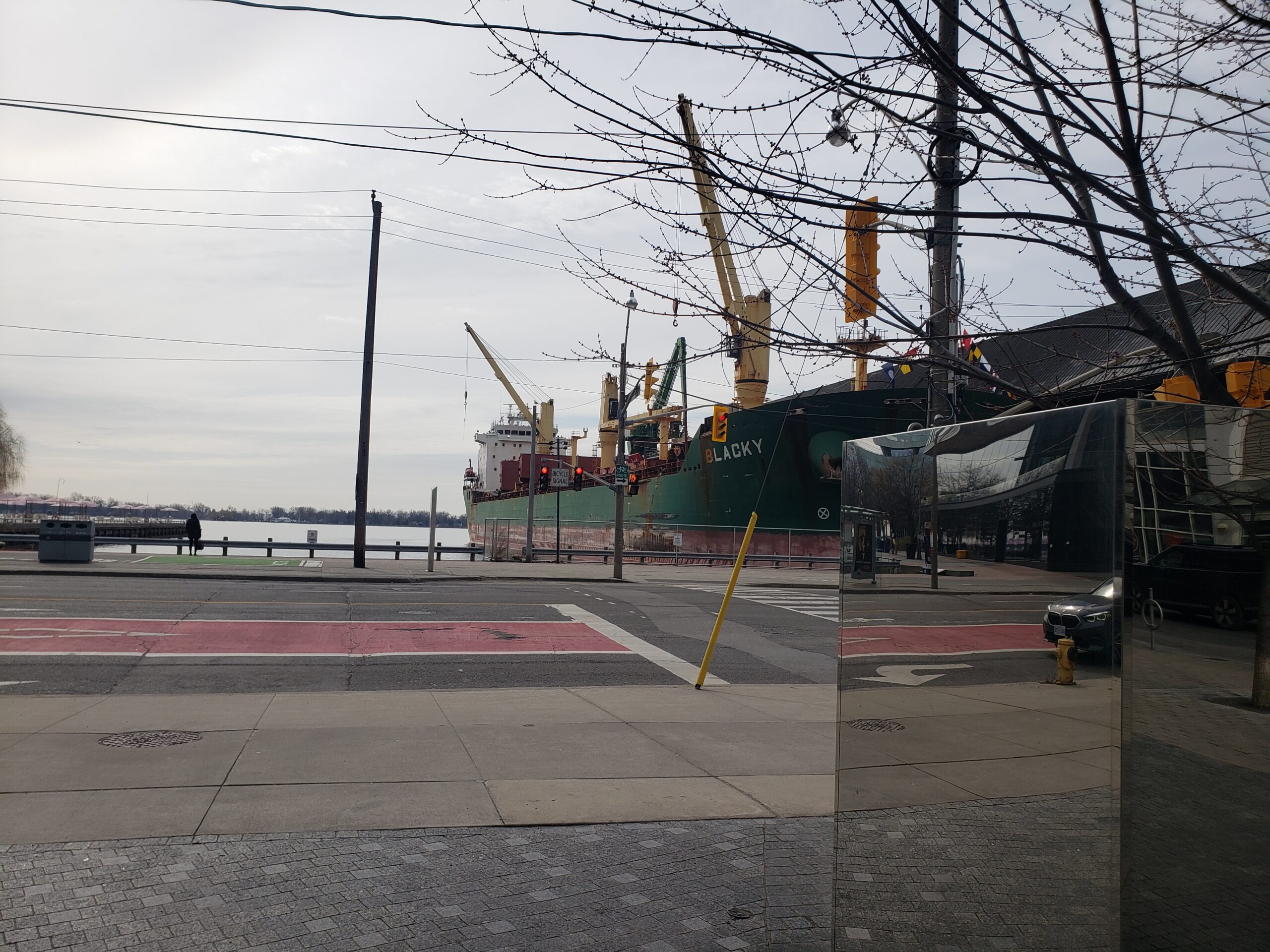
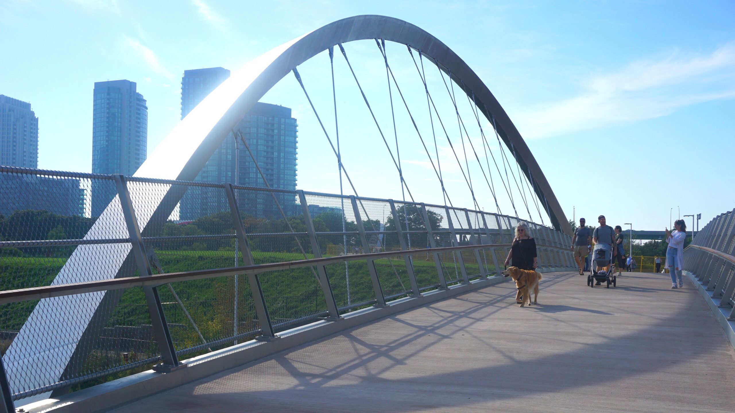
The Bayview Extension trail offers an OK alternative. At the lakeside, spotted a freighter being loaded with sugar.
The Chrysler building is my favorite New York sky scraper. What’s not to love about its stainless steel roof and Art Deco perfection?
And the fact that its observation deck on the 71st floor has been closed to the public adds to its mystery. What’s inside that steel dome? A secret nightclub? The most exclusive penthouse condo in NYC?
Visitors to the Chrysler Building are actively discouraged. Ten years ago, we were able to walk into its beautiful Art Deco lobby for a look-see, but on our first visit after COVID, we were summarily chased out by the security guard! That, of course, piqued my curiosity even more.
Beautiful lobby of the Chrysler Building
To my surprise the answers to the Chrysler Building’s mysteries popped up on the internet and we can visit inside its stainless steel roof -virtually – thanks to urban explorer, Moses Gates, author of Hidden Cities. (Eat that Book!)
Walter P. Chrysler, famed auto magnate, wanted a personal monument to himself. The building was completed on May 28, 1930, according to a design by architect, William Van Alen. Somewhat foolishly, Van Alen never signed a contract with Chrysler, who refused to pay him, accusing him of shady dealings with the building contractors. Van Alen sued and did get his money eventually but the fight ruined his reputation and he never worked as an architect again. (Sound familiar?)
Then as now there was a lot of dick-waving: to own the tallest building in the world and to make them taller with spires. The Chrysler Building’s 61 meter spire, made of special stainless steel, was hidden inside the building and installed as a crowning touch. For about 11 months, it was the tallest in the world until the Empire State Building surpassed it.
Walter Chrysler kept his own office and apartment in the building though apparently he didn’t use either much. He like to boast that he had the highest toilet in the world.
Walter Chrysler’s potty
Interestingly, the other private apartment in the Chrysler Building belonged to a woman, photo-journalist Margaret Bourke. Despite her wealth and fame, she had to have the lease to her 61st floor apartment co-signed by Time, Inc. because she was female. Here she is astride one of the building’s gargoyles. She had a remarkable career as a war correspondent and adventurer. (Read more about her here.)
Margaret Bourke and gargoyle
At the behest of Texaco, Chrysler installed the Cloud Club, with three exclusive dining rooms – and a speakeasy – on floors 66 to 68. The Cloud Club lasted 40+ years until the late 1970s when it was demolished for office space. That was much longer than the celestial-themed observation deck on the 71st floor, which was shut down in 1945.
Celestial-themed observation deck
But there was a way, you could see NYC from the top of the Chrysler Building: you could go to the dentist! From 1962 to 2012, Dr. Charles M. Weiss ran his dental practice, mostly located on the 69th floor. He was known as The Dentist in the Sky and was an innovator in dental implantology.
The Dentist in the Sky
But what about inside that glorious stainless steel roof? Are there hidden speak-easies? Secret apartments for mistresses? Who better to ask than urban explorer, Moses Gates? Here’s the YouTube video of his visit INSIDE the stainless steel roof.
It’s a dizzying climb with a spectacular forbidden view of NYC, but the inside is underwhelmingly functional, with concrete beams, ladders and steel walkways.
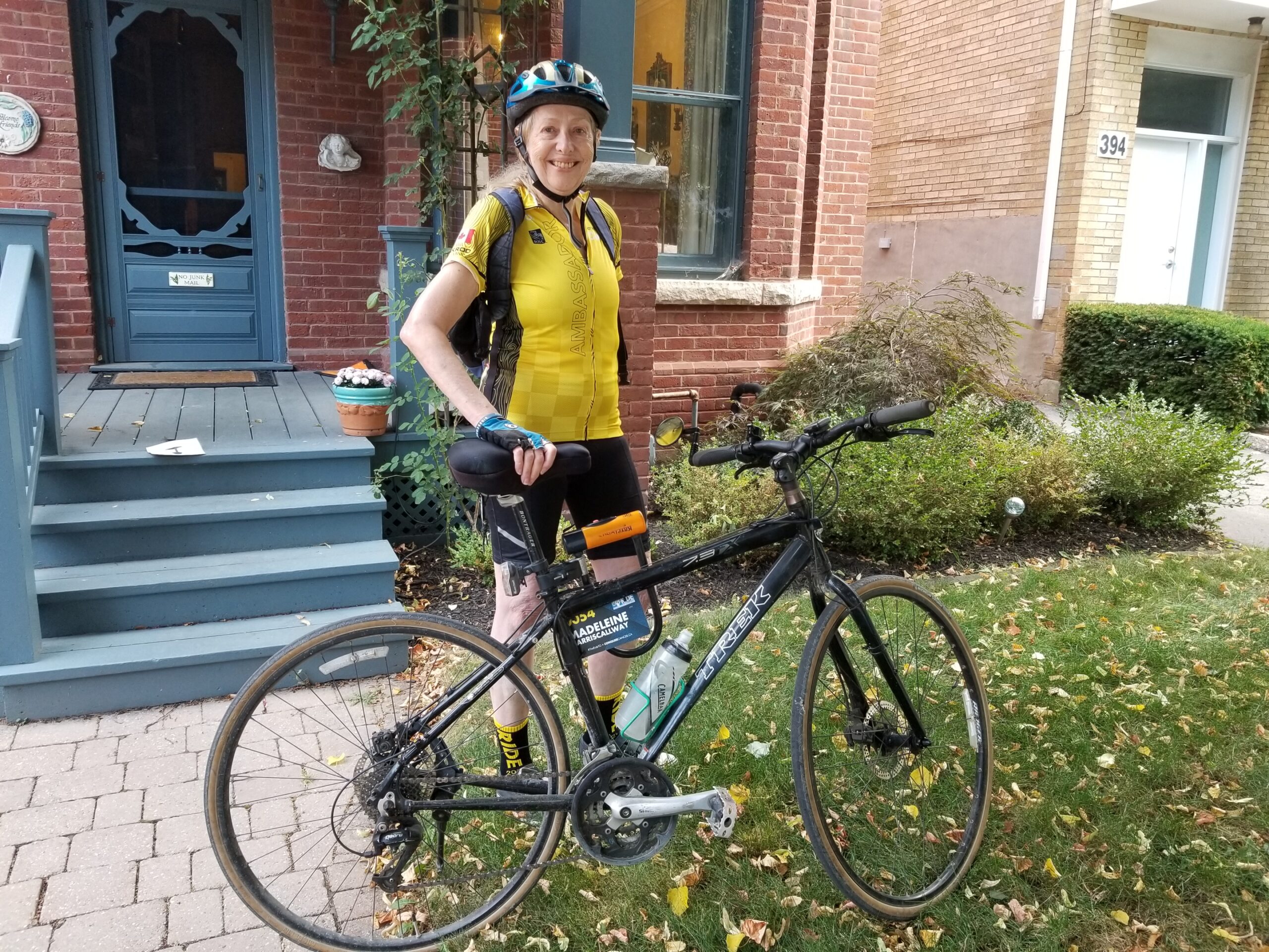
The 2021 Virtual Ride to Conquer Cancer took place over two days, the August 28-29th weekend. For Ride #4, my final pledge ride, I picked Saturday, August 28th, mostly because my parents got married on that date in 1943, nearly 80 years ago!
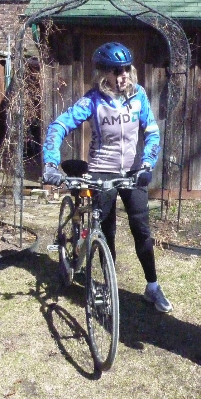
Ed snapped this pic of me as I headed out, wearing my yellow Ambassador’s jersey. The weather looked cloudy and unsettled so I skipped the opening speeches on YouTube to beat the heat.
I rode east to Bayview and turned south, treating myself to a 1 km downhill zoom to the Don Valley bike trail that runs parallel to the Bayview Extension – an easy ride past the Brickworks and Rosedale Valley Road to River Street.
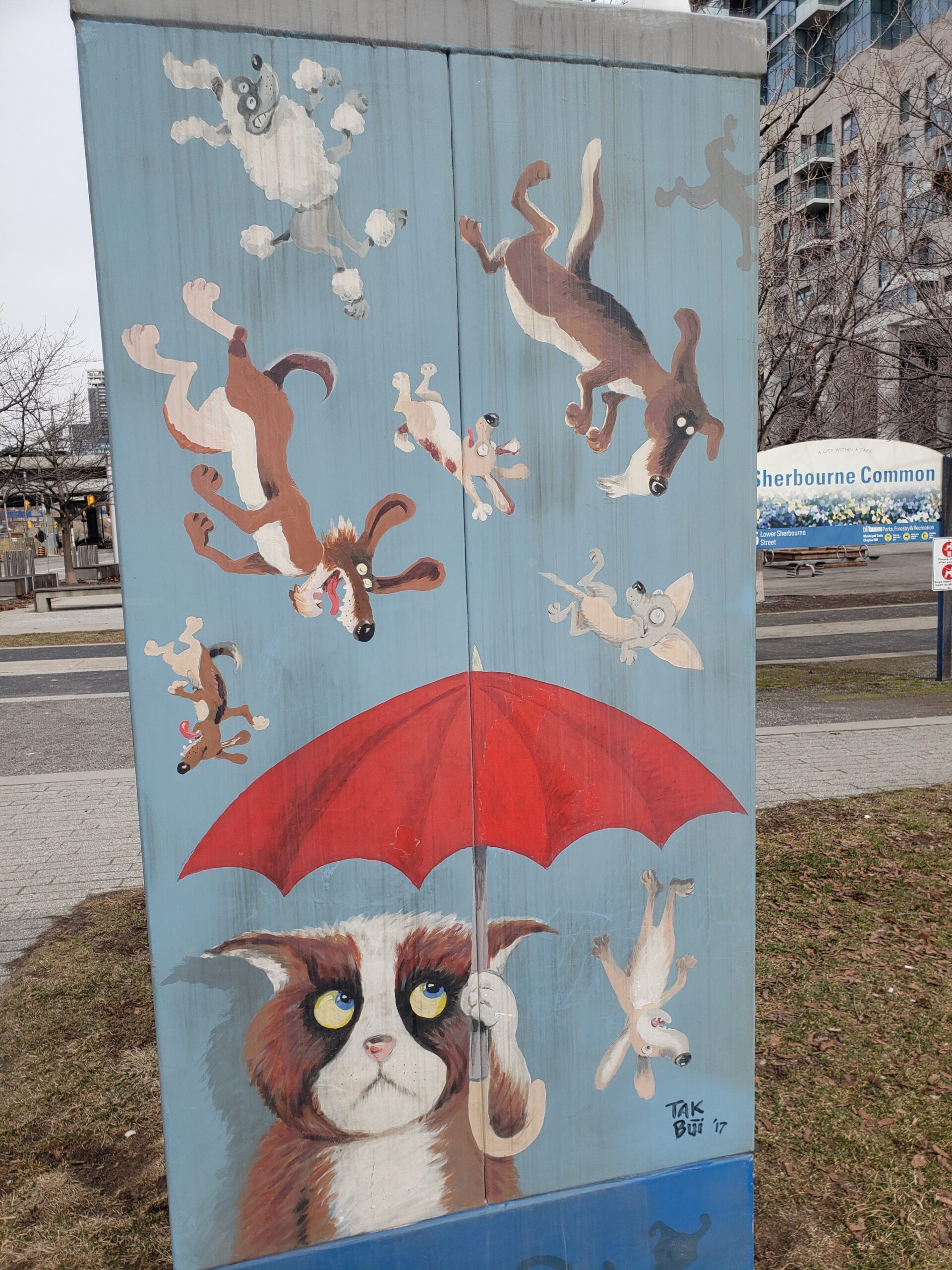
Thanks to COVID, the City has made the tail end of Bayview Extension one way and carved off half a lane for a new bike path. That deposited me squarely into the Canary District and the corporate art therein.
Where is Fight Club?
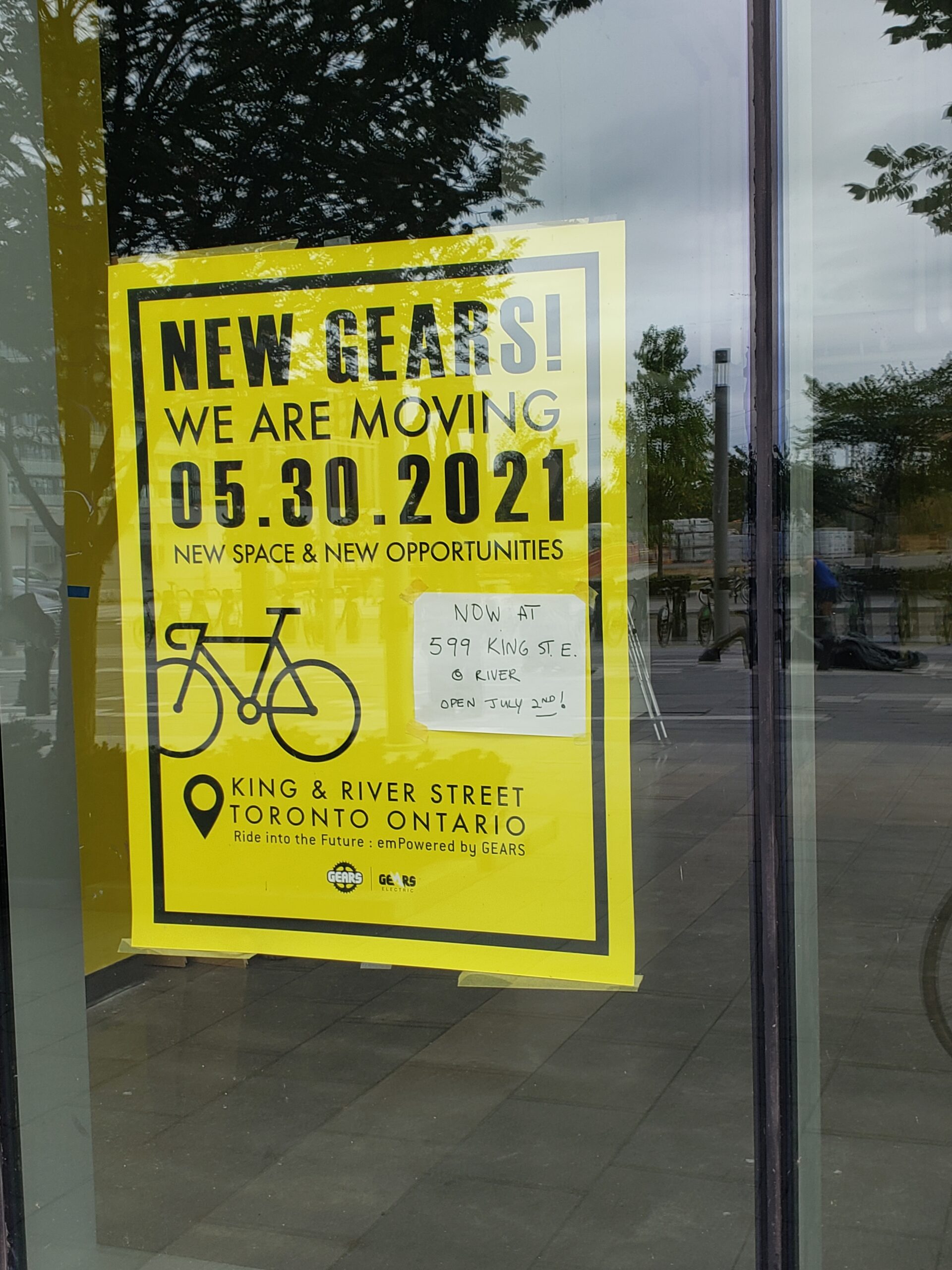
A moment of nostalgia for the super-techs at Gears Bike Store: they fixed my flat in 15 minutes during the 2020 virtual Ride. They’ve now relocated north to King St. The Canary District looked deserted: not the eastern twin of overbuilt Liberty Village…yet.
I decided to take the lakeshore trail to stay out of traffic and use the headwind to ward off the promised heat.
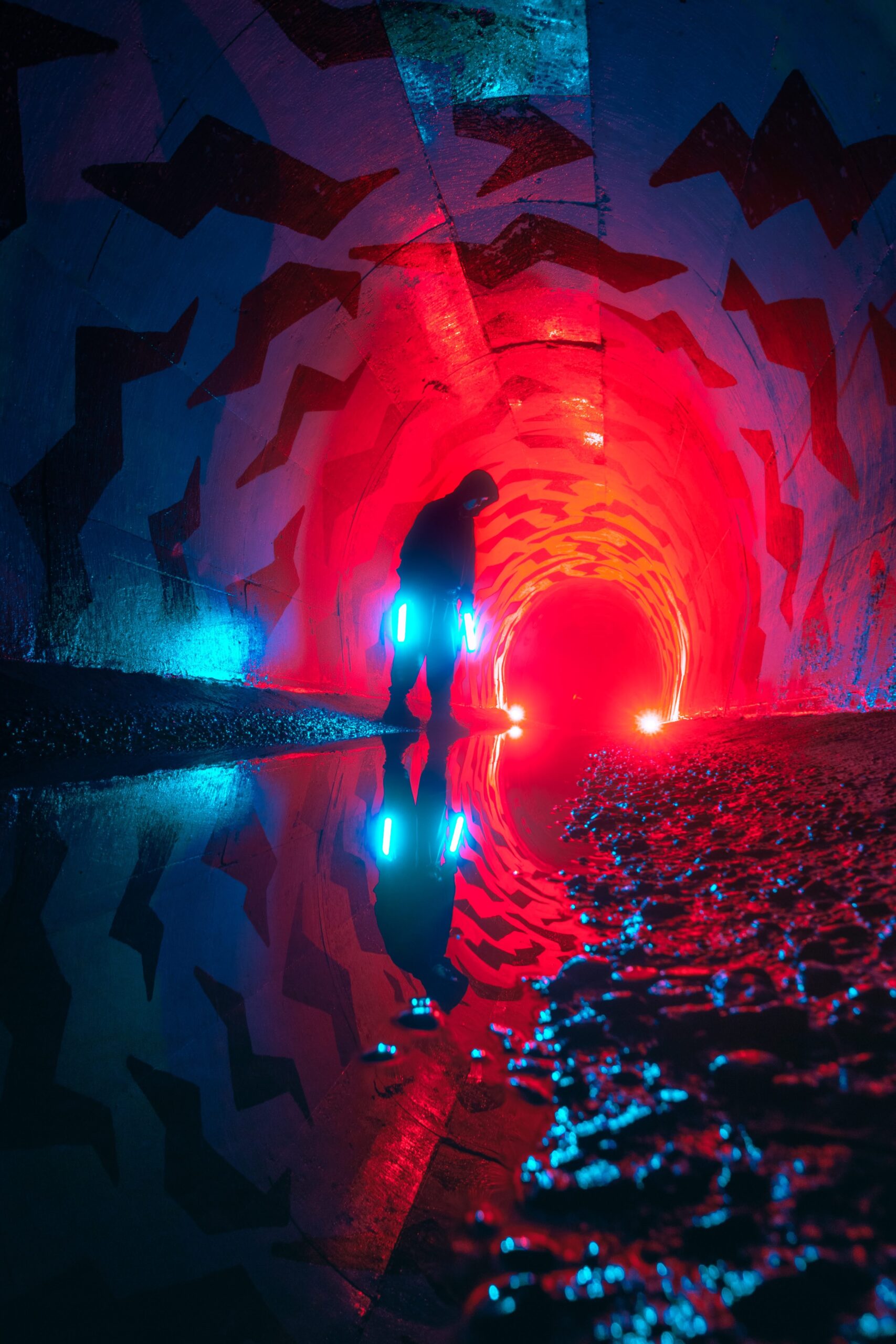
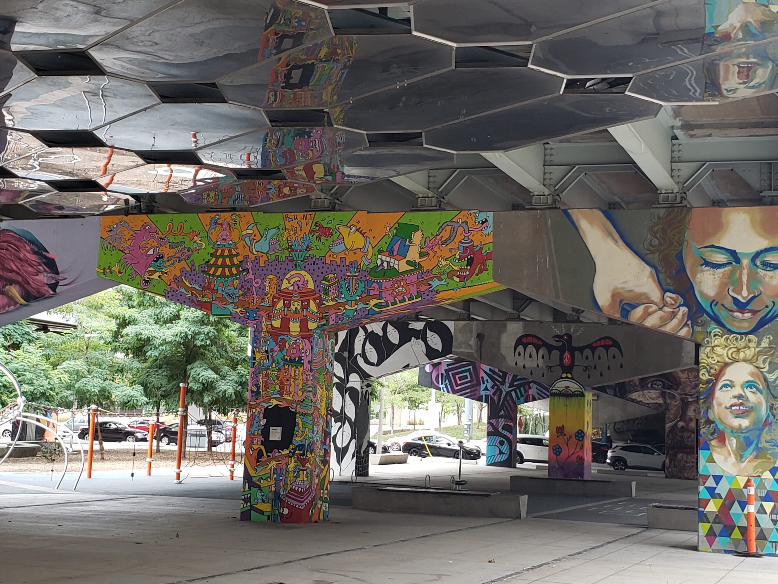
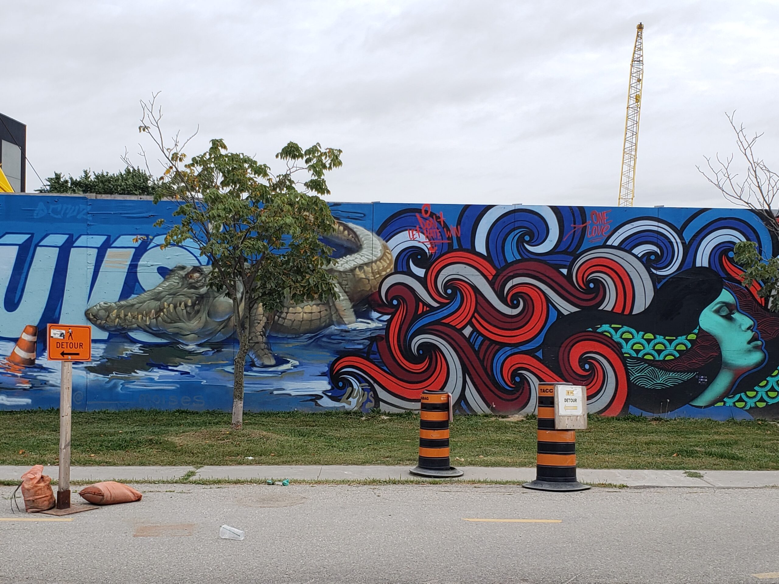
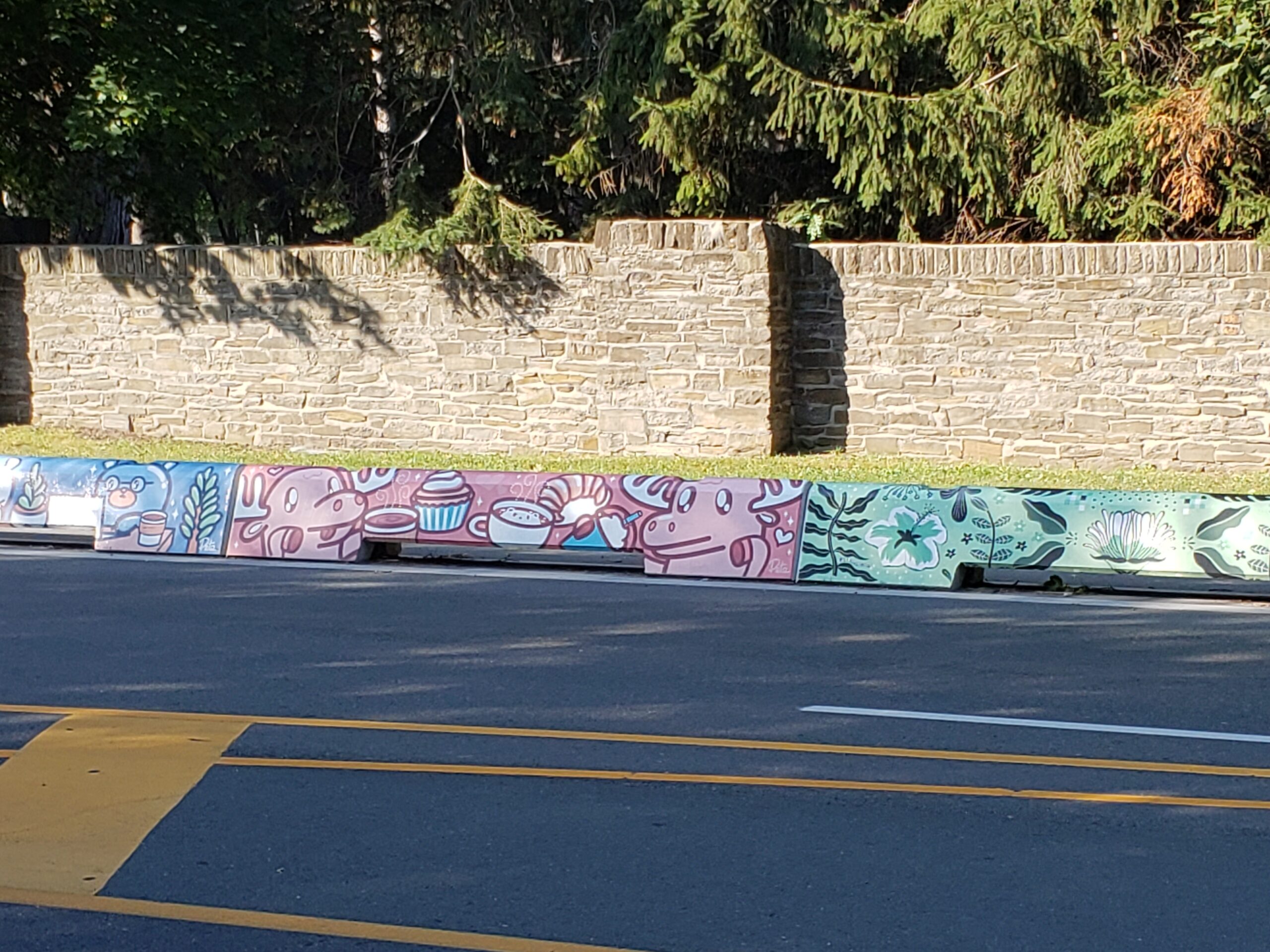
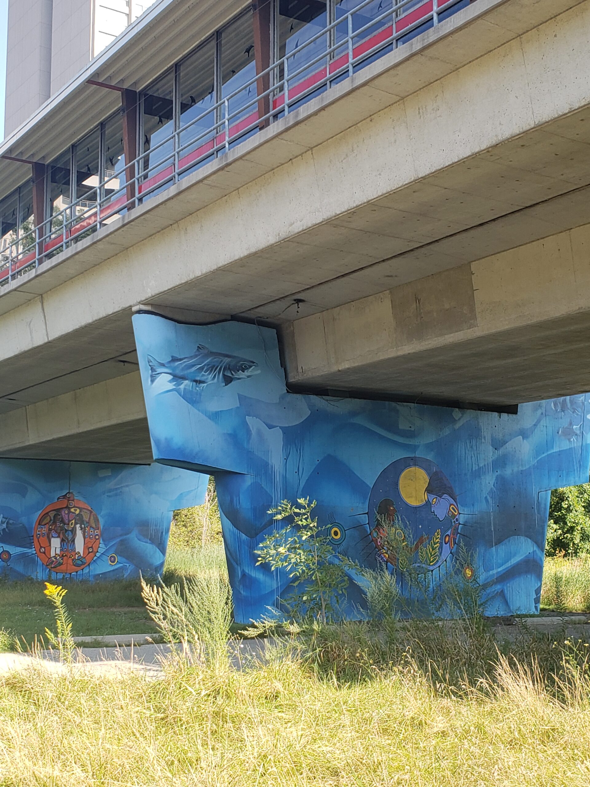
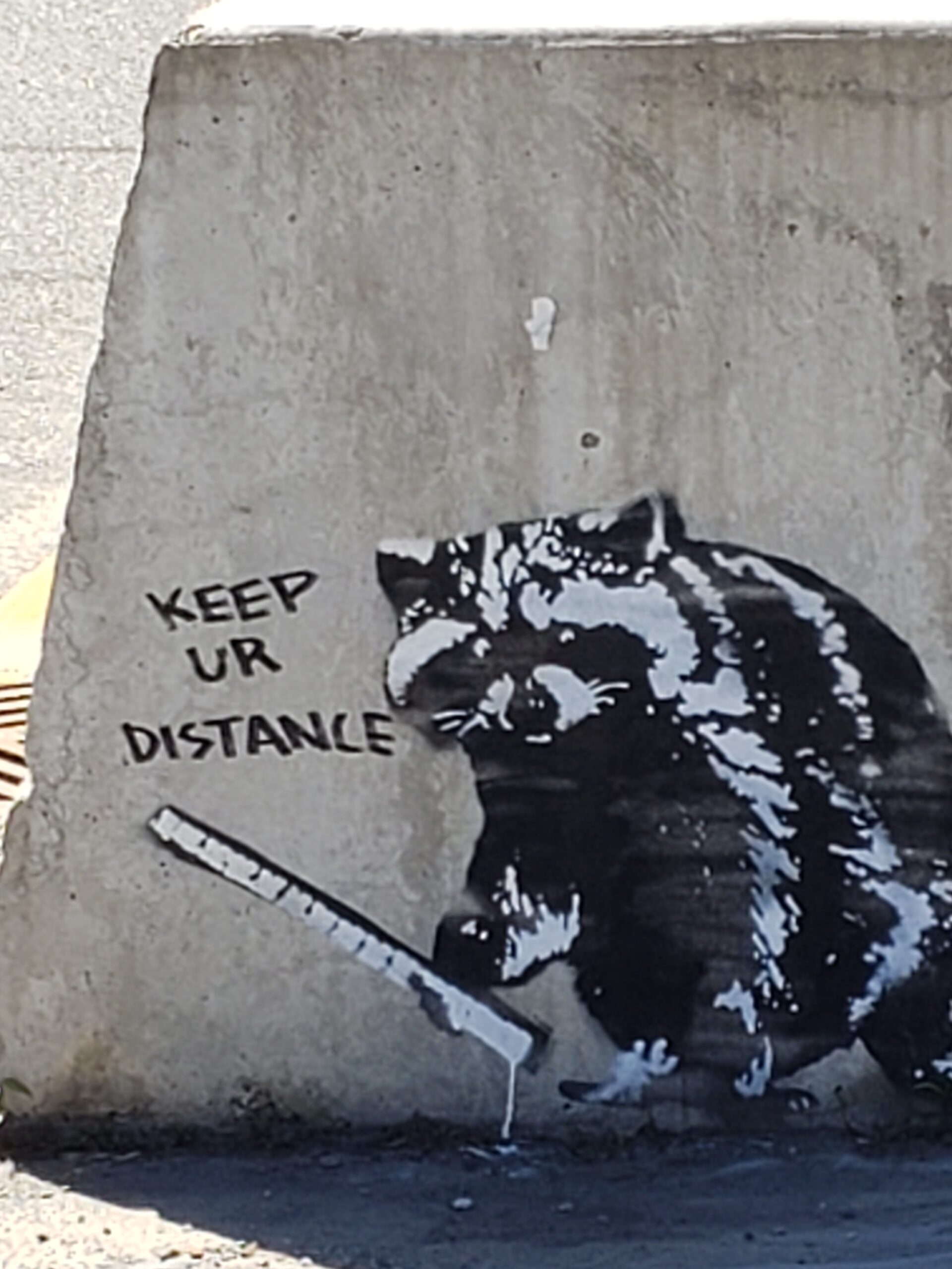
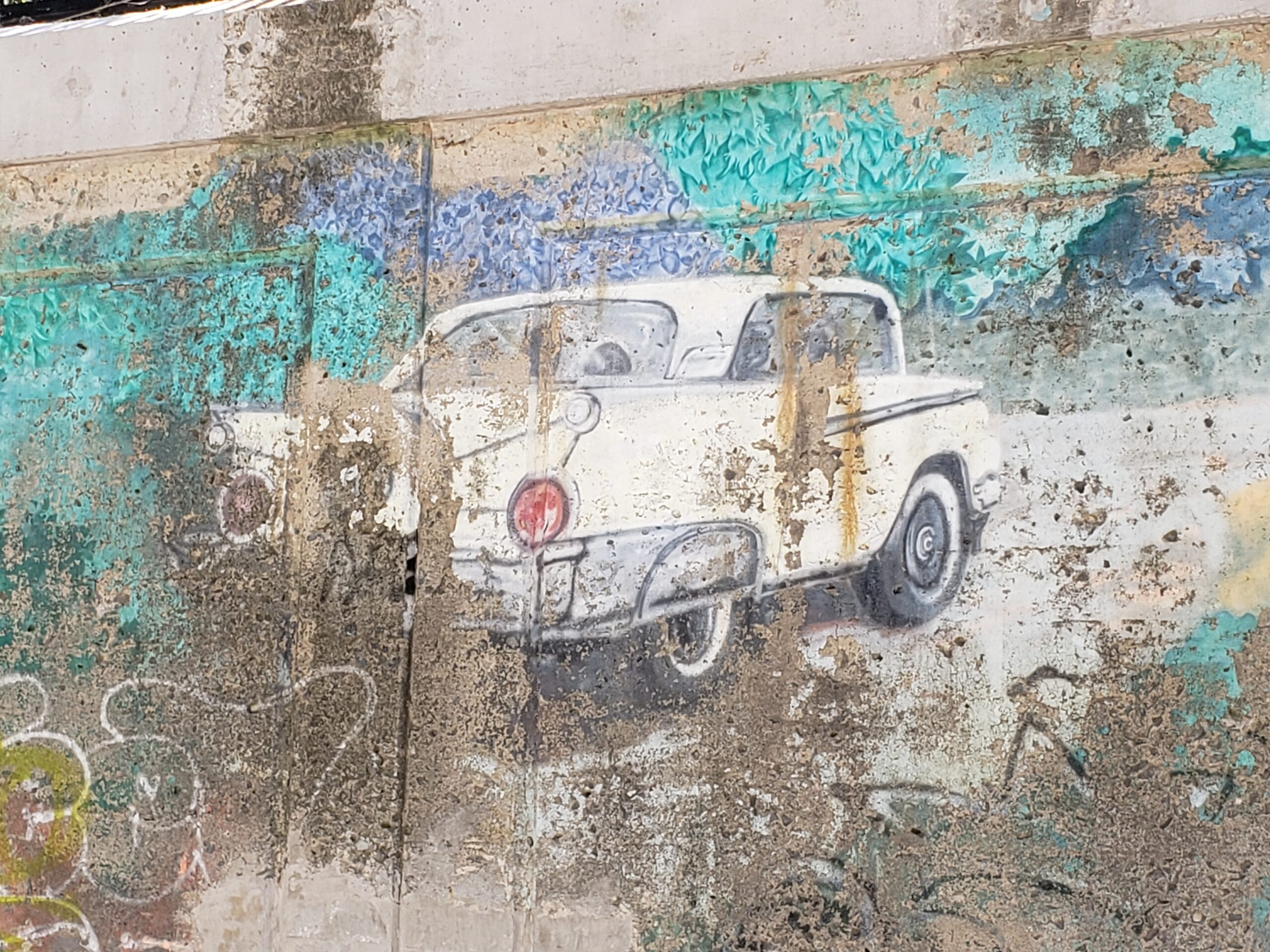
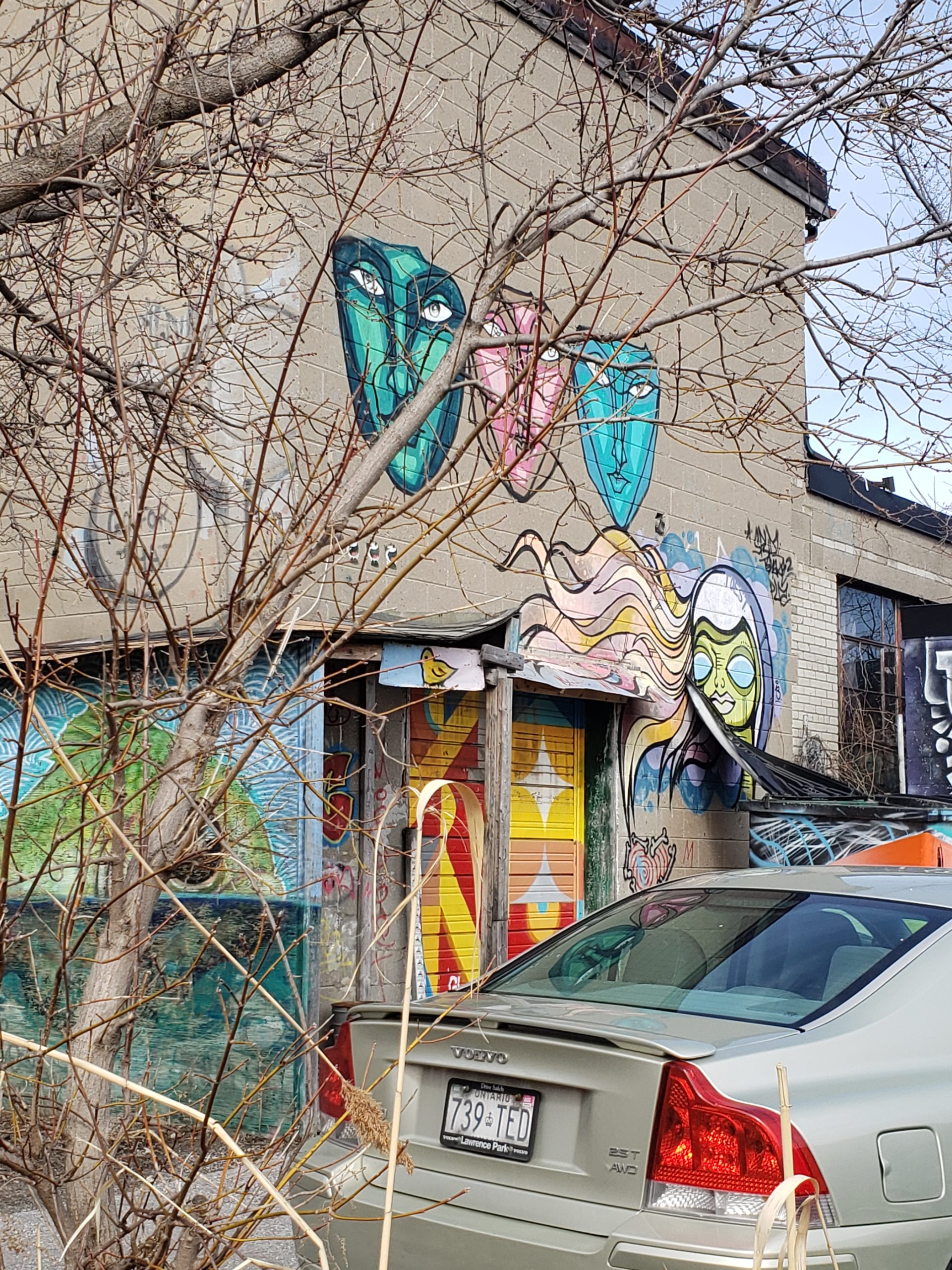
Passing under the Gardiner Expressway, I took in the gallery of street art.
Murals worth a special visitFav detail: not exactly Ru Paul though
Skater park
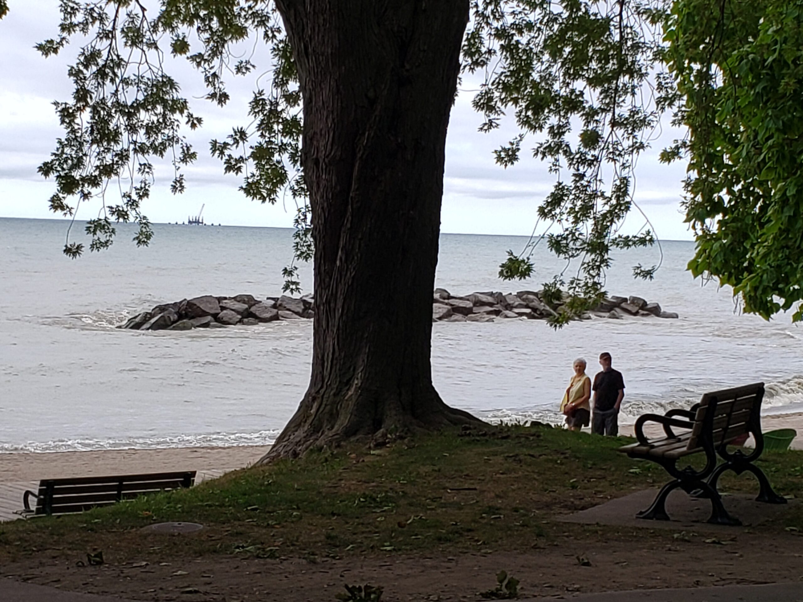
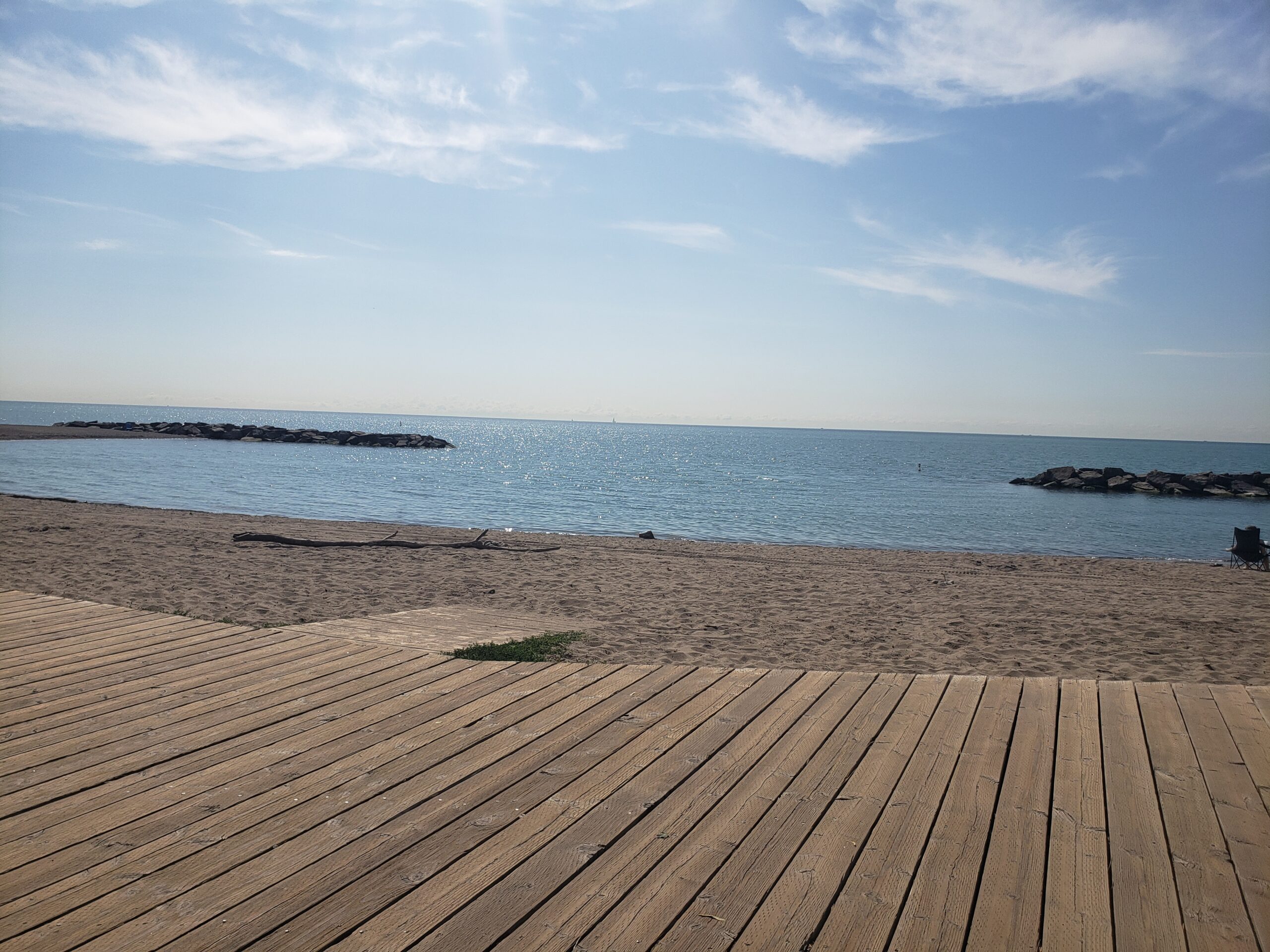
Once again, it was a fast ride with the west wind behind me. The lake looked spectacular though the rain clouds did look ominous.
Beaches turnaroundStorm warning
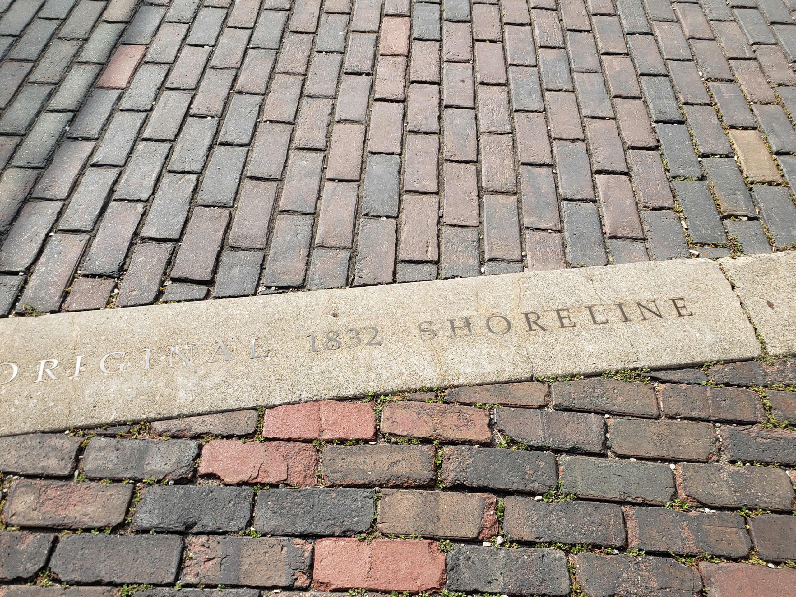
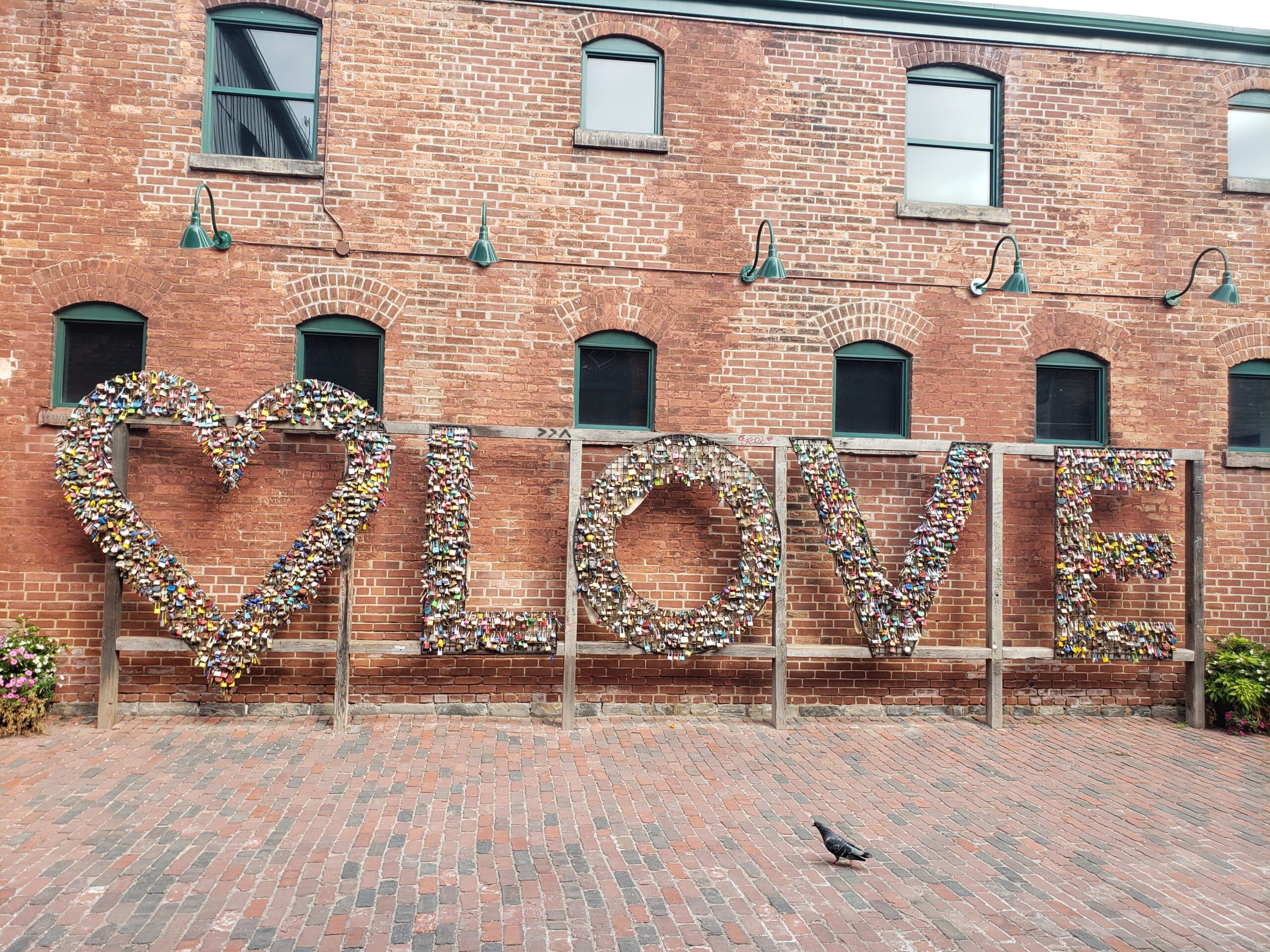
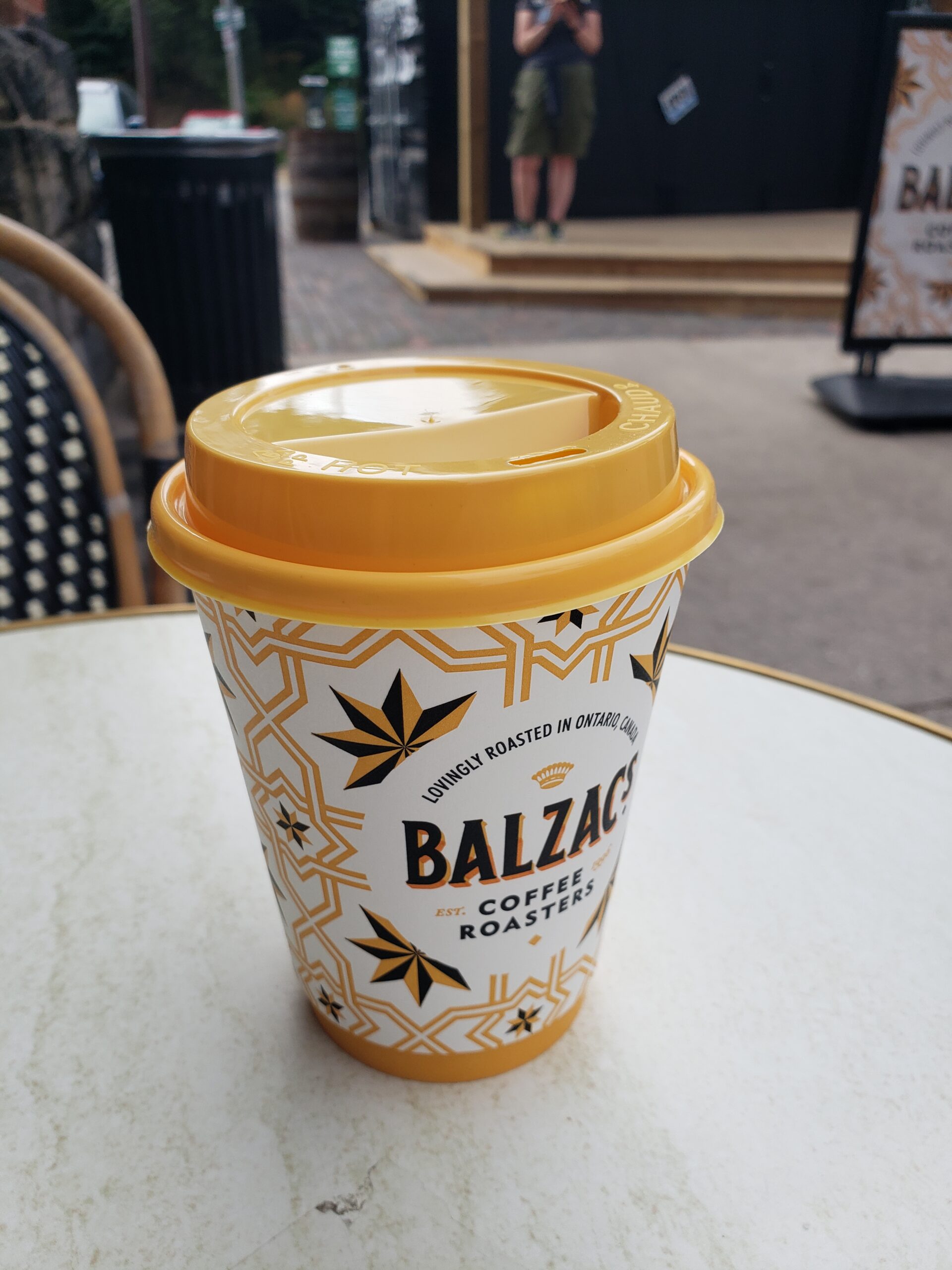
Few people were out this morning. I passed the occasional dog walker and happily connected and chatted with a fellow Rider who was doing her third Ride. By the time I reached the Distillery District for my usual Balzac’s break, I was almost exactly halfway done. Waiting for Ed to drive down to join me, I found some neat things: the original shoreline of Lake Ontario memorialized and the LOVE sculpture.
Beyond this line, trash and infill from building Toronto!Love spelled in padlocks
Pledging eternal love by using a padlock originated in Europe in the early 2000s even though the origin is sad. During WWI a young Serbian woman fell in love with a soldier and they put a padlock on the Bridge of Love. He left her for another and she died of heartbreak.
Not a great recommendation but since 2000, lovers have placed locks on bridges and fences throughout the world. In Paris, the Pont des Arts was so overloaded that in 2014 part of its parapet collapsed. Cities now routinely remove these padlocks. Some, taking a more positive route, invite people to create sculptures like LOVE above. Read more about love locks here.
Halfway there!Welcome break!
After coffee, I cycled out along the Lakeshore bike path to my usual turnaround point at the Humber Bridge and Palace Pier.
On the bridge, I met and chatted with a team of fellow riders, all wearing yellow jerseys. They all work for the same software company and were riding for the father of the young woman with them. A heartfelt moment and reminder of why we ride.
On the way back, I began to feel the heat, but luckily I was nearing the end of the journey. I turned up Bay Street and kept to the lane reserved for bikes, cabs and buses. I played chicken with three buses all the way up to Belmont Street. With relief, I turned right and from there went north onto Yonge St.
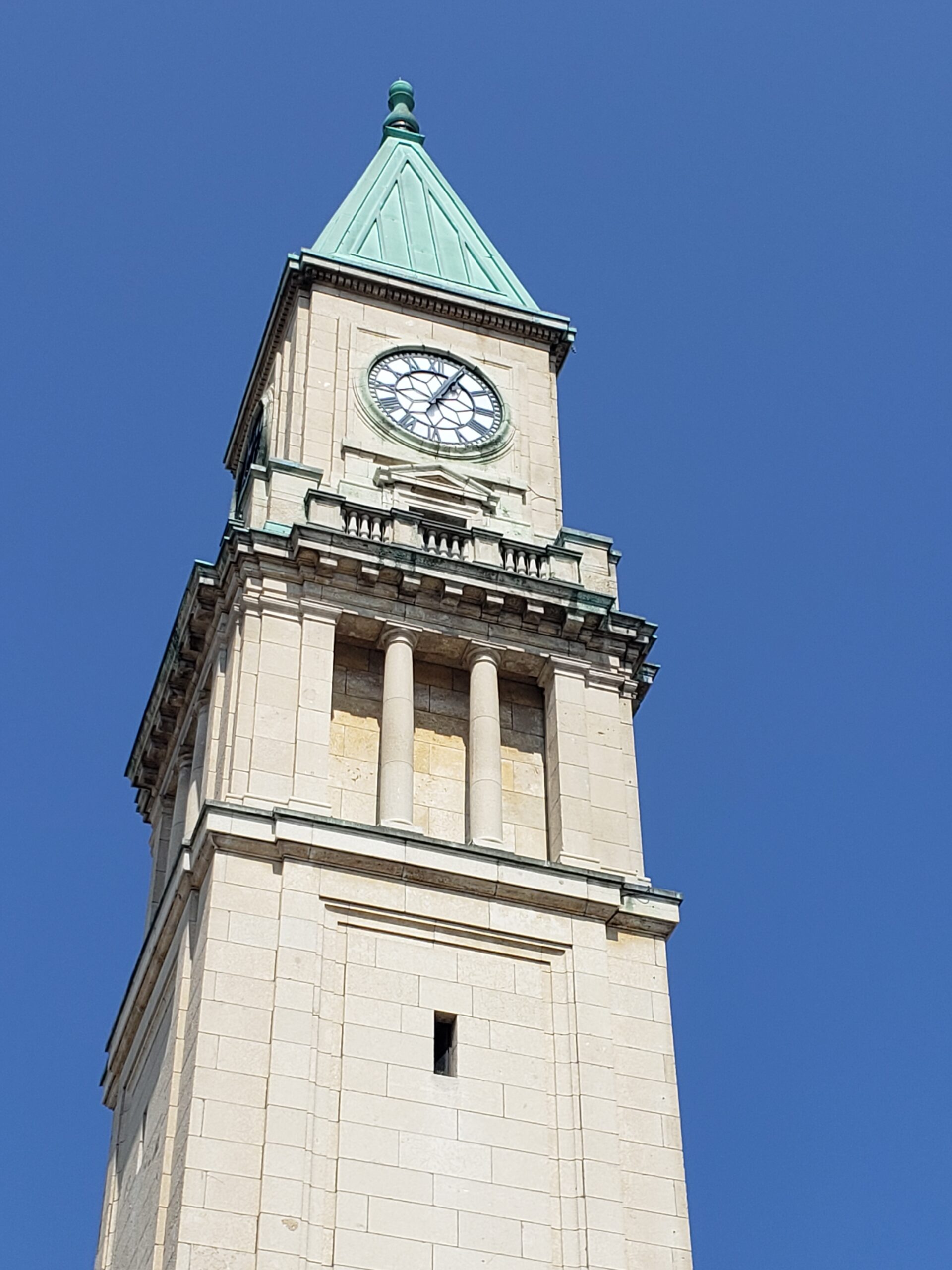
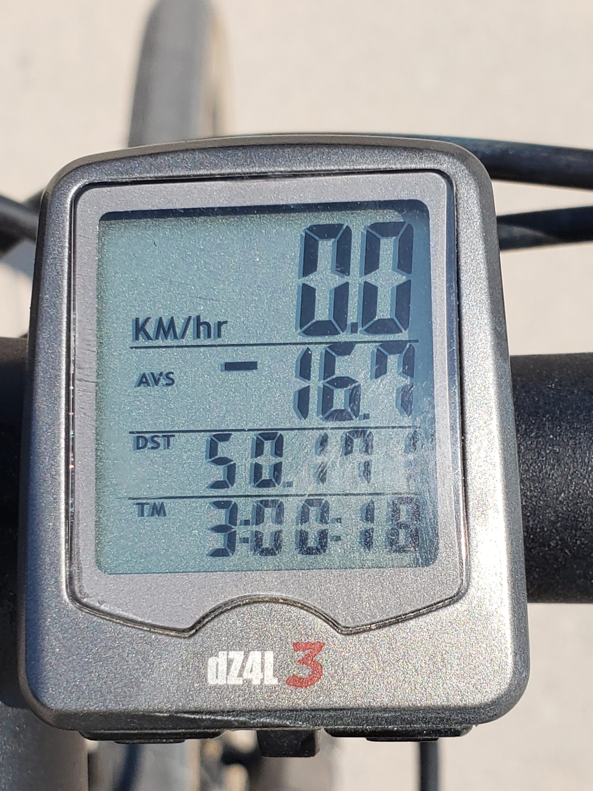
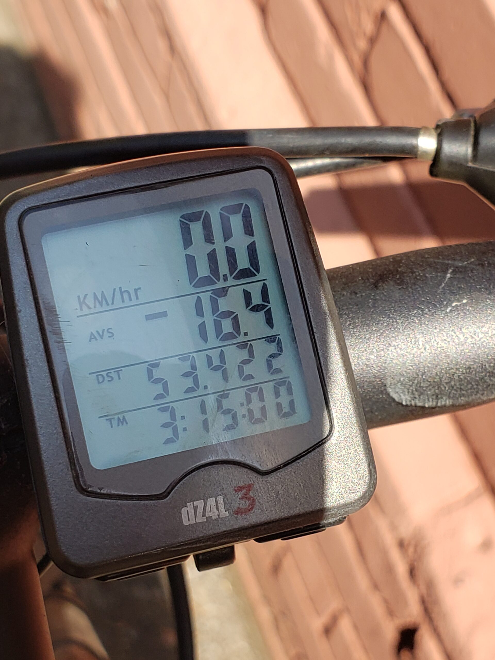
Summerhill LCBO clock tower50 km done!
Once again, thanks to COVID, the City has installed a bike lane up Yonge St. starting at Bloor St. It was the fastest way home for me though it did mean two thigh-burning climbs between Summerhill and St. Clair Ave.
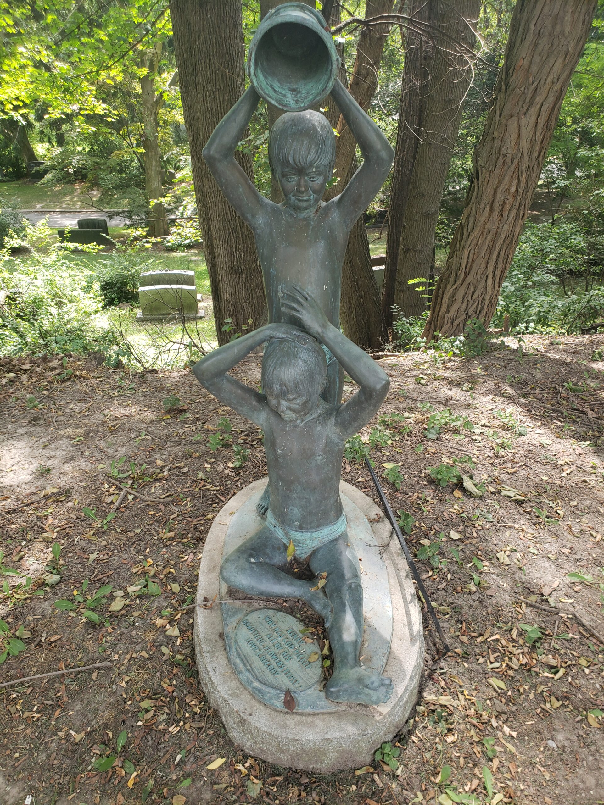
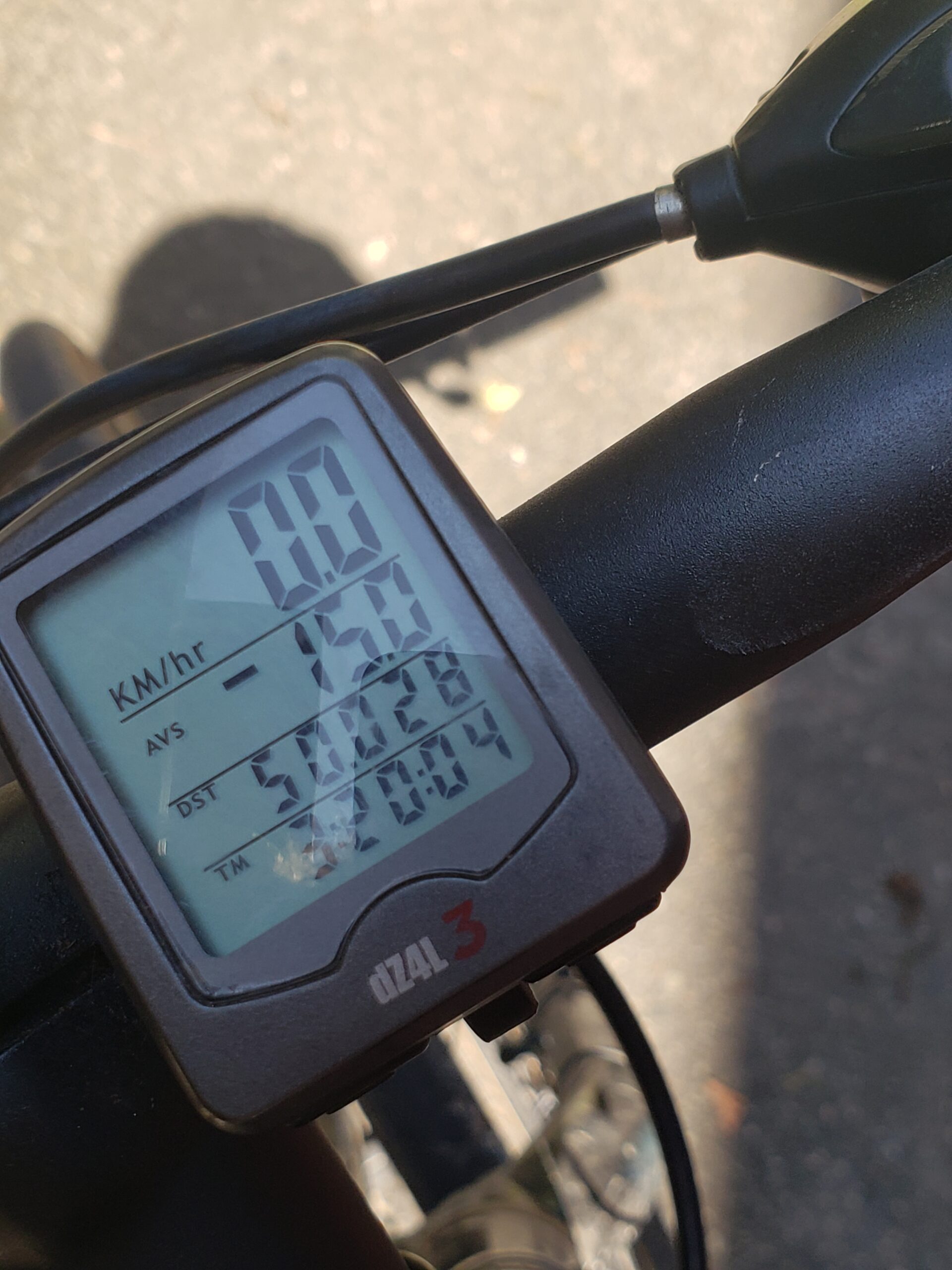
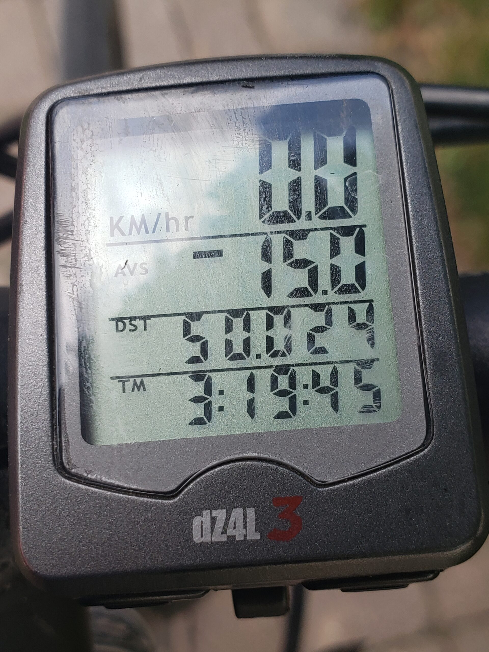
Happily when I passed the Summerhill clock tower, I hit the 50 km mark! After I reached St. Clair, I had a quick pedal through the calm of Mt. Pleasant Cemetery, said hello to the boys and arrived home in time for lunch. Total distance: 53.422 km!!
The BoysHome and done!
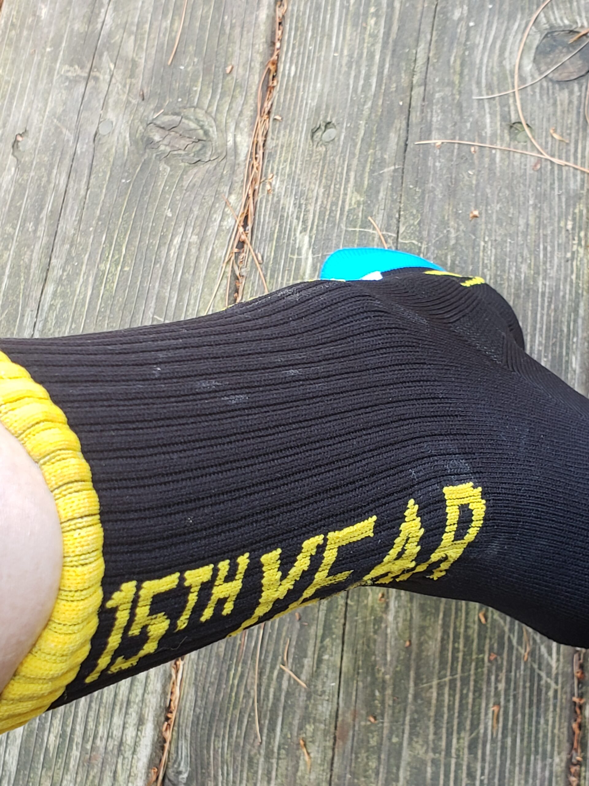
This was my 14th Ride. Did I sign up for next year? Of course, I did. Who could say no to a pair of stylish socks like these?
Apparently only 64 riders have done the Toronto Ride every single year since the inaugural one in 2008. I’m one of them!
On to training for 2022 and big hugs and many, many thanks for your wonderful support of cancer research at Princess Margaret Hospital.
Here at last is my blog on Ride #3. (Spoiler alert: I did successfully complete my four pledged rides for a total of 200 km!)
Tuesday, August 24th I headed west to the Humber River one of my favorite trails. Getting there from mid-town Toronto unfortunately requires a hair-raising pedal through traffic. I started out early to beat the promised scorching heat. The first few kilometers were along the cool shade of the Beltline trail.
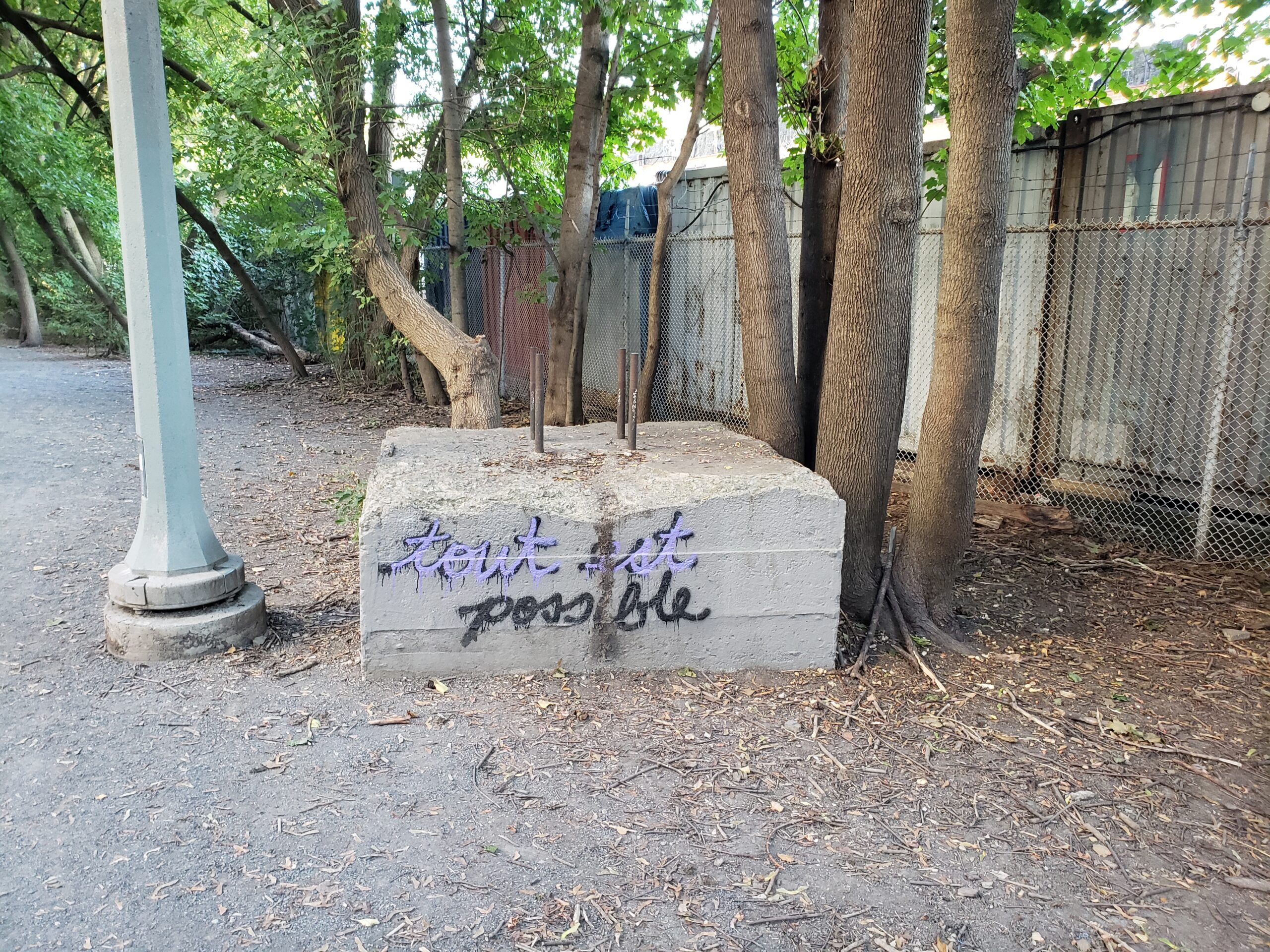
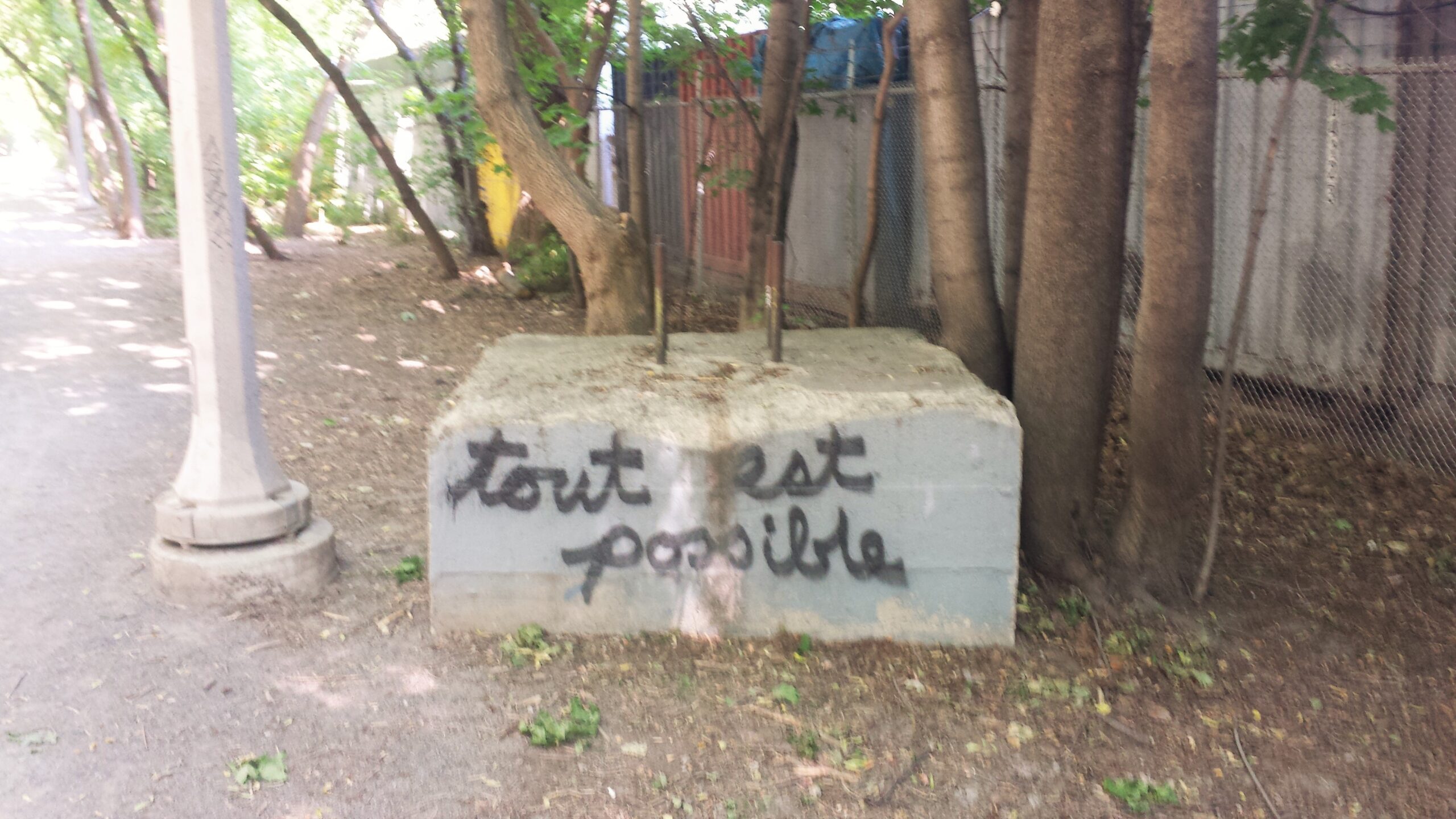
Tout est possible – a fav landmark!
The Beltline trail follows the path of a commuter railway that opened in 1892. It never turned a profit and only lasted two years. For almost a century afterwards Torontonians wrangled over how to use the land until David Crombie, Toronto’s tiny perfect mayor, turned it into a bike path. (If you’re having a sleepless night, you can read the detailed history of bureaucracy and indecision here. )
Hidden western entrance to York Beltline TrailPylons and not much else – York Trail
As a runner, I was familiar with the Kay Gardner section that runs from Mt. Pleasant Cemetery to the Allen Expressway. There my buddies and I would literally “hit the wall” before looping back, 11 km roundtrip from the Pearly Gates on Bayview. I ran across the York section west of Allen Road purely by accident, actually coming east from the Humber. The access from the west is well hidden down a narrow sidewalk past an auto bodyshop and as The Hitchhiker’s Guide to Galaxy would say behind the sign saying “Beware of the leopard”.
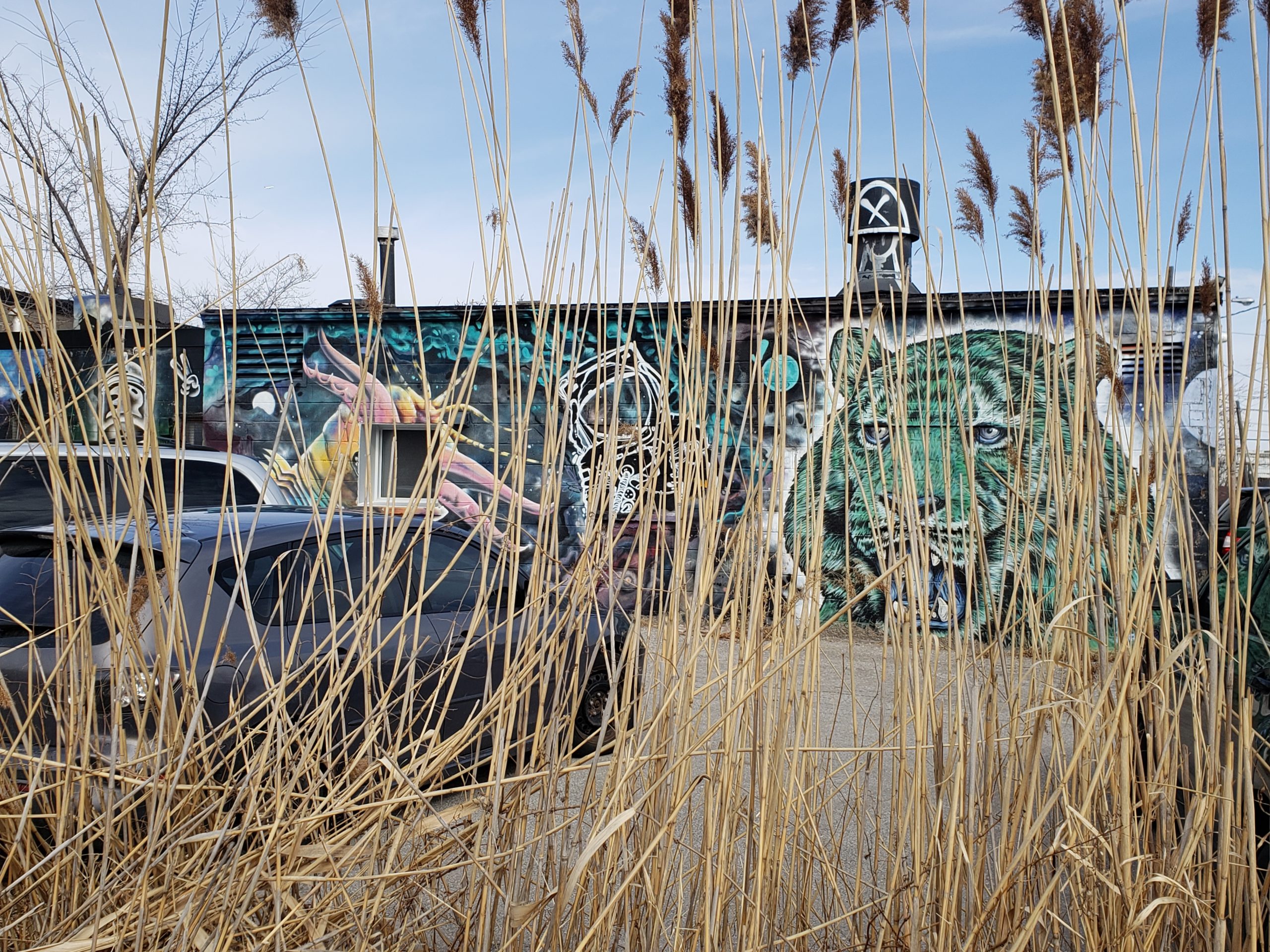
The York Trail is belied by the overgrown entrance. It’s actually quite exposed and bland, running as many rec trails do, under a set of hydro wires and pylons. But behind a set of industrial buildings, there’s some neat street art.
The Leopard??Optimistic name I think
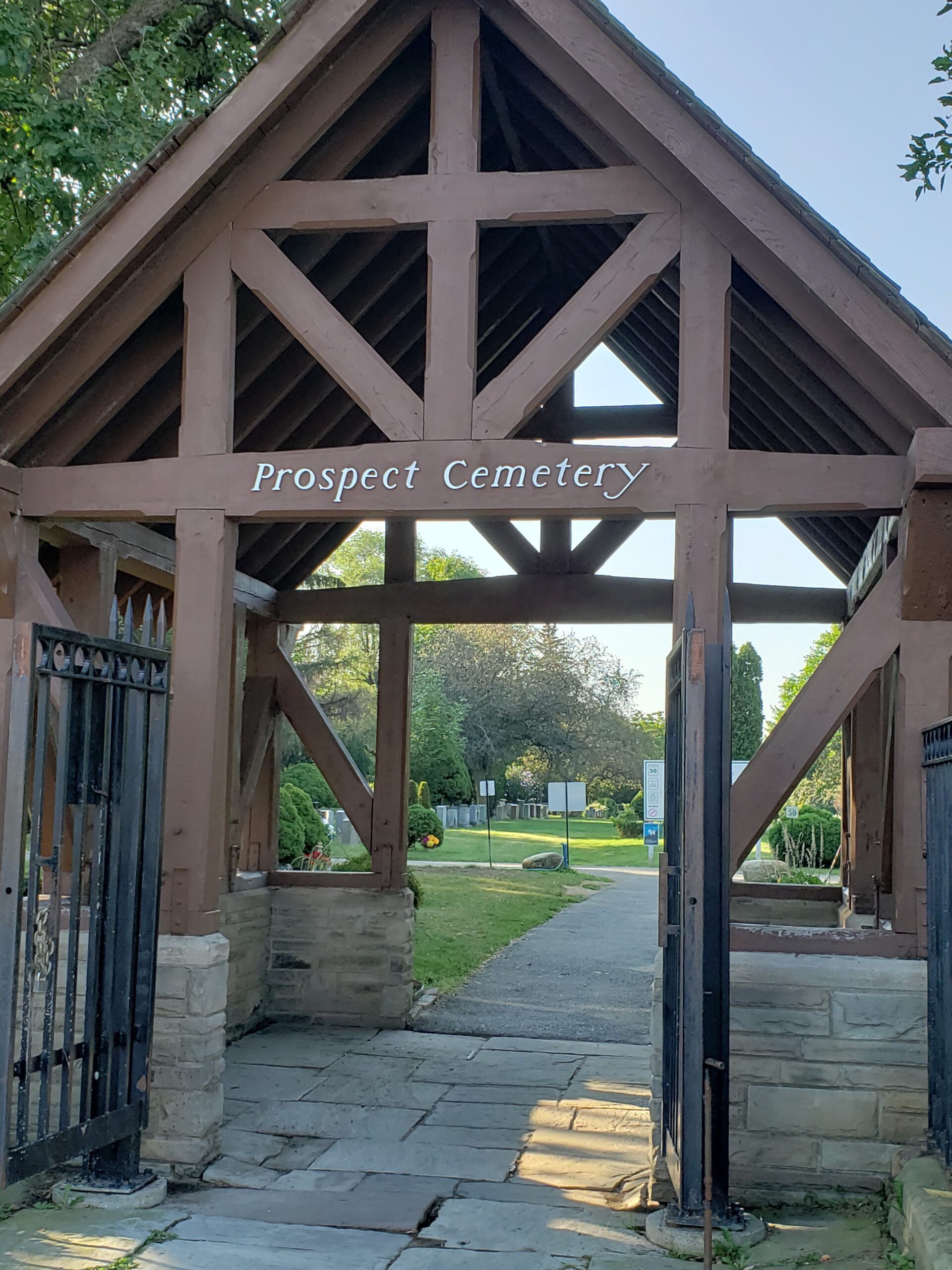
At the end of the Beltline, I pedal back along Bowie to Montgomery and cut through Prospect Cemetery, which bears a striking resemblance to Mt. Pleasant Cemetery, which is hardly surprising since they were designed by the same people. Prospect is bigger than Mt. Pleasant, consisting of three pleasantly green sections to ride through despite a steep climb midway.
You might think that Prospect provides a lengthy stretch in which to contemplate one’s own mortality, but death is far more imminent on the next part of my route which follows St. Clair Avenue west until it ends at Scarlett Street.
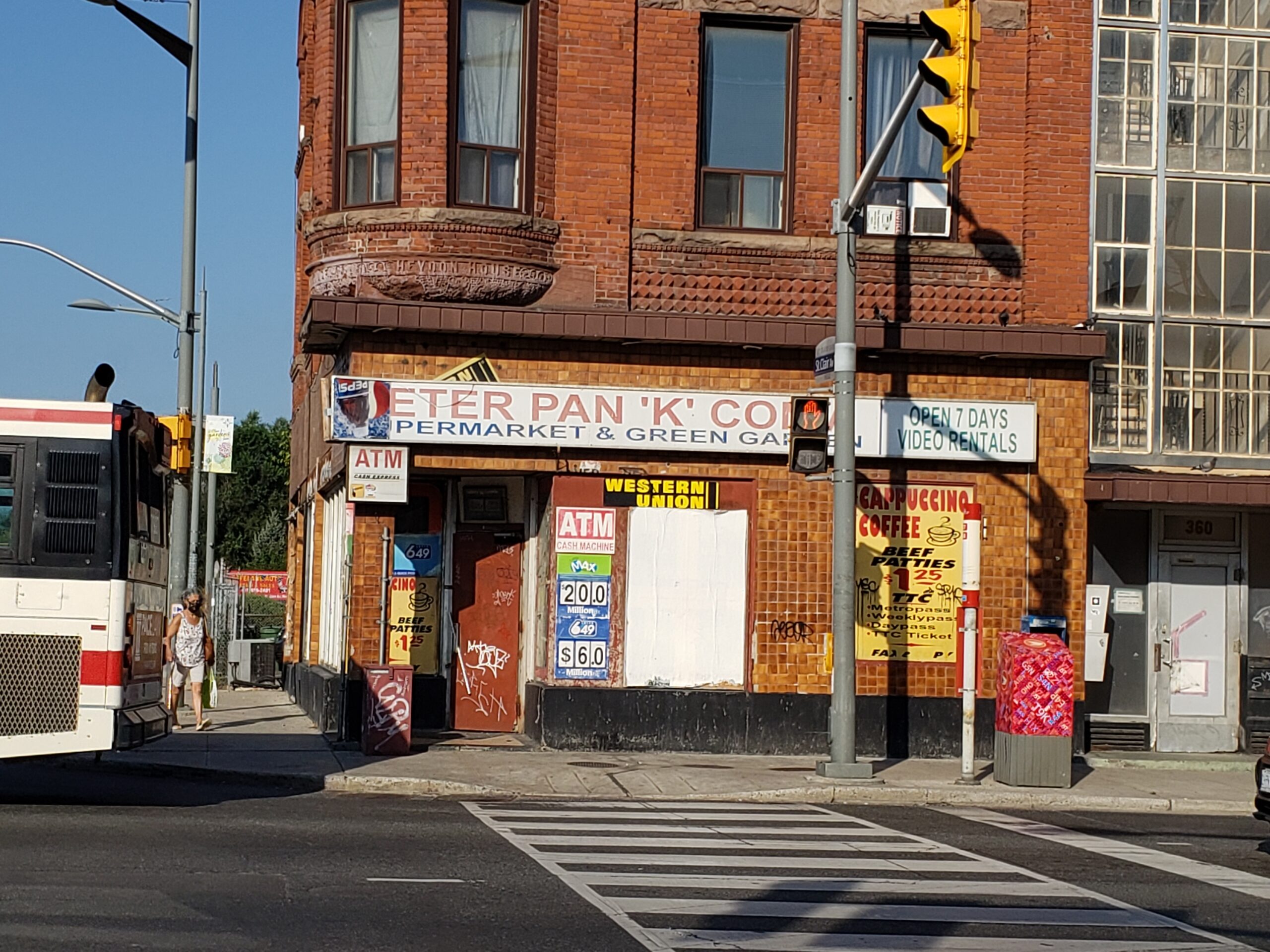
There are no – and I mean NO – accommodations for cyclists along busy St. Clair. Stay alert, stay alive. I watch for car doors opening, street car tracks and open air patios that have narrowed the thoroughfare to one lane. In some sections, I beat a retreat to the sidewalk. Better to be humbled into walking with pedestrians than blending in with the traffic in a grisly way.
The misnamed Peter Pan minimart is sadly no moreGood street art though
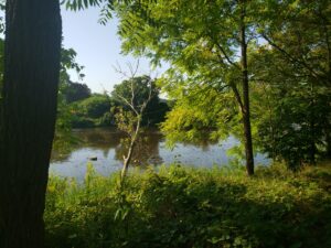
At last, the Humber River
I’m much relieved to turn onto Scarlett Street and its bike path. It’s a speedy downhill ride for the most part to the quiet refuge of the Humber River trails.
Cool painted curbstones along Scarlett
The northern parts of the trail are wilder and susceptible to flooding. One spring, a cycling team mate and I watched an enormous snapping turtle swim across our path.
In 1954, Hurricane Hazel struck Toronto with winds of 115 km/hr. The Humber, Don and Rouge Rivers overflowed and killed 81 people, destroying nearly 2000 homes. After this disaster, Toronto no longer builds on floodplains and developed an early warning weather system. Today though the trail is dry. I say hello to the few hikers and wave to the kids at a bike camp.
The Humber Trail has a general downgrade interspersed with some short steep hills. Long sections are being rebuilt in the section north of Old Mill Road. I’m glad that my trusty bike is a hybrid and that Ed pumped up my tires as I negotiate the gravel and mud.
Old Mill TTC station and street art
South of Old Mill, the trail gets challenging with two heart thumper climbs out of the valley. There’s a short section that detours through city streets before I reach my midway point and the last part of the Humber trail.
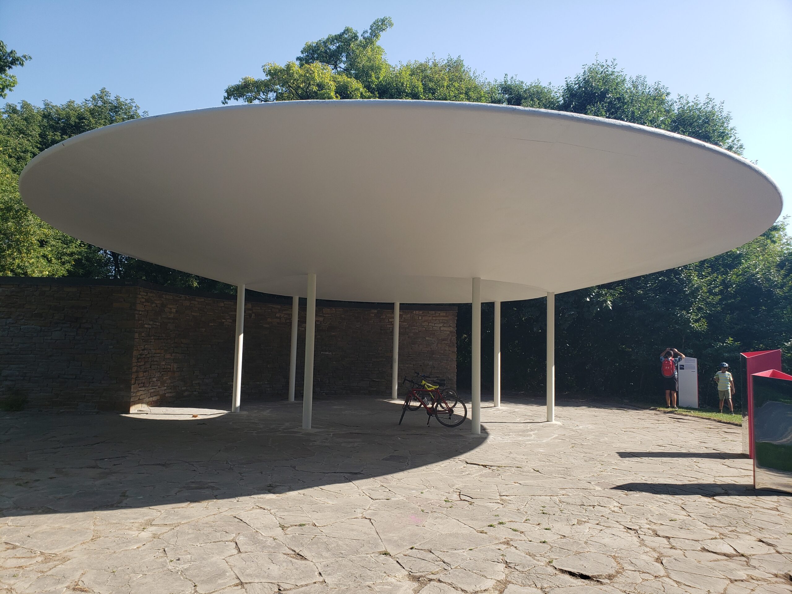
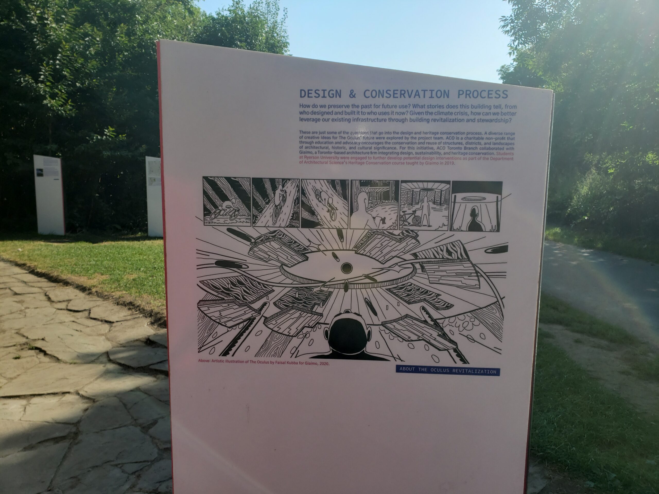
It’s now a downhill zoom through a wood and field flowers. One of my fav features along the trail is the Oculus, a UFO-inspired 1950s pavilion designed by British architect, Alan Crossley, and engineer, Laurence Cazaly. Over the years, Oculus had been defaced by tag graffiti and the City considered demolishing it. Happily, in 2019, it was saved. It’s now an art installation complete with alien graphics. (See pics below.)
Happily cleaned up OculusSpace adventure explanation
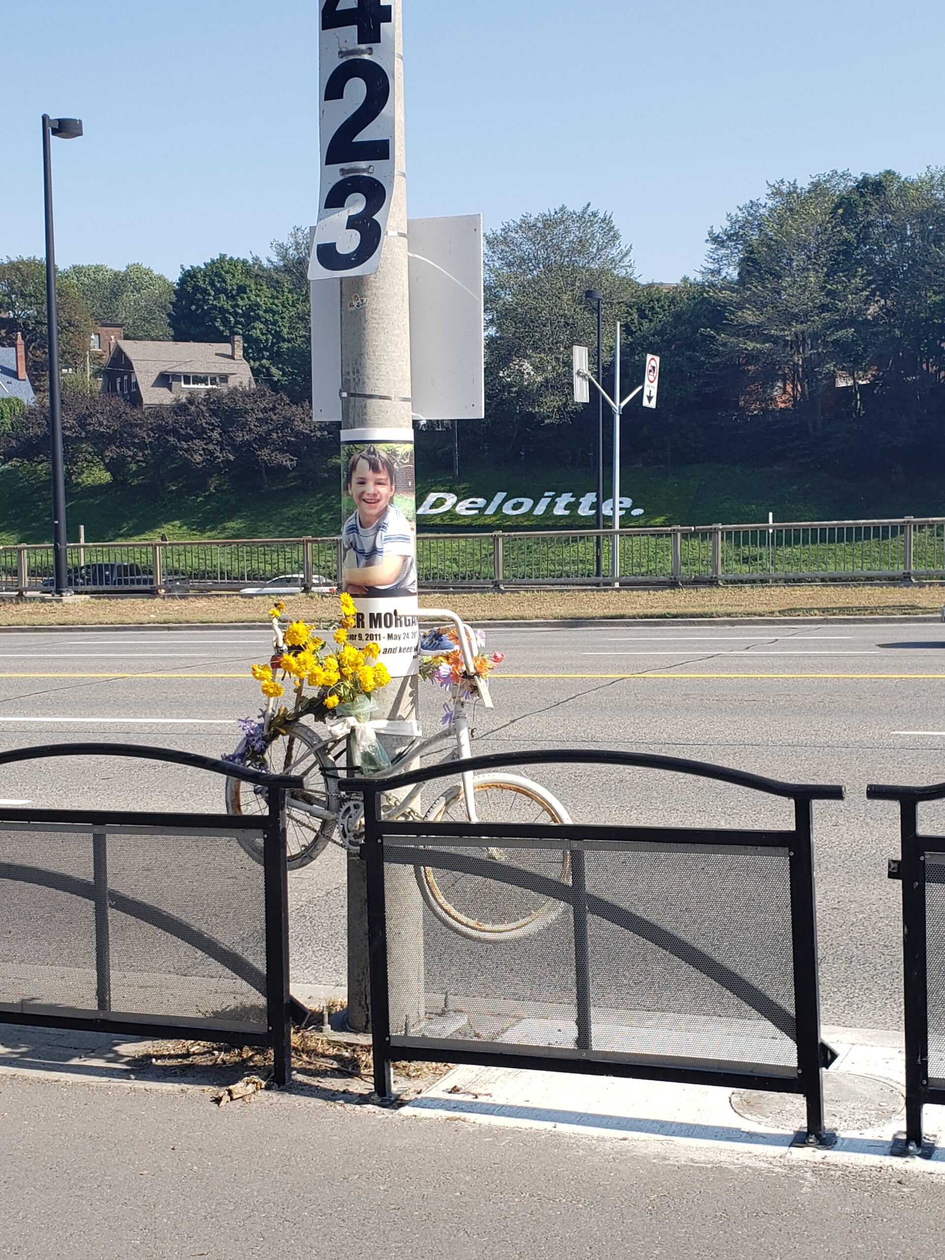
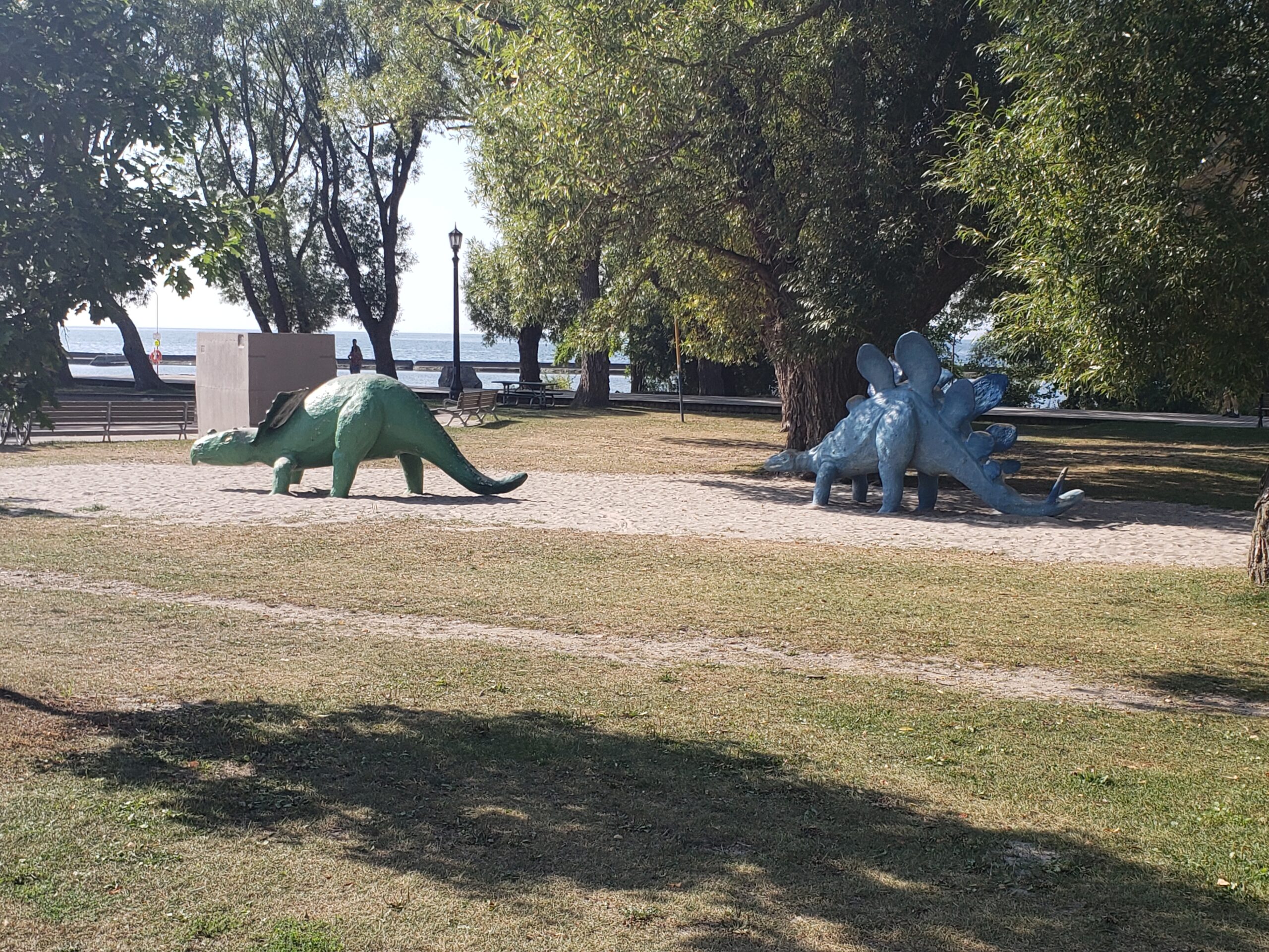
At the pedestrian bridge by Palace Pier, I turn east for the 15 km journey along the lake shore. I pass a kid-friendly dinosaur playground. Along the way I pass one of Toronto’s saddest ghost bicycles, a memorial to a 5 year old boy killed when he fell into Lake Shore traffic.
Sad memorialI still love dinosaurs
It’s full sun by now and 30+ degrees. Too hot even for biking. No free Perrier today at Ontario Place. At Balzacs in the Distillery District, I treat myself to an iced coffee before taking my usual route home: up Sherbourne through Summerhill and Mt. Pleasant cemetery.
Home at last and my third pledged 50 km ride is done
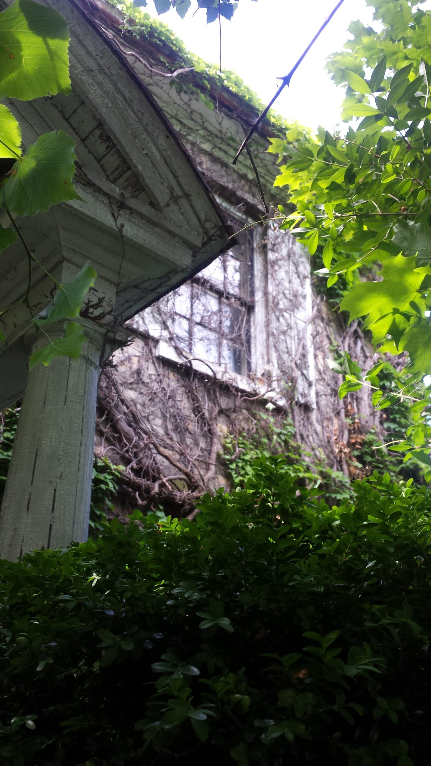
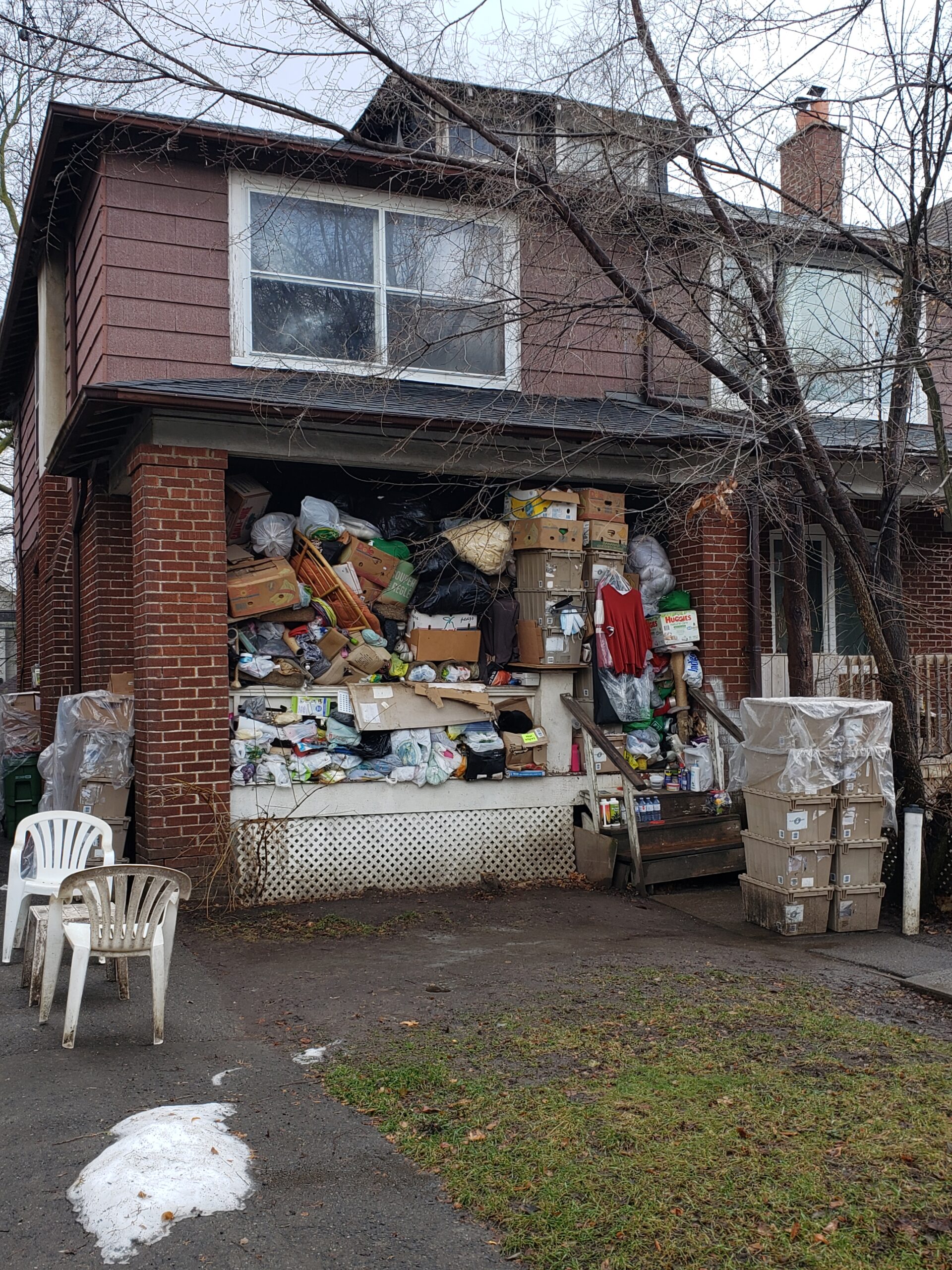
But do such houses exist in Toronto? Yes, they do! And I’ve learned to spot them.
The obvious clues are boarded up or broken windows, wildly overgrown gardens, leaking roofs and guttering. Though occasionally these signs can apply to a fully inhabited, sadly neglected house!
More subtle signs appear for vacant homes: usually the overgrown garden is a giveaway. No obvious cars, a sheen of dust on the windows, a dispirited ambience…Though someone somewhere is keeping up the basic maintenance to avoid destruction.
Water, sun and nature move swiftly to claim back the planet.
What fascinates me are the reasons why the house stands deserted. There are stories there. Did the owner grow too elderly or infirm? Turn away from the world because of heartbreak? Was there a family dispute? A lingering estate problem?
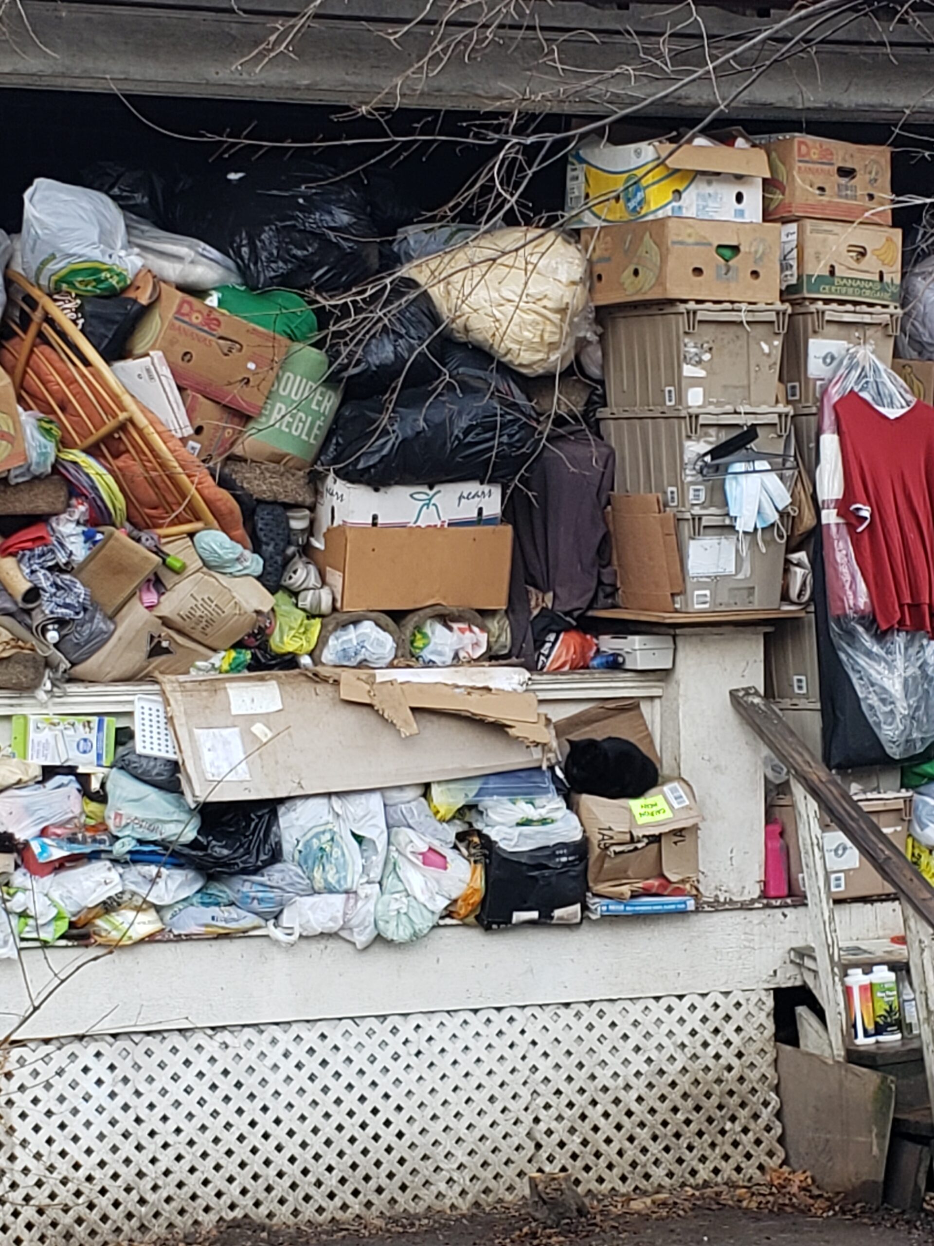
And what of this strange sight, spotted on a winter walk?
Has the hoarding become so extreme that it’s spilled onto the veranda? Or did someone clear it out for the junk removal service?
It’s March and my thoughts turn to training for The Ride. If Toronto’s wild weather allows, mid-March means riding the real roads!
The 2021 Ride to Conquer is virtual once again, but training is real – and an escape from COVID.
And a chance to Urbex Toronto. (Urbex = urban exploration.)
Spring this year promises to be mild and soon. I jumped on the bike the earliest since the inaugural 2008 ride and pulled off 13 km.
First snow drops
The Beltline trail proved to be treacherous. Crossing over the Iron Horse Bridge, I hit ice. It’s like hydroplaning in a car: don’t steer, don’t brake, don’t waver. Maintain speed and balance and hope to *$%# you make it over the next 50 feet.
I reached my beloved icon, Tout Est Possible – and happily contended with mere mud before retreating to dodging traffic on regular roads.
It turns out that the Beltline Tout Est Possible is only one of at least 20 such icons scattered throughout Toronto. Many appear in non-obvious locations in places like Sherwood Park, Nordheimer Ravine and Taylor Creek Park.
The artist remains unknown like Banksy since their work started appearing in 2011. I’m happy to report that when my fav got erased, the artist restored it before too long.
For a description of fellow cyclists’ full tour of the icons, see the blogTO article here.
On Monday, August 17th, I headed on Ride #2 of my pledge to do 200 km in August, the distance from Toronto to Niagara Falls.
The morning was perfect, one of the most beautiful this summer. Cool, sunny, no blustering head winds. I headed down through Leaside into Sunnybrook Park through the Lyndhurst Hospital entrance.
I’m familiar with the rehab hospital because a friend spend several months there after a bad car accident. He’d travelled down to the USA to buy a vintage sports car, but on returning to Canada, he slid off the road. The problem: the rubber in the vintage tires had gone hard with age and lost all traction. Happily, he made a remarkable recovery.
The other reason, I’m familiar with Lyndhurst is because of the killer hill down into Sunnybrook. During my marathon training days, we used to run UP this hill. Fortunately today, I am biking DOWN.
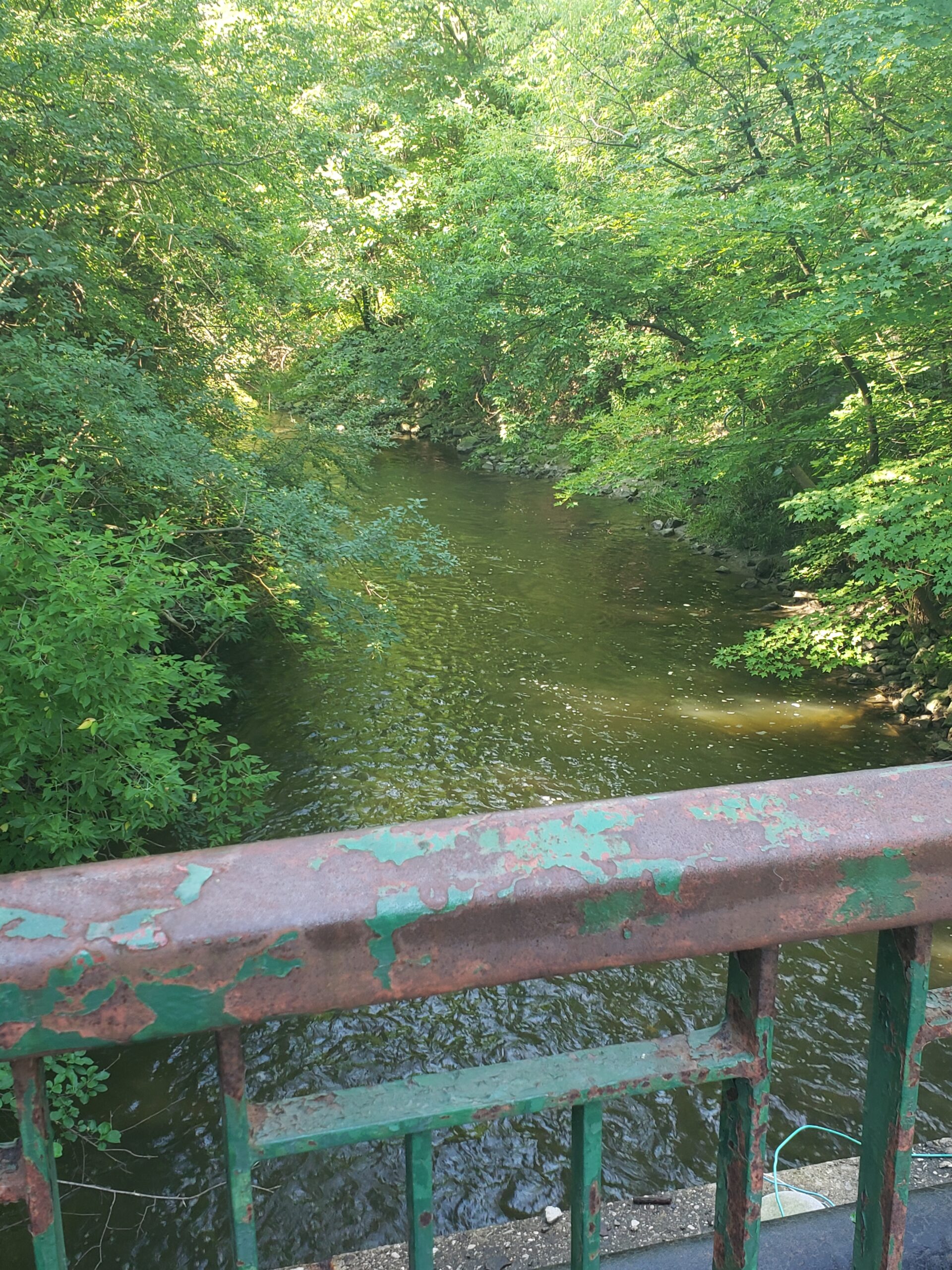
Creek in Sunnybrook
Past the dog park and along a picture perfect creek . Few people out this Monday morning other than the usual runners, hikers and dog walkers.
The wild flowers are out!
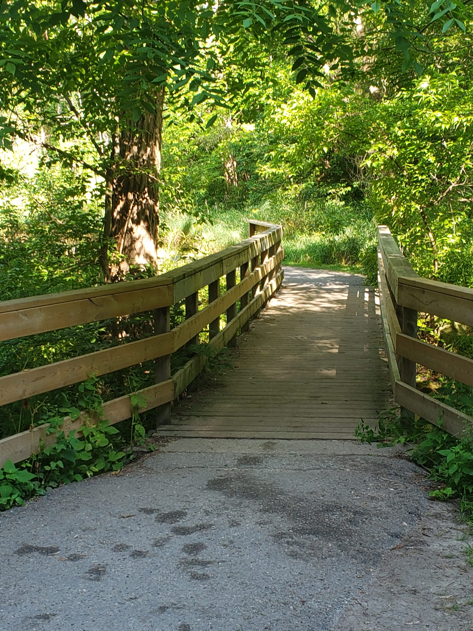
A tricky aspect of Sunnybrook trails for cyclists is negotiating the narrow, heavily used pedestrian bridges. I’m less worried about COVID than I am about blunt force trauma, having nearly been crashed into numerous times by MAMILs (cyclist pejorative for obnoxious middle-aged men in lycra). Luckily I cross over the Don Valley pedestrian bridge with no incident before stopping at “The Teeth”.
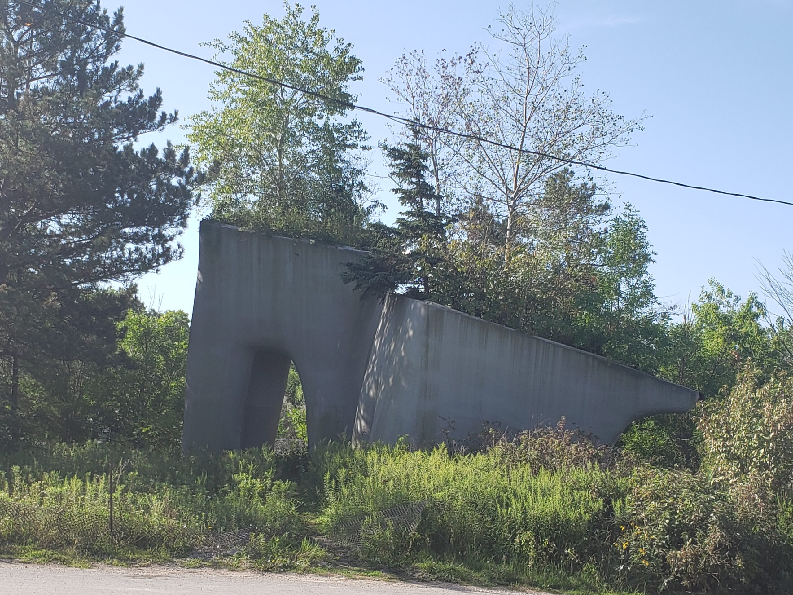
Teeth or elephants – you decide
Allegedly the artist created the concrete structures to be elephants that would blend with nature. Hence the trees growing out of them. But for Toronto runners “The Teeth” are a landmark for running routes. And, yes, I agree they really look like molars.
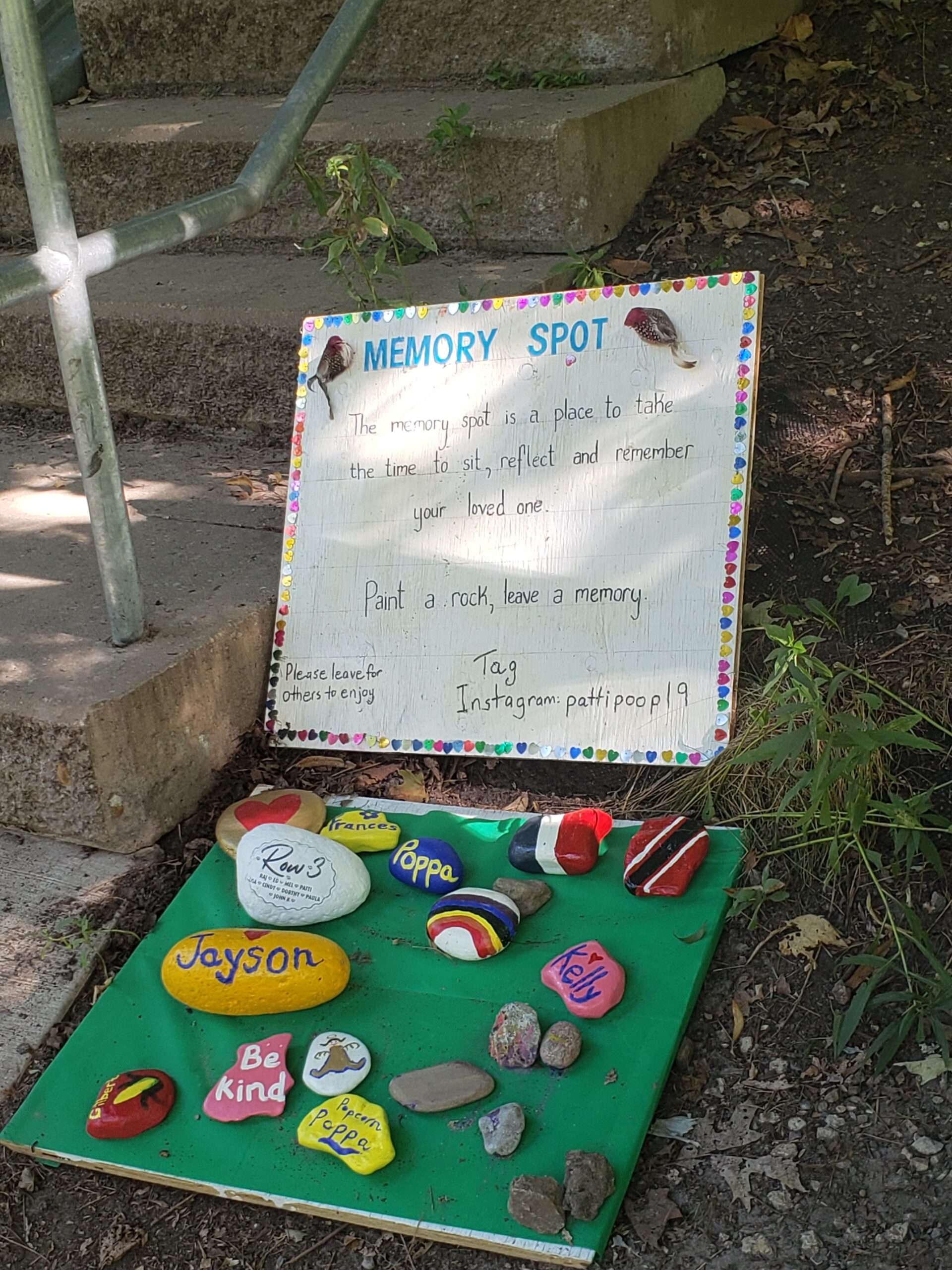
Nasty narrow pedestrian bridgeMemory spot
Today, I decide to head east into Taylor Creek Park, a trail with numerous dread pedestrian bridges over rocks and running water. My luck holds – few MAMILs crushing everyone in their path to score their Personal Best time! I take a breather to check out an impromptu memorial along the way.
The stones remind me of the lovely Jewish tradition of leaving a stone in the cemetery after visiting a loved one.
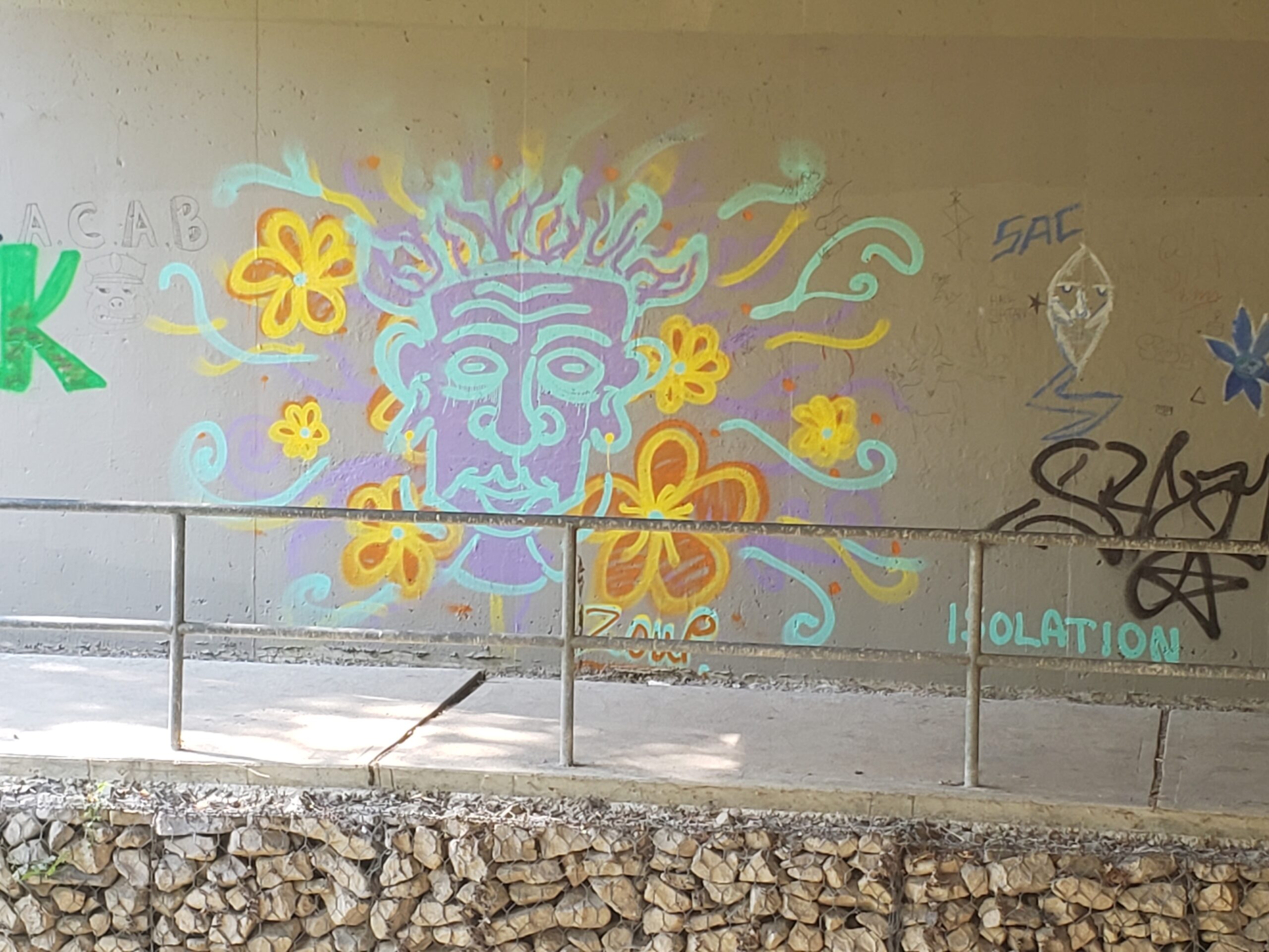
The main trail ends at Dawes Road. To get to Victoria Park, I cross yet another pedestrian bridge and bike through an underpass with some neat street art. After this the trail is mostly a gravelly track that gets muddy and floods after a rain. The climb up to Victoria Park is another heart thumper.
This is my Test Hill. If I can make it up all the way in my “Granny Gear” or the lowest possible on my hybrid, I’m fit enough for The Ride. But since, the Ride has gone virtual, I bike up the first half and walk up the rest.
Underpass street art
Down the Victoria Park bike path across Danforth. This heavily trafficked road is a bit nerve-wracking, because my riding buddy once took a header over the handle bars after hitting a pothole beneath the underpass.
Kids care about the environment
Over to the safety of Scarborough Road for a straight run down to the Beaches. I pass by Adam Beck school with its colorful murals. This is one of my favs.
Beautiful Lake Ontario
Today the weather cools noticeably as I near the lake. It and the boardwalk are especially lovely today.
A strong headwind as I pedal toward the Distillery District and my usual reward at Balzac’s cafe. While munching down my muffin, I see thunderous clouds building in the west.
Change of plans, the route through to the Humber will have to wait until Ride #3 or #4. I charge north, taking the bike path along Sherbourne making for home.
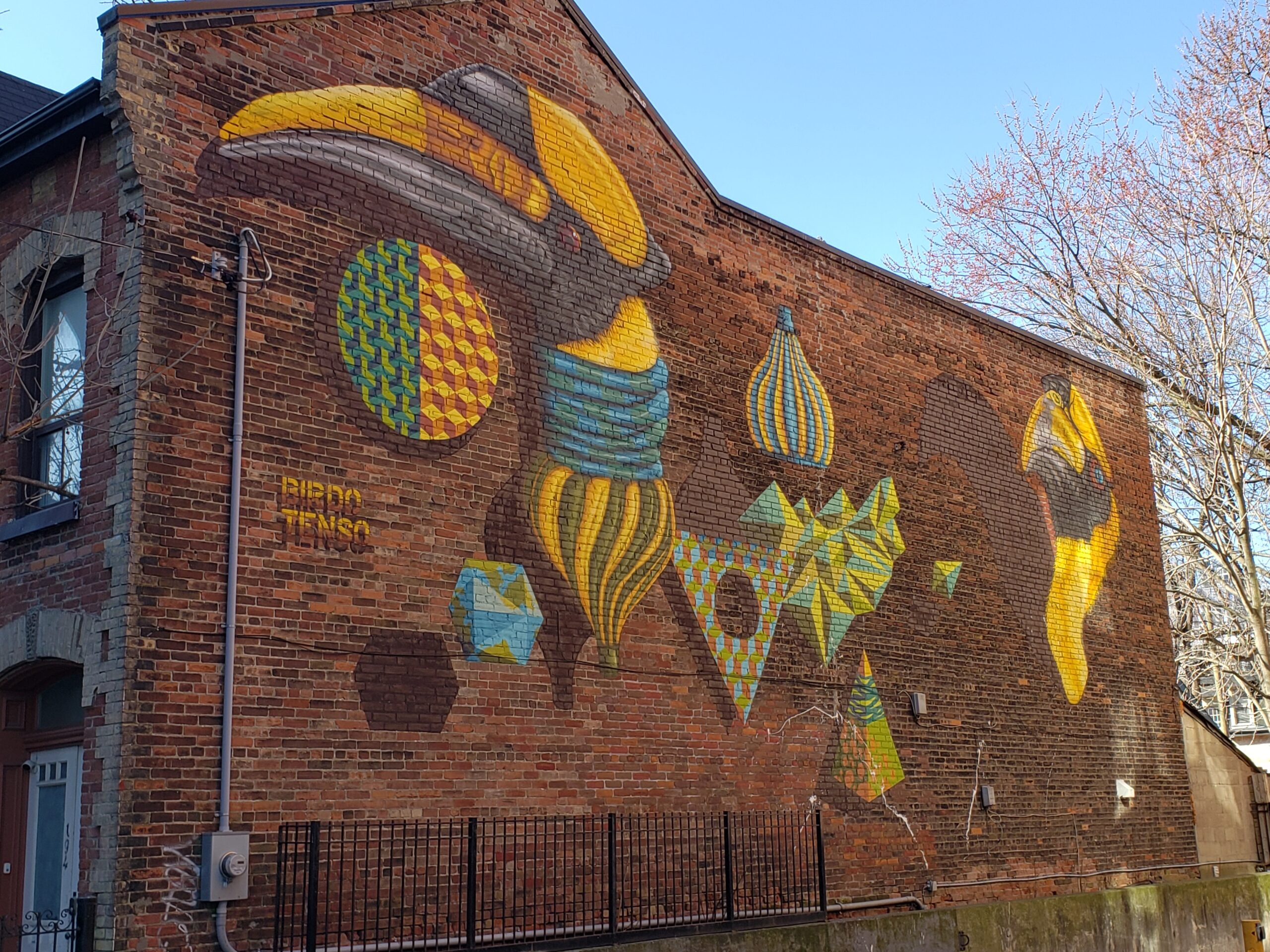
Moss Park mural
This is a sad route; I call it the Economic Disparity Route. It passes by Moss Park arena and the neighboring homeless shelter. During COVID, many more homeless are wandering the streets often shouting, in distress, deluded in the middle of traffic. Cop cars and emergency vehicles every time this year when I’ve passed through – and that’s a lot.
Enough said
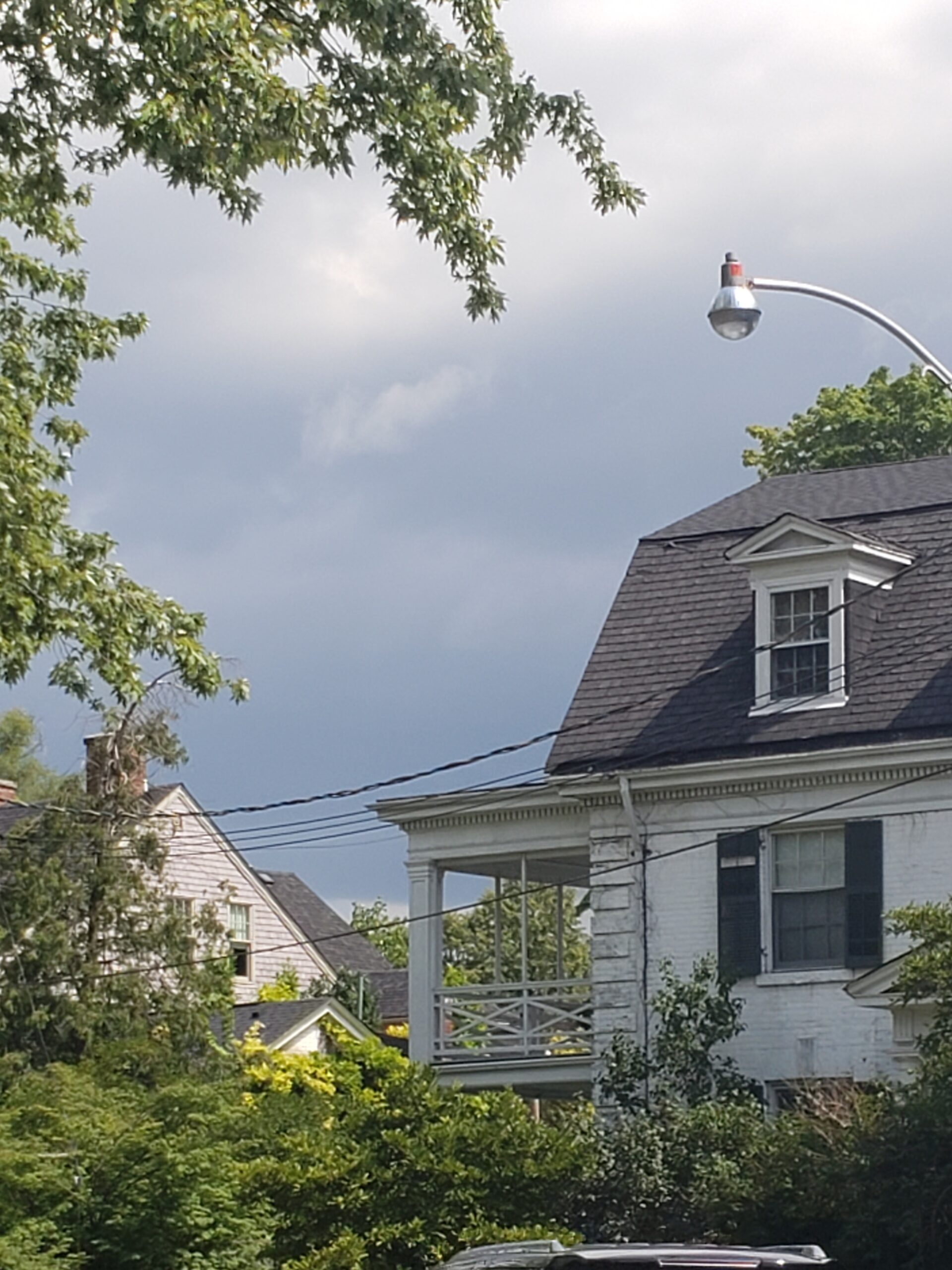
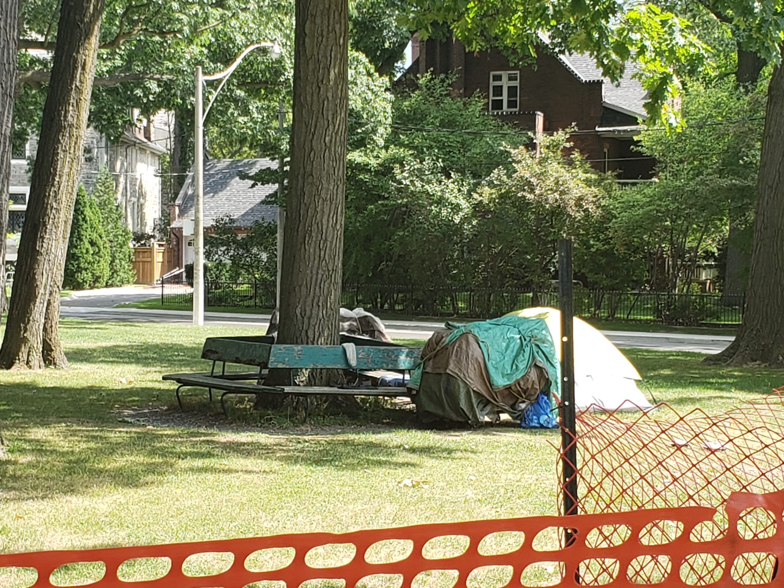
Sherbourne crosses over into Rosedale, once of Toronto’s wealthiest enclaves. To my surprise I see people camped out in a parkette within a stone’s throw of multi-million dollar mansions.
Thundery weather over Rosedale
Encamped in Rosedale
Summerhill pedestrian bridge again requires careful negotiating. I usually walk my bike over to dodge schoolkids, nannies with babies, seniors and of course, the ubiquitous MAMILs. Some neat street art on the crumbling concrete walls bordering the steep hill of McPherson Drive.
My fav: Ghost Car
From here it is short pleasant ride through Moore Park into Mt. Pleasant cemetery.
Keeping a watchful eye on the threatening weather, I finish off the distance via the Beltline and looping through Mt. Pleasant. There are enough hills and gradients to keep my heart pumping.
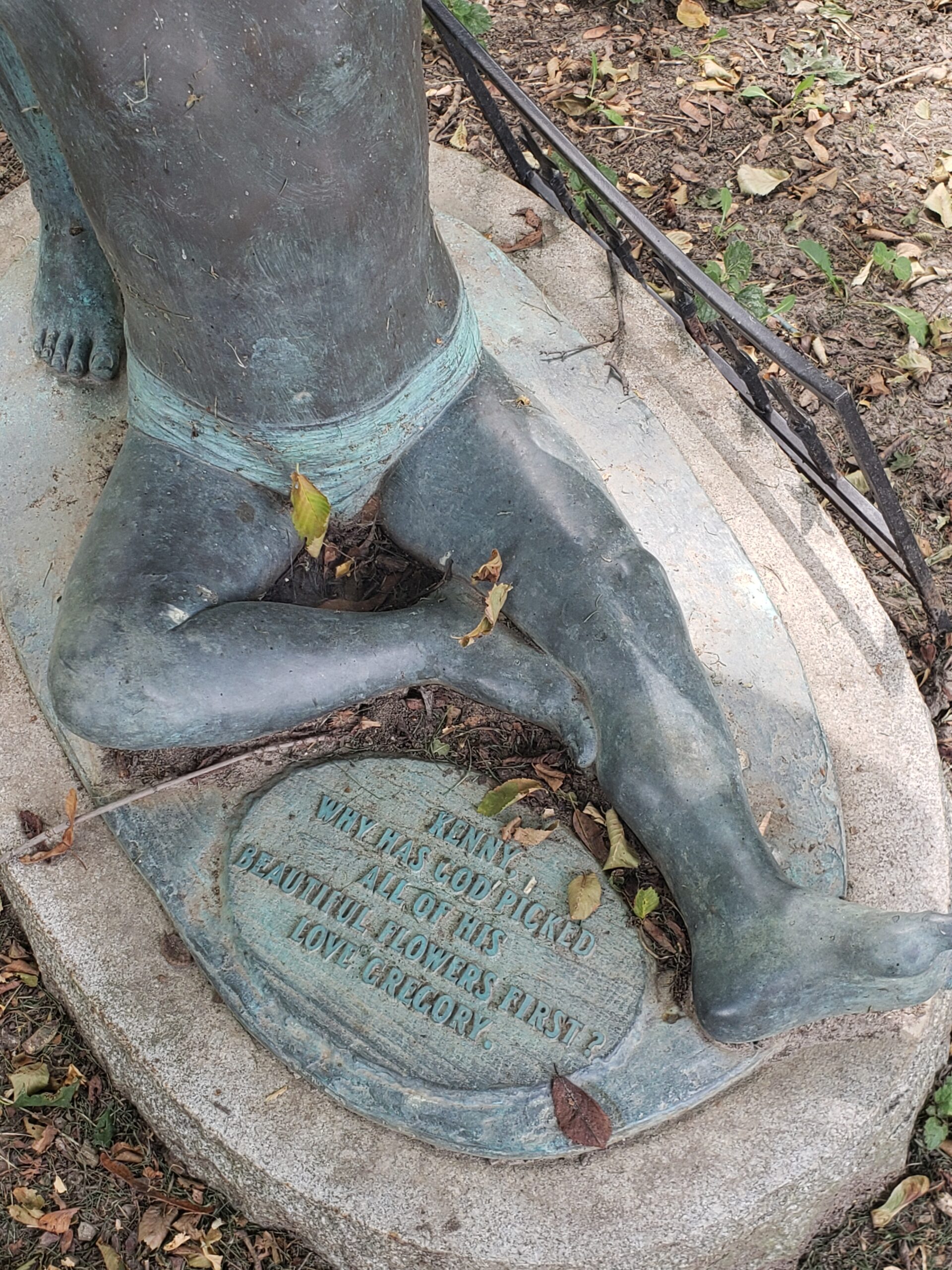
Almost done for Ride #2, I pause by one of the Mt. Pleasant icons, a memorial to two young men who died within months of each other. The plaque reads: Why has God picked all his beautiful flowers first. There is a love story here.
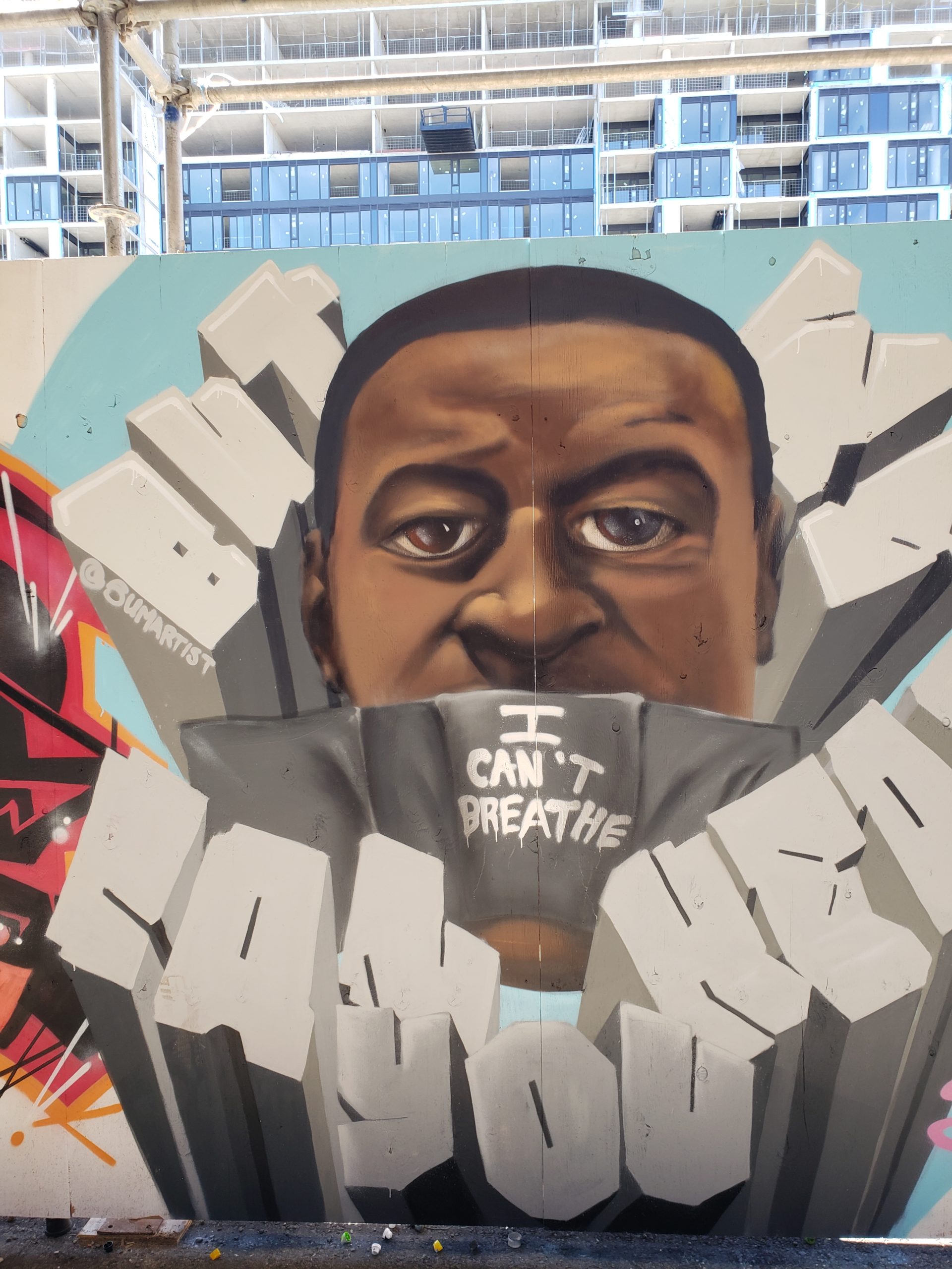
COVID forced the pause button down on modern society. And the intensification of social media meant the whole world watched George Floyd get murdered. Yes, let’s use the right word – murdered over an alleged counterfeit $20 bill.
Many times I’ve handed a $20 bill to a cashier who semi-surreptitiously checked it out with a UV light under the counter. What’s the worst that would have happened to me if it looked fake? The cashier would simply have handed it back and told me it’s phoney.
Because I’m white. Also I live in Canada.
As a kid, I witnessed the shootings at Kent State University on the TV news. The image of state troopers firing into and killing unarmed student protestors seared into my memory forever. Up until then, I believed the world was the way society and my folks told me it was. That day I began to see the way the world really is.
I’m hoping there’s an upside to the ubiquitous spying technology we’re so addicted to. (In case you missed it, our phones are turning us into “Little Brother”.) But amidst FAANG’s avid personal data collection, the truth occasionally slips out.
Will public outrage reach the critical mass needed for meaningful action? Does this mean Revolution, Baby?
Maybe.
Maybe this time it’s really gonna be different.
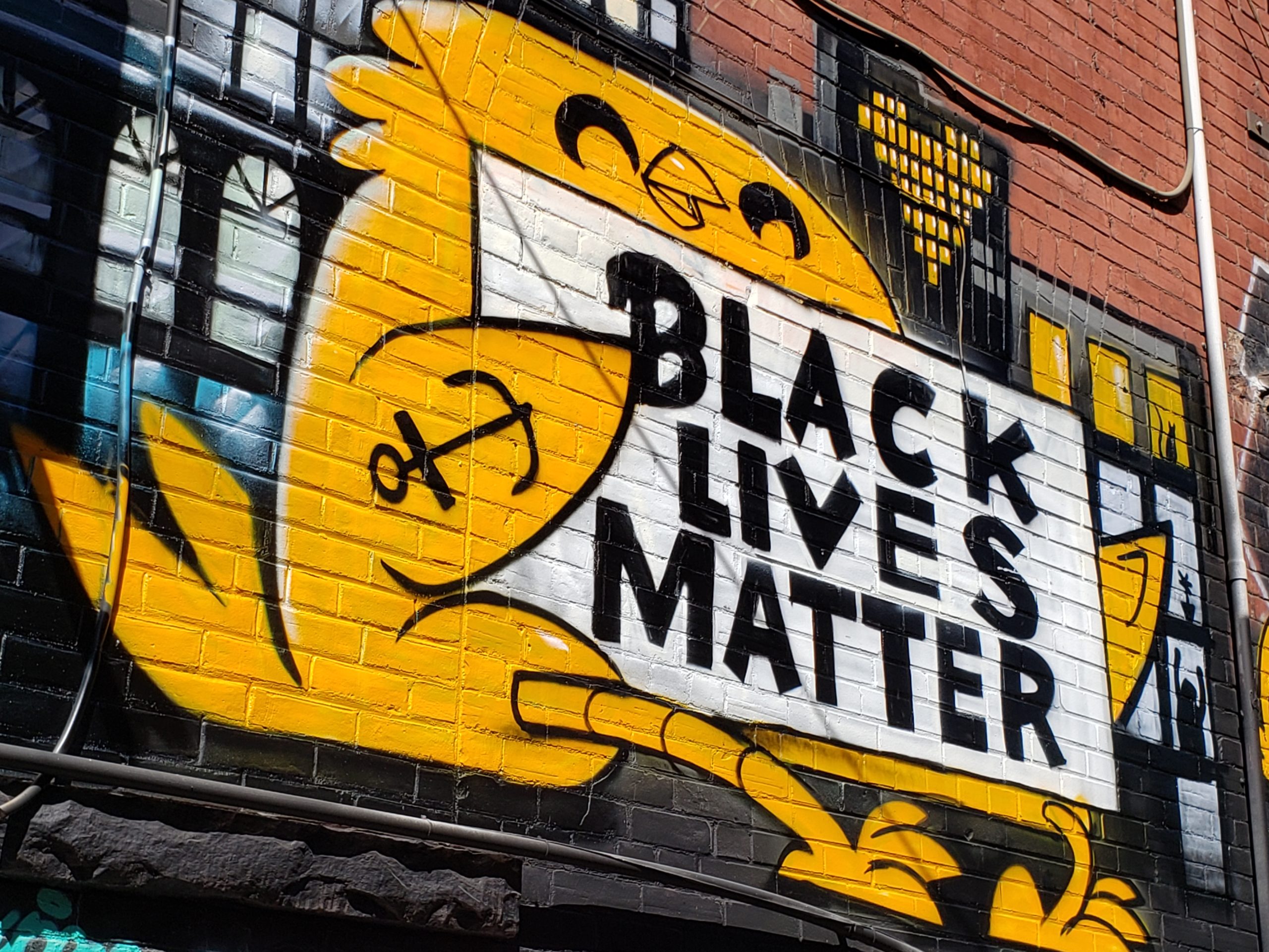
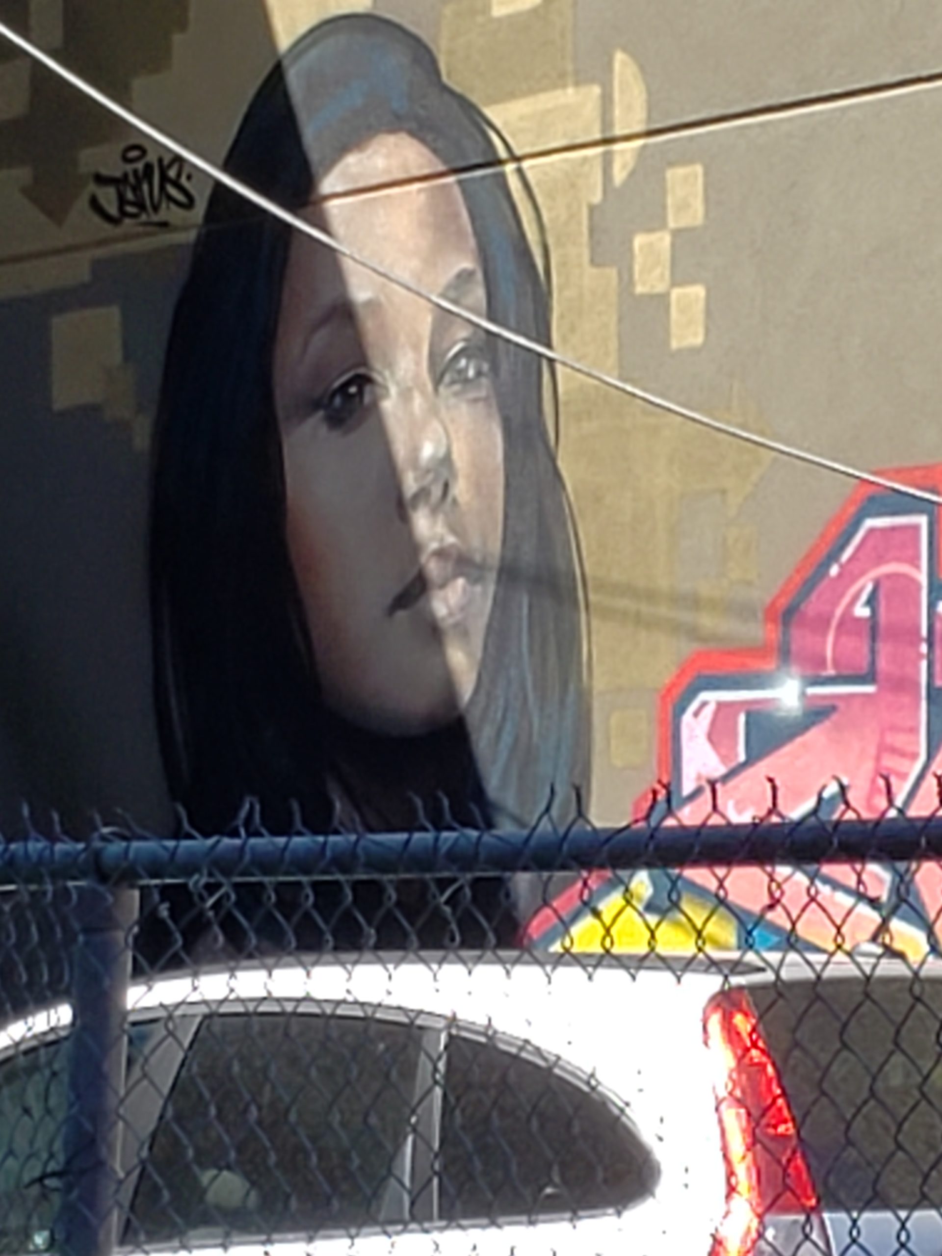
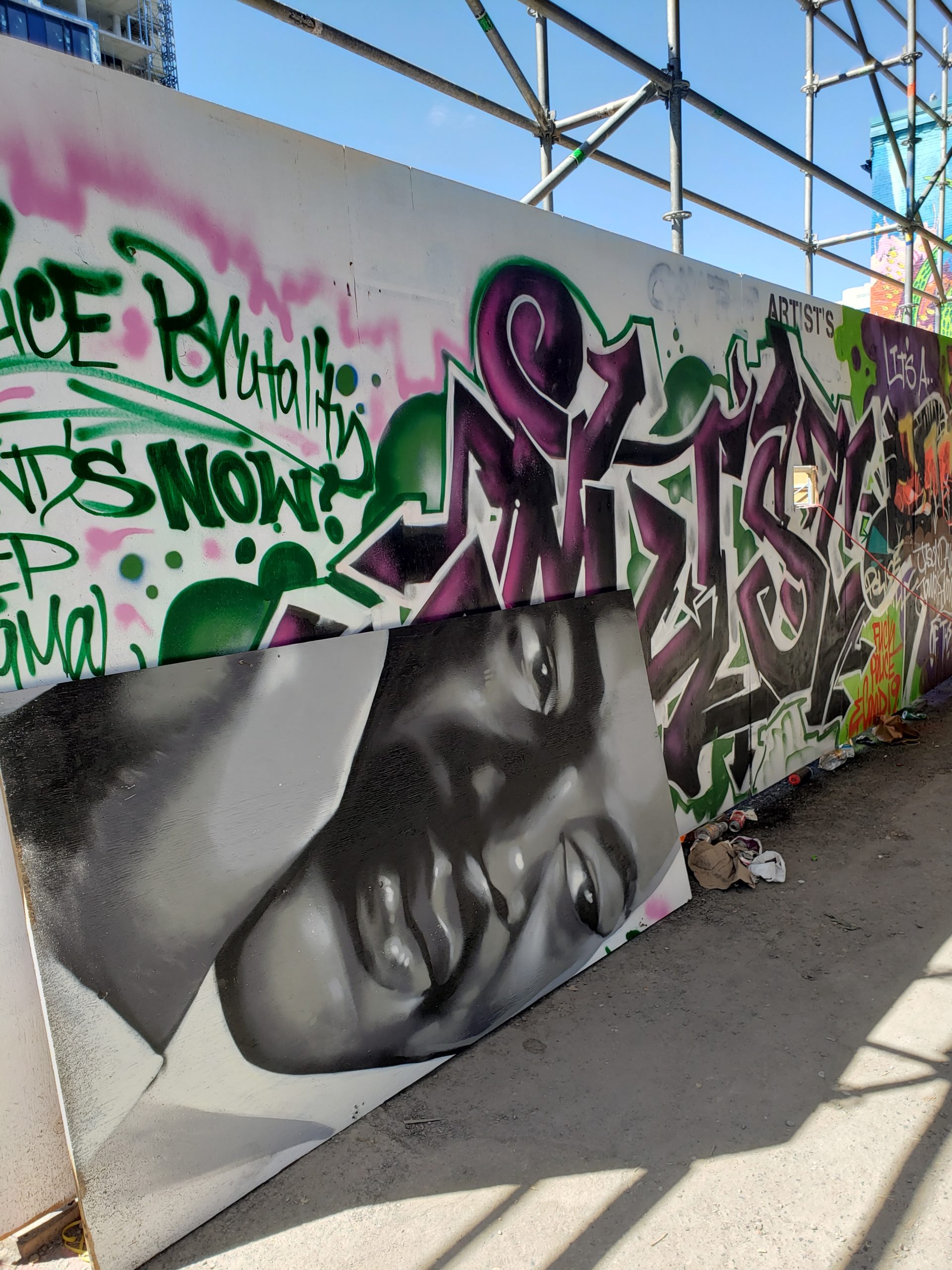
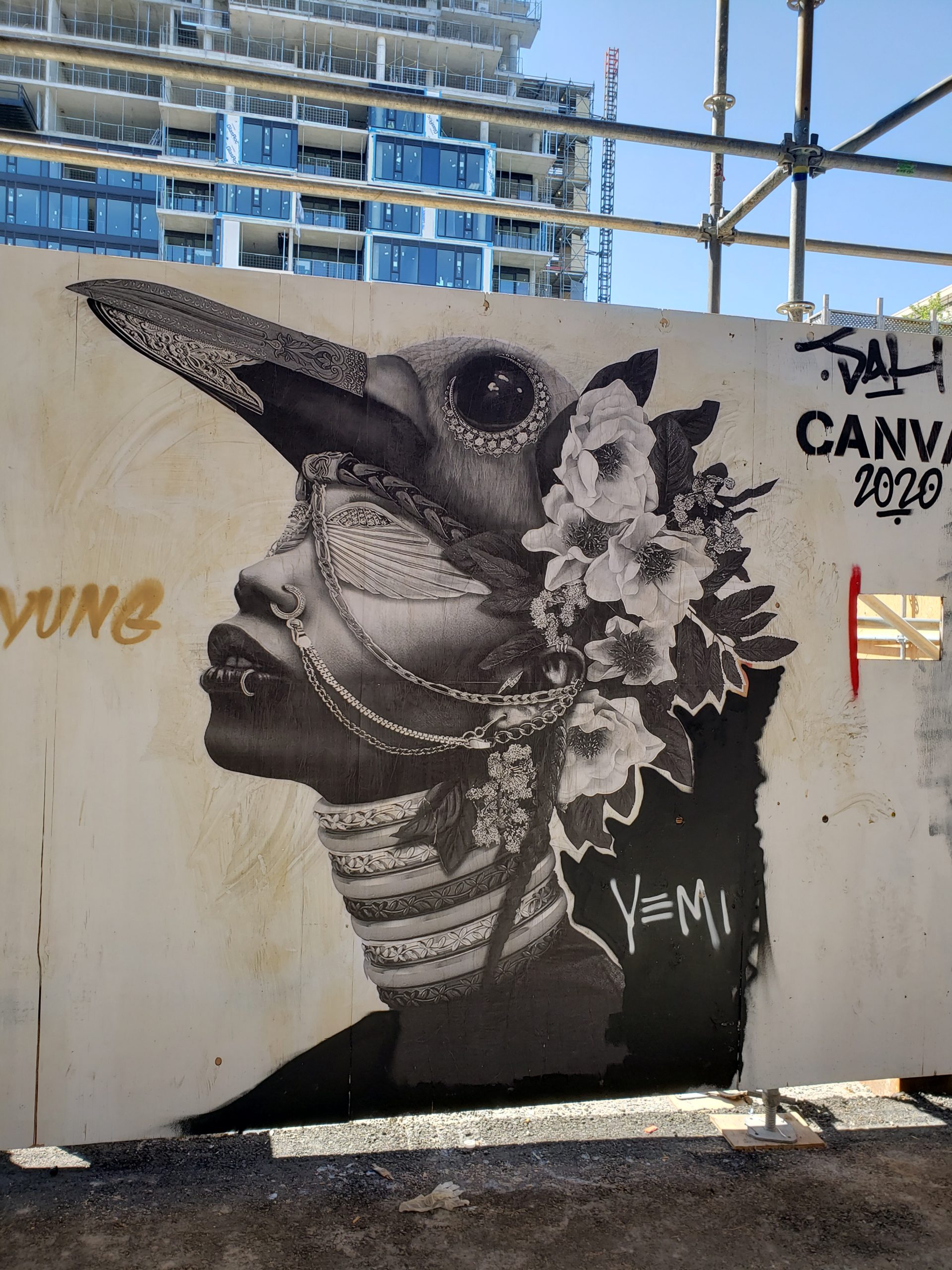
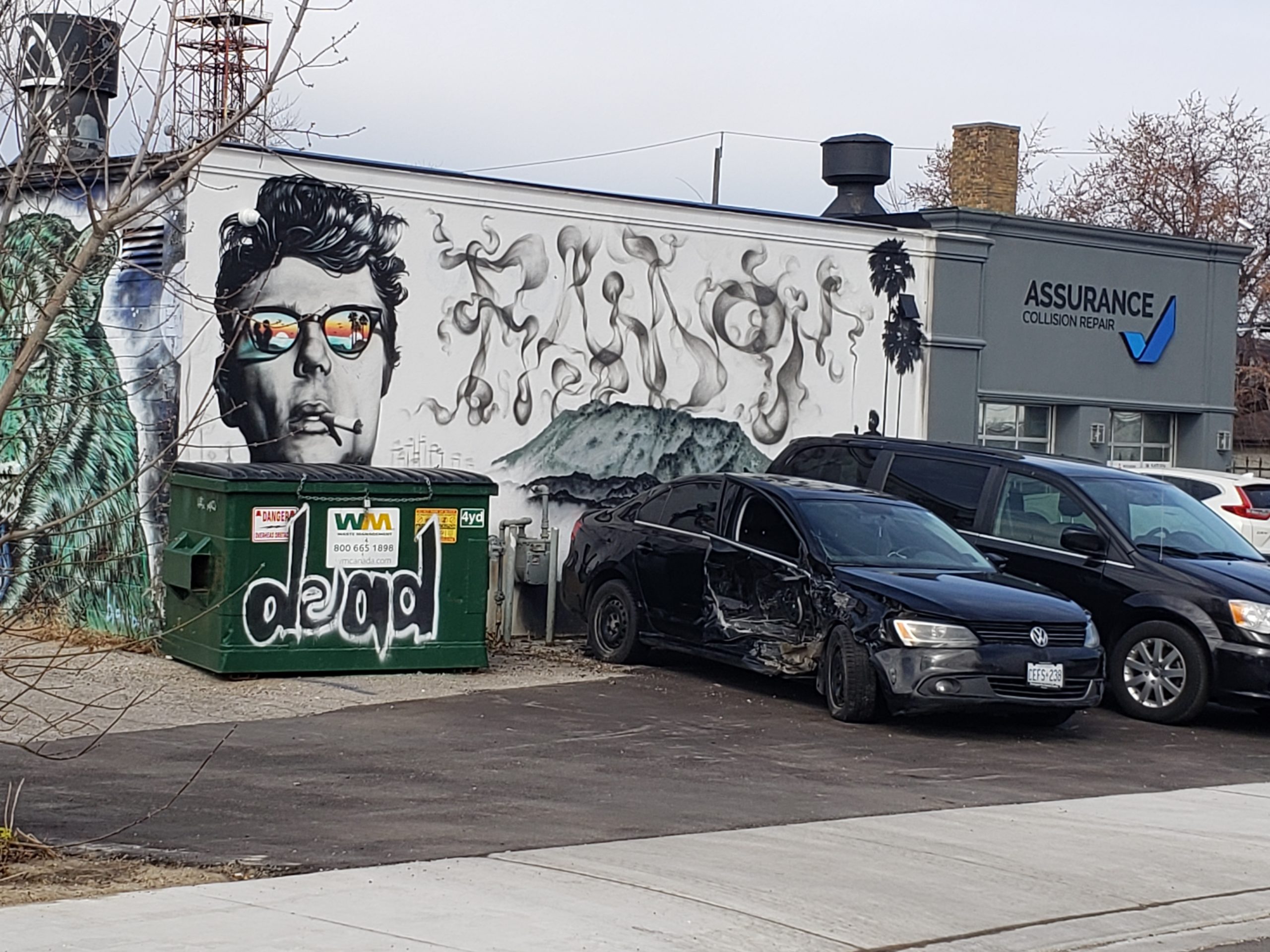
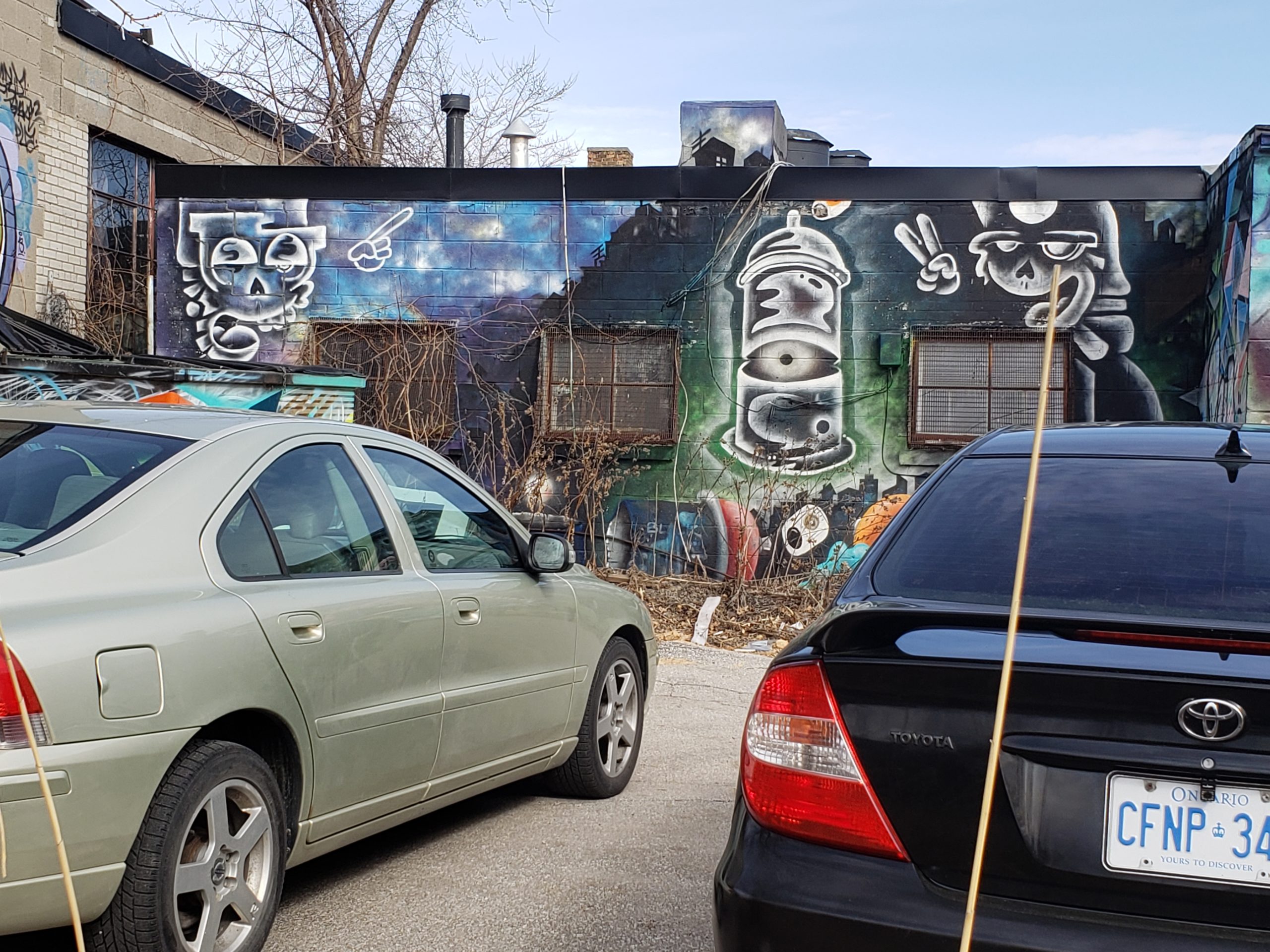
So I biked through Toronto’s Graffiti Alley to take in the street art memorializing George Floyd. Here’s what I found. The pics speak for themselves.
Graffiti Alley runs a short block south of Queen, east-west from Spadina to Bathurst. It’s gritty, the paintings multi-layered and ever-changing. Check Google Maps for location.
Strange times indeed. Normally in March and April, I’m training for The Ride to Conquer Cancer, to support cancer research at Toronto’s Princess Margaret Hospital, one of the top five centres in the world.
2020 would have been my 13th ride. Alas, not to be. The Ride is in limbo along with the rest of our world. Hard to see how an event of 4000+ sweaty riders plus 1000 volunteers, all served by well-used porta-potties, leaking buckets of energy drinks and pawed-over treats, could happen in this epidemic year.
No matter what they decide about the Ride itself, the donations will go to cancer research, if not this year, then in 2021. If only cancer went into quarantine! Happily though PMH has officially joined the war on CORVID-19 with researchers working on a treatment / vaccine.
What to do in the meantime? Luckily because I’m a runner and cyclist I’m not housebound. No rules against either activity…yet. Public health authorities encourage everyone to get fresh air. But where?
My favorite training loop, Mt. Pleasant cemetery, is closed, but city trails are not. And the streets are eerily empty of traffic. Surreal to be sure. My intrepid fellow companions are: dog walkers, families with small children, senior citizens and other crazy cyclists and runners. Waved to a gym buddy – an 82 year old grandmother and long distance runner who grew up during the Battle of Britain.
My British blood stirs. This is our boomer moment, I guess. Crap! And it’s spring and reason for happiness.
Seen in RosedaleCrocuses!More spring flowers
One of my favorite bike routes runs along the Beltline. Uplifting to discover that its interesting street art is not only intact, but restored.
James Dean artistGreen tiger burning brightNew. Condom rocket?Watching u
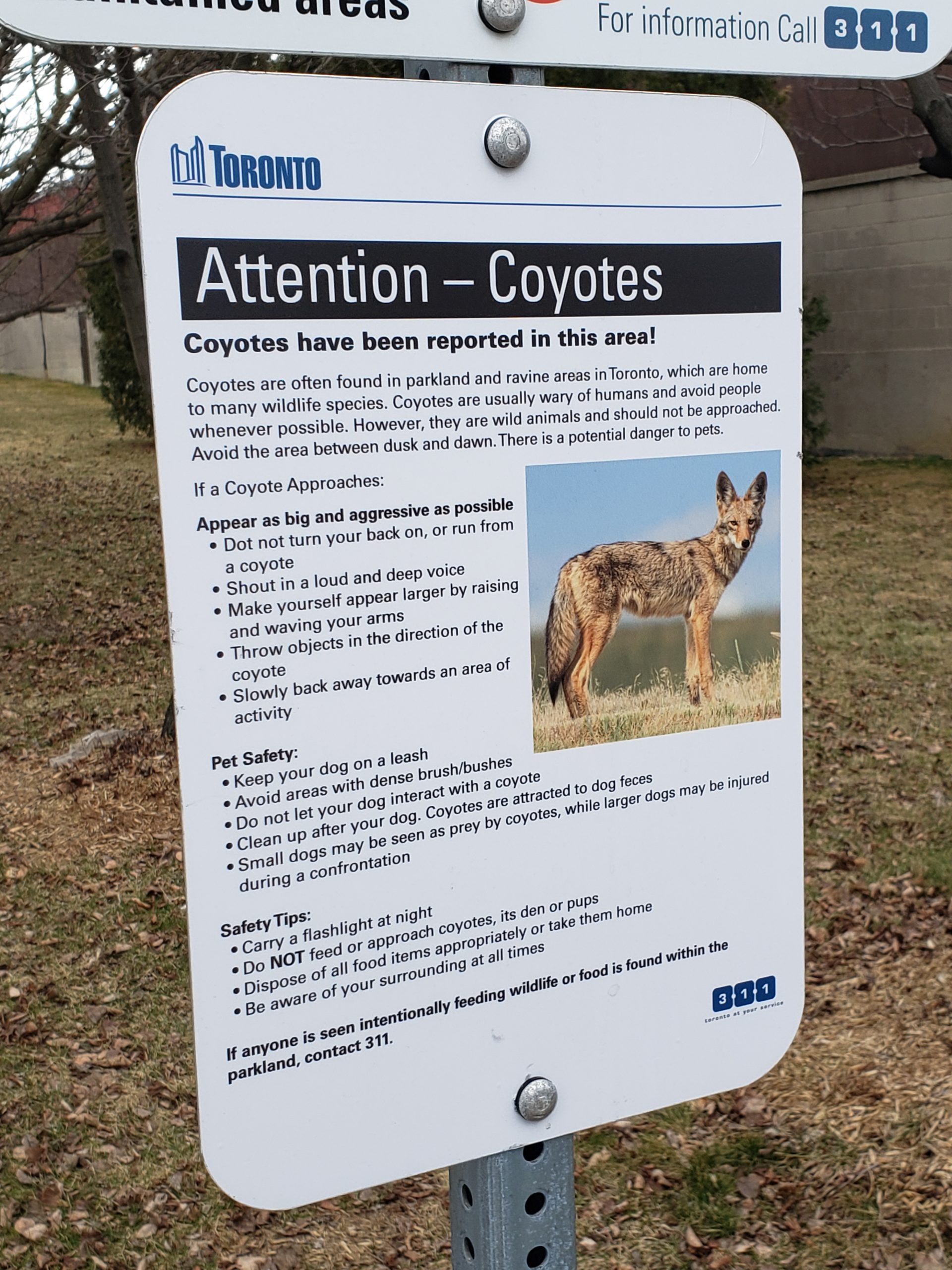
Wildlife may be reclaiming their habitat judging by the sign spotted near the end of the Beltline. Stay safe, my friends!
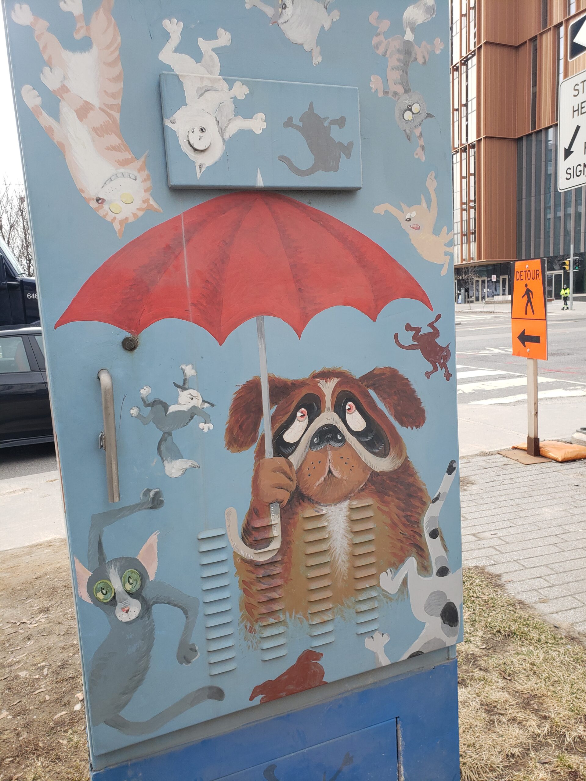
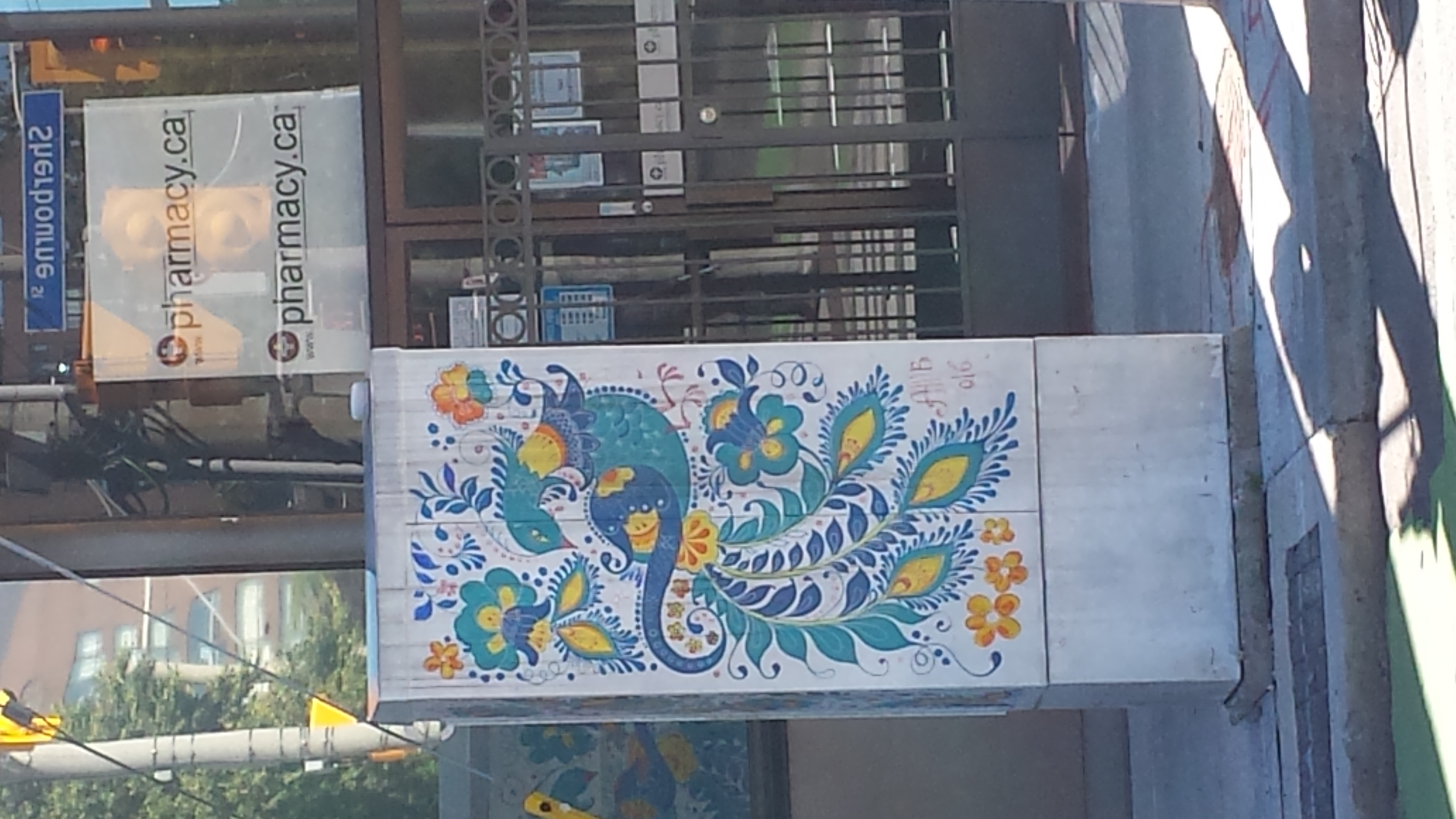
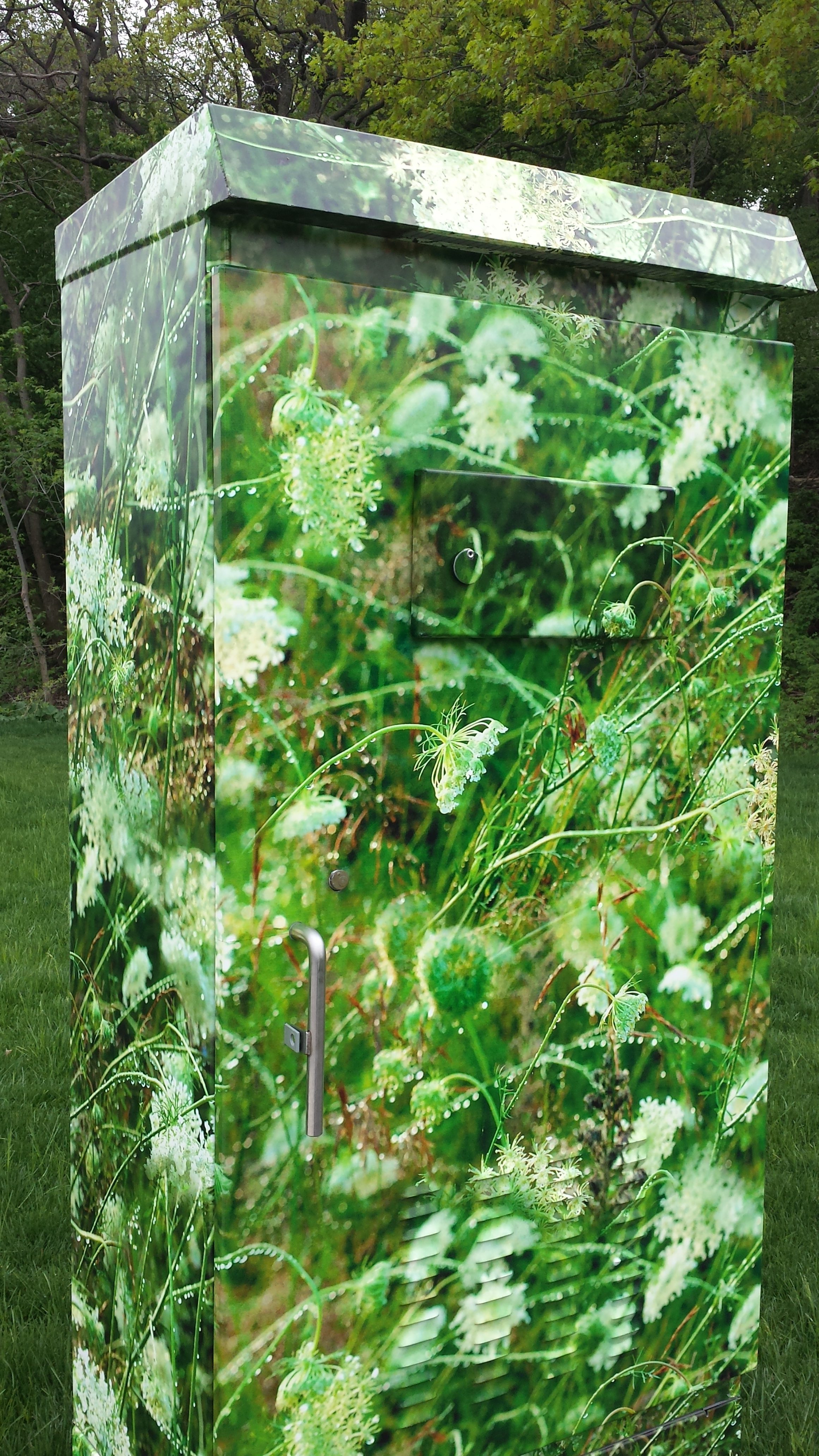
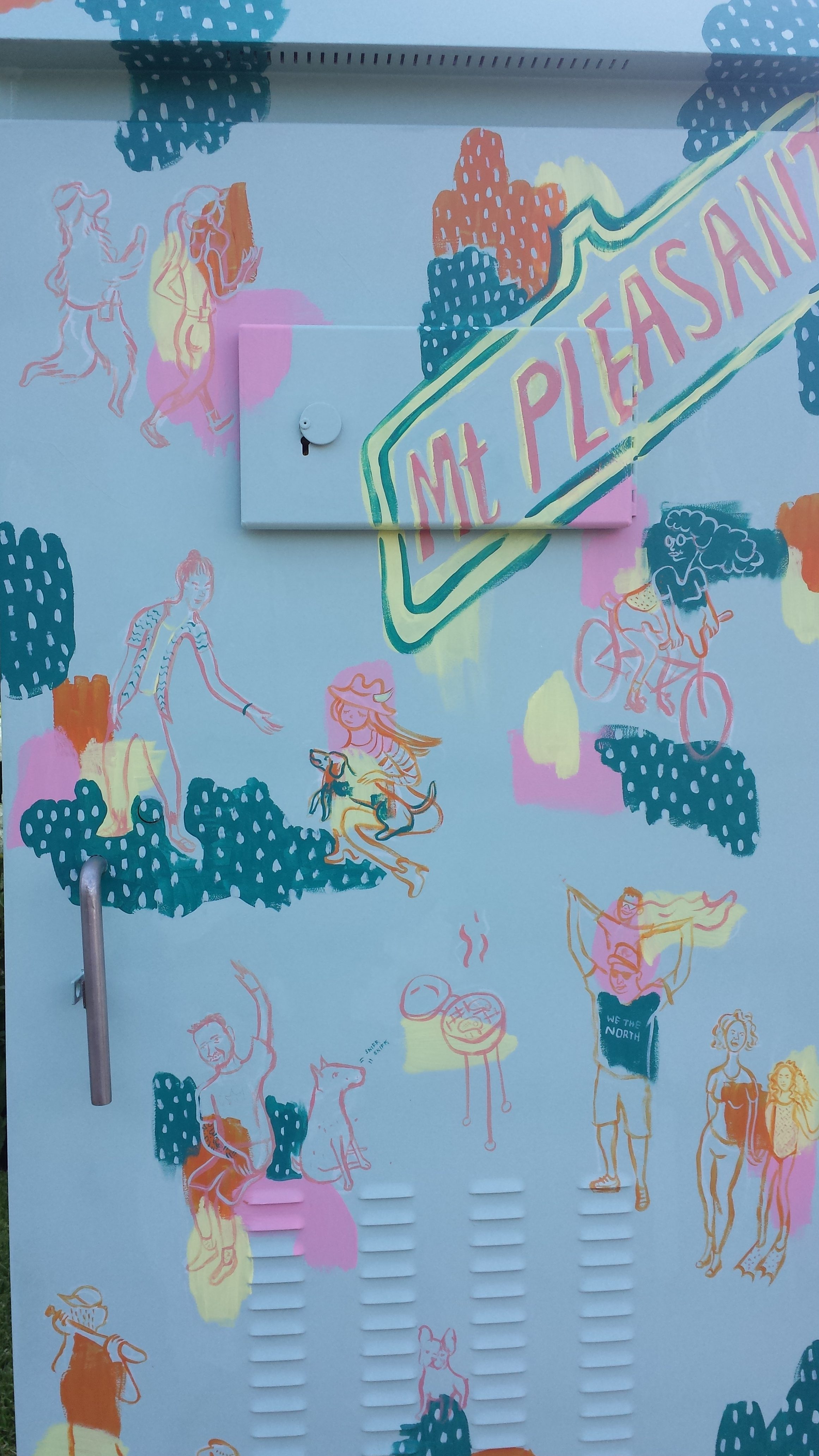
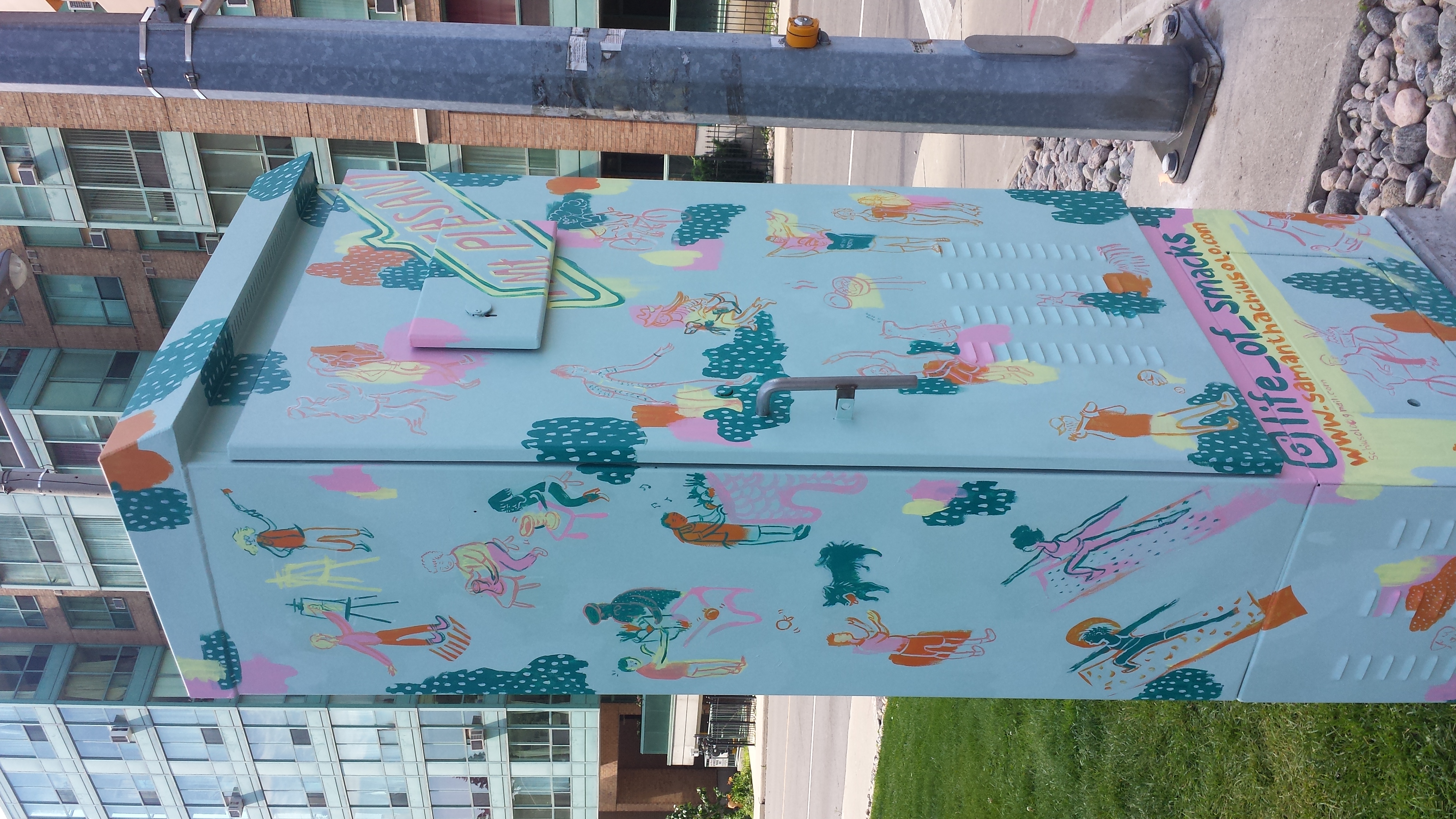
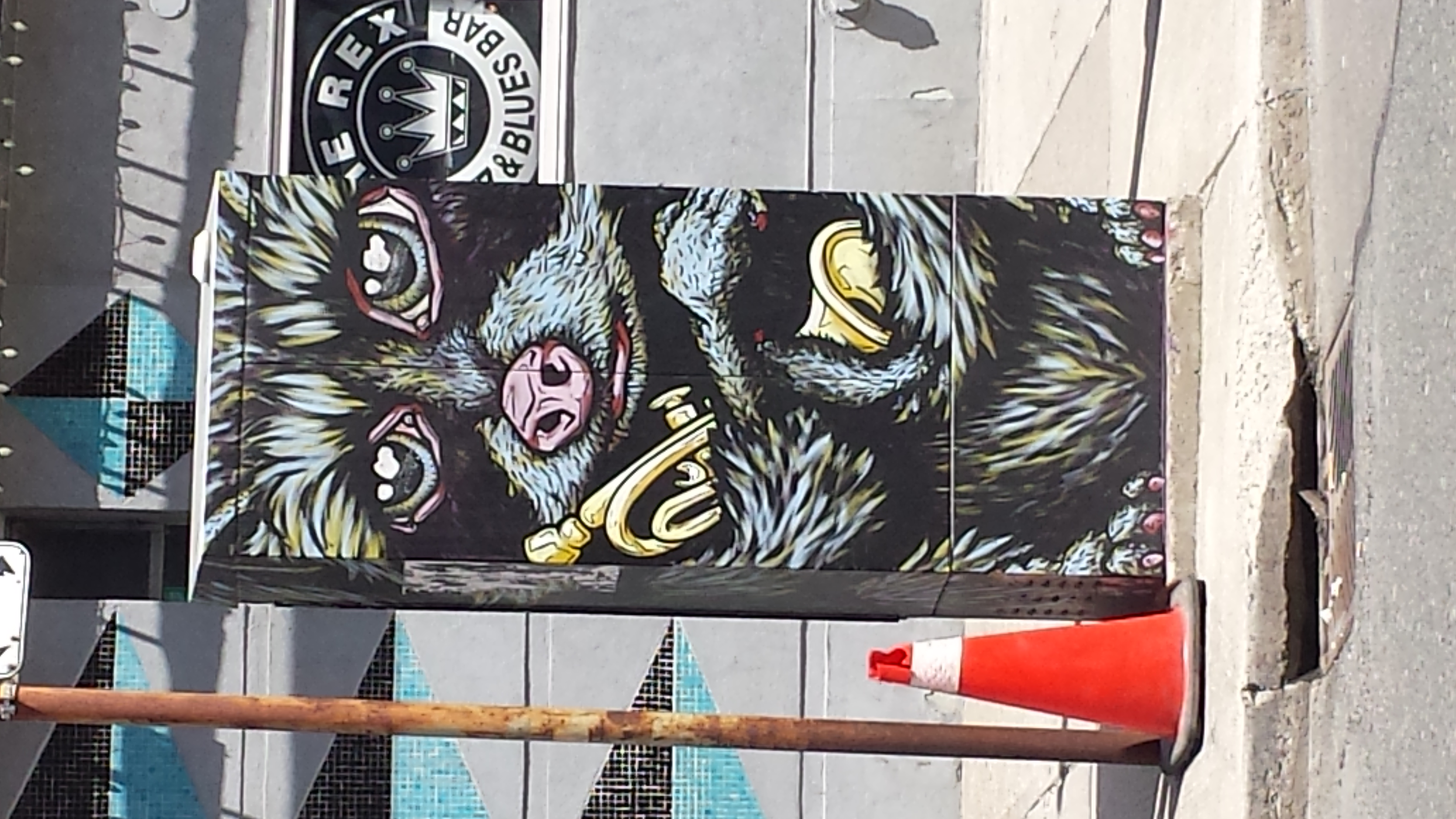
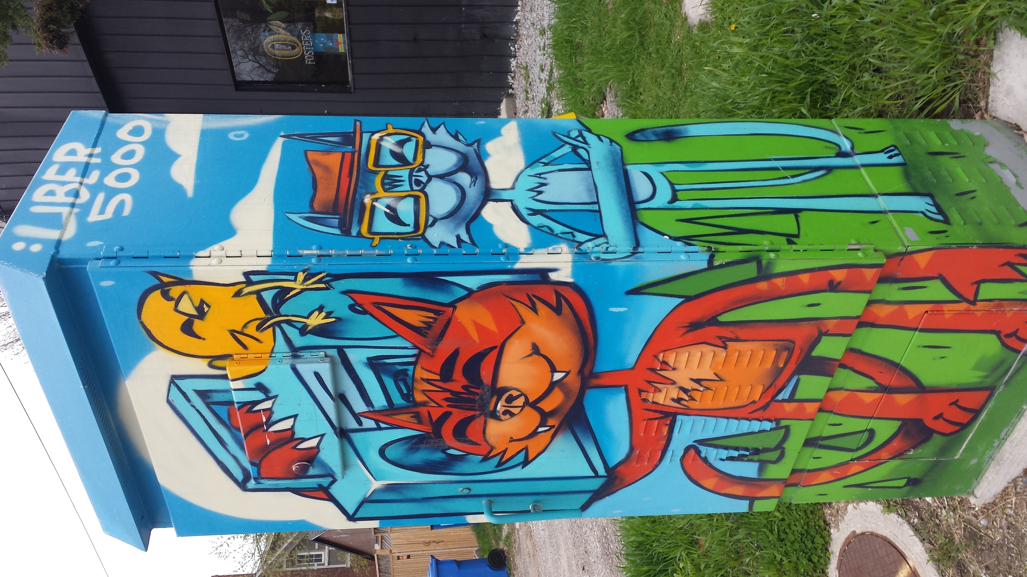
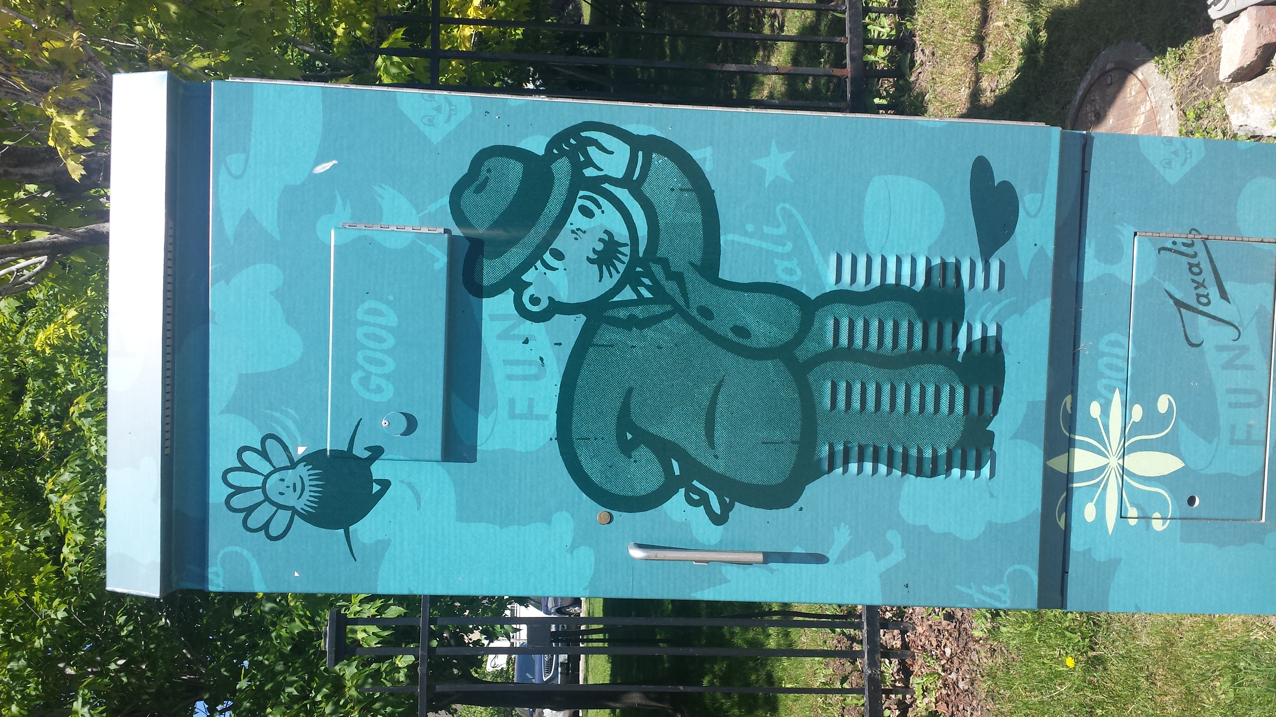
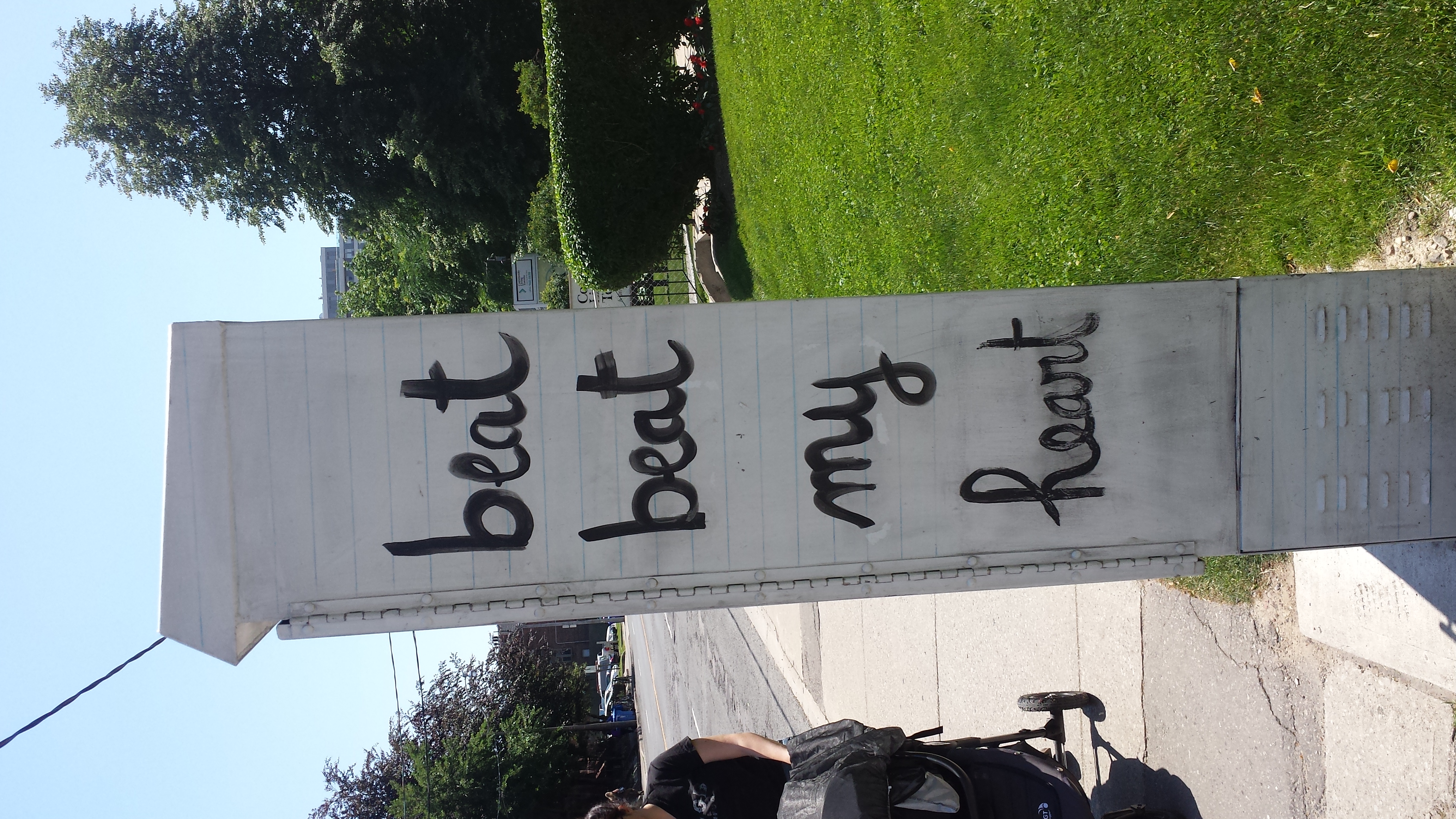
A well-kept secret in Toronto is that our city actively promotes street art. There’s even hope that Toronto can become a go-to destination for followers and fans.
One interesting sideline is the beautification of our plain, military-grey hydro boxes. Hell, the city even pays artists to do this. Here are some neat examples spotted on my cycling forays. Click on each image to enlarge it.
 It’s March already. Riding the bike at the gym is deadly dull and boring. Also you don’t get the wind resistance and the hills. Time to get out there! Besides the spring flowers were out.